
MyTopo
Classic USGS Chunchula Alabama 7.5'x7.5' Topo Map
Couldn't load pickup availability
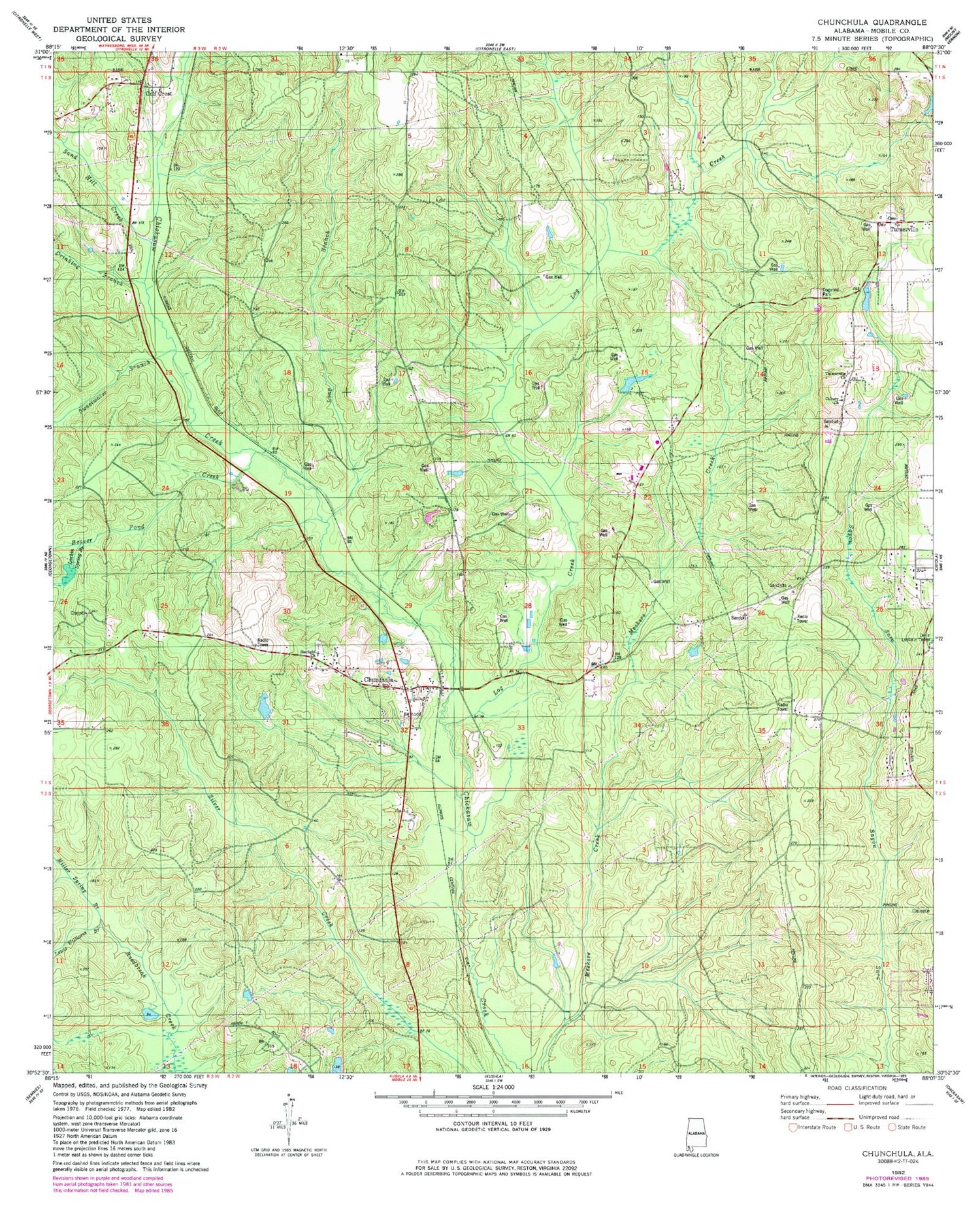
Historical USGS topographic quad map of Chunchula in the state of Alabama. Map scale may vary for some years, but is generally around 1:24,000. Print size is approximately 24" x 27"
This quadrangle is in the following counties: Mobile.
The map contains contour lines, roads, rivers, towns, and lakes. Printed on high-quality waterproof paper with UV fade-resistant inks, and shipped rolled.
Contains the following named places: Adams Branch, Arden Church, Beaver Meadow, Beaver Pond Creek, Calvary Church, Chunchula, Chunchula Census Designated Place, Chunchula Gas Field, Chunchula Post Office, Dogwood Park, Drinking Branch, Dubois Lake Dam, Duboise Lake, East Chunchula School, Fellowship Baptist Church, Fred Hildesheim Dam, God Church, Gulf Crest Church, Gulfcrest, Gulfcrest Cemetery, Gulfcrest Census Designated Place, Larkin Spring Branch, Lewis Williams Branch, Log Creek, Long Branch, Maddox Mobile Home Park, Mickers Creek, Miller Spring Branch, Oak Grove School, Orvin Lookout Tower, Sand Hill Creek, Starlight Full Gospel Church, Starlight School, Sweetwater Branch, Turnerville, Turnerville Cemetery, Turnerville Church, Turnerville Volunteer Fire Department Station 1, Turnerville Volunteer Fire Department Station 2, ZIP Code: 36521


