MyTopo
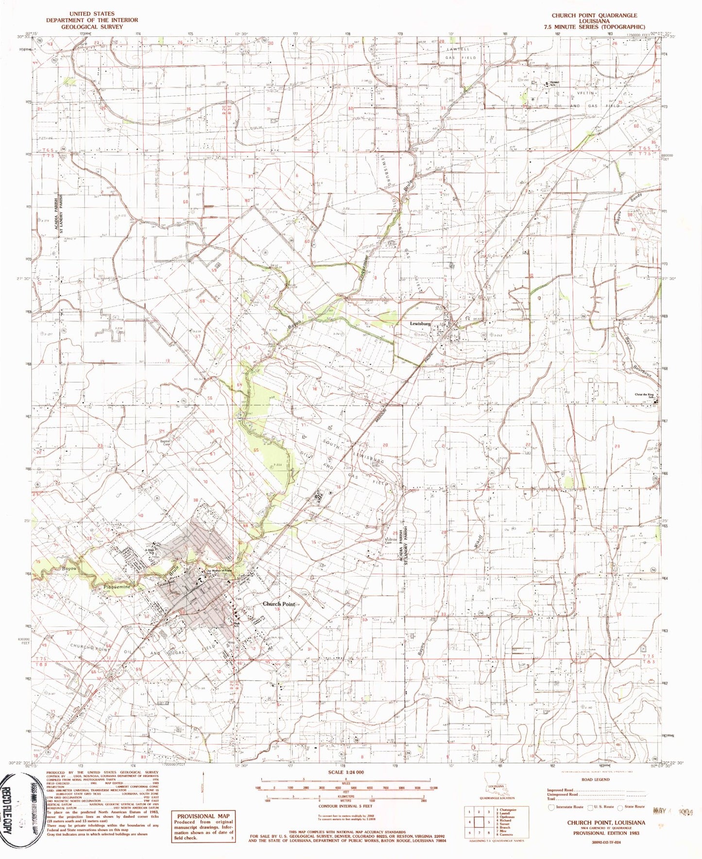
Classic USGS Church Point Louisiana 7.5'x7.5' Topo Map
Couldn't load pickup availability
Historical USGS topographic quad map of Church Point in the state of Louisiana. Map scale may vary for some years, but is generally around 1:24,000. Print size is approximately 24" x 27"
This quadrangle is in the following counties: Acadia, St. Landry.
The map contains contour lines, roads, rivers, towns, and lakes. Printed on high-quality waterproof paper with UV fade-resistant inks, and shipped rolled.
Contains the following named places: Acadia - Saint Landry Hospital, Acadia Parish Community Clinic, Acadia Parish Library Church Point Branch, ASLH Helipad, Baptist Cemetery, Booties Store, Briggs Airfield, Christ the King Church, Christ the King School, Church Point, Church Point Elementary School, Church Point Flyers Airport, Church Point High School, Church Point Middle School, Church Point Oil and Gas Field, Church Point Police Department, Church Point Post Office, Church Point United Methodist Church, Church Point Volunteer Fire Department, Church Point Wastewater Treatment Plant, Davids Trailer and Recreational Vehicle Park, Degand School, Faith Christian Fellowship Church, First Baptist Church, Greater Love Church of God, Hyland School, Kibs Air Park, Lewisburg, Lewisburg Oil and Gas Field, Lost Airfield, McBride Cemetery, McBride School, Noah's Ark Day Care Center, Our Lady of the Sacred Heart Church, Our Mother of Mercy Church, Our Mother of Mercy Church Point Head Start School, Our Mother of Peace Elementary School, Parish Governing Authority District 11, Parish Governing Authority District 12, Peach Bloom, Peach Bloom School, Plaquemine Ridge, Saint Charles Church, South Lewisburg Oil and Gas Field, Town of Church Point, Veltin Oil and Gas Field, Victory Life Christian Center, Ward Three, ZIP Code: 70525