
MyTopo
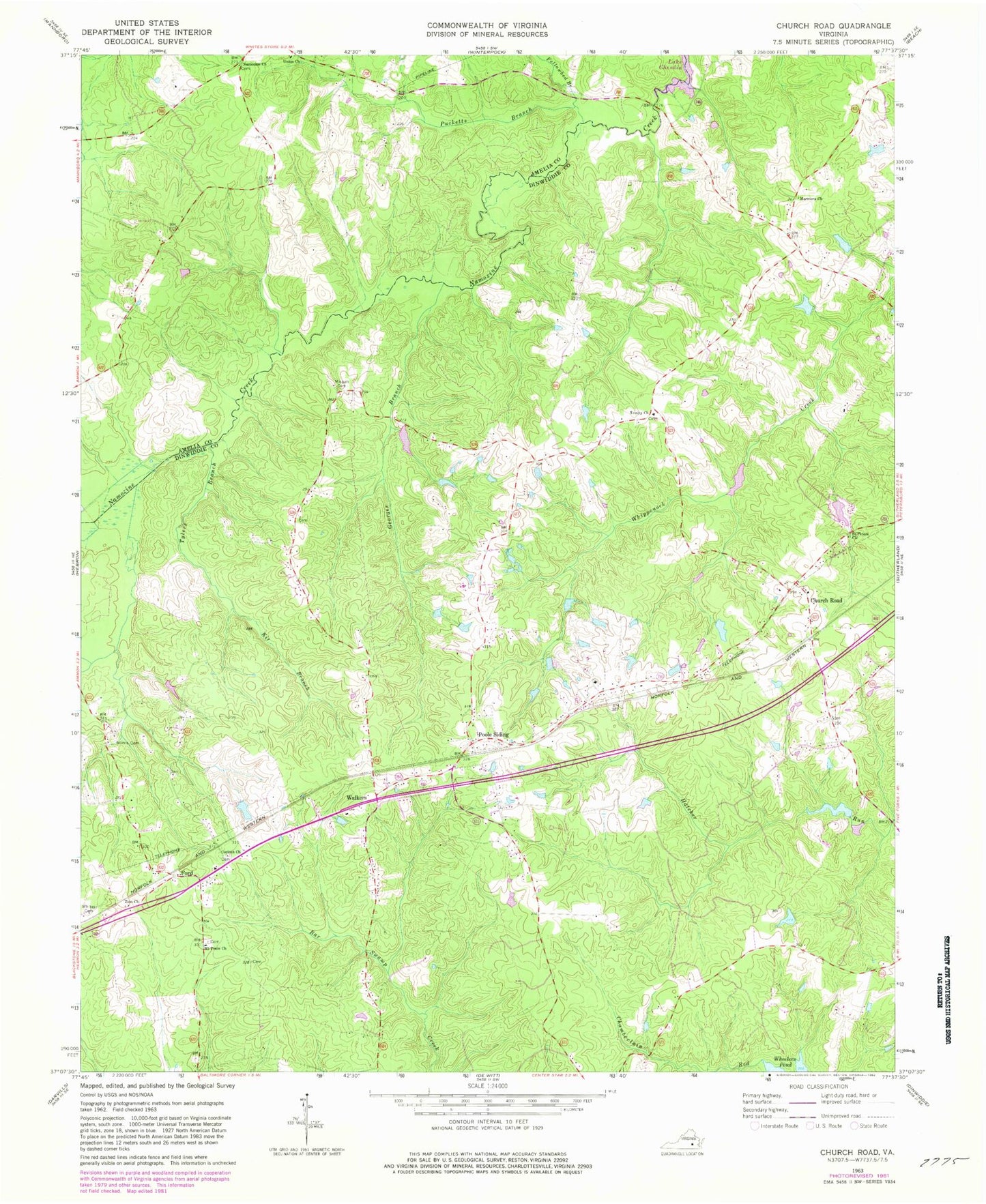
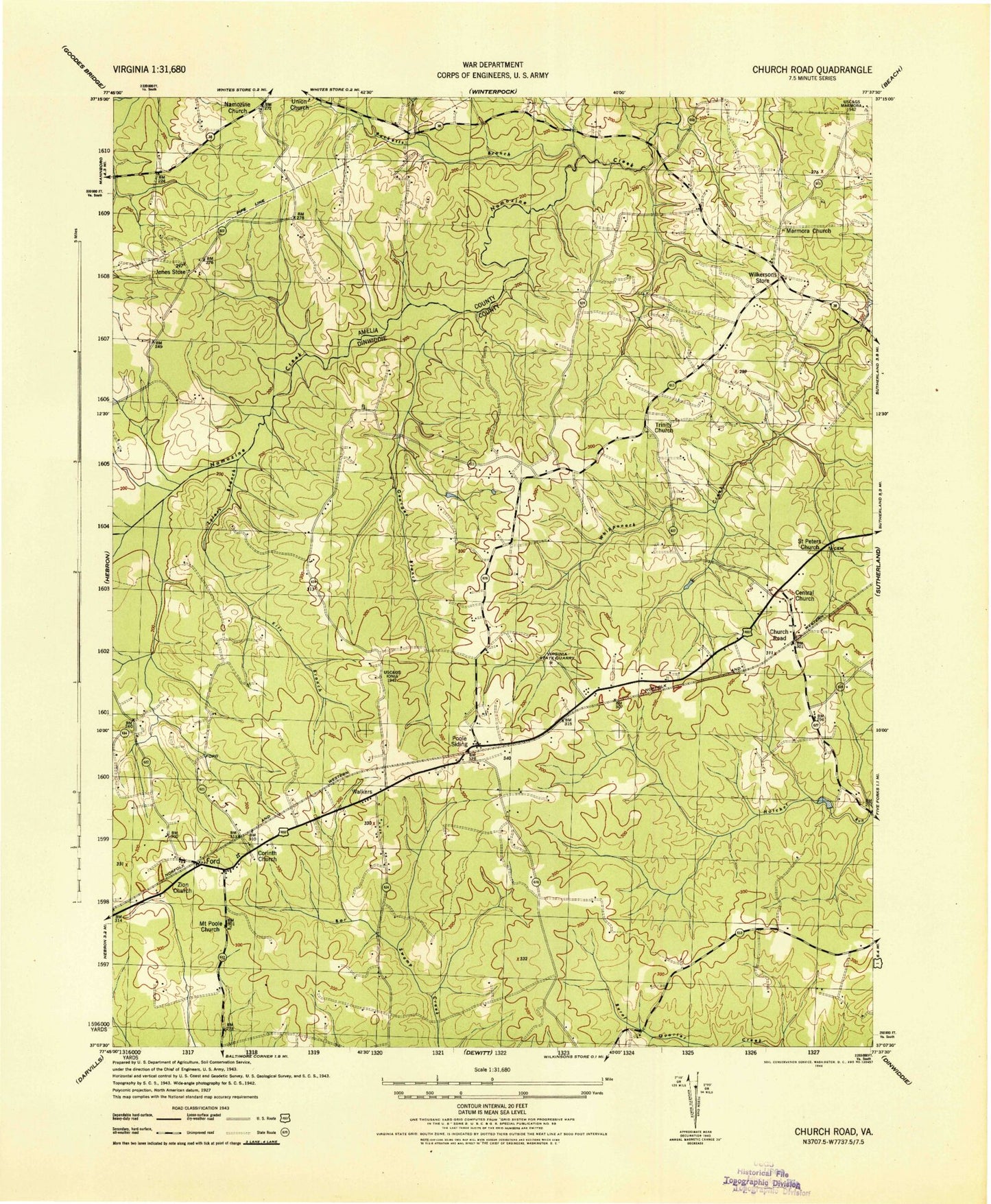
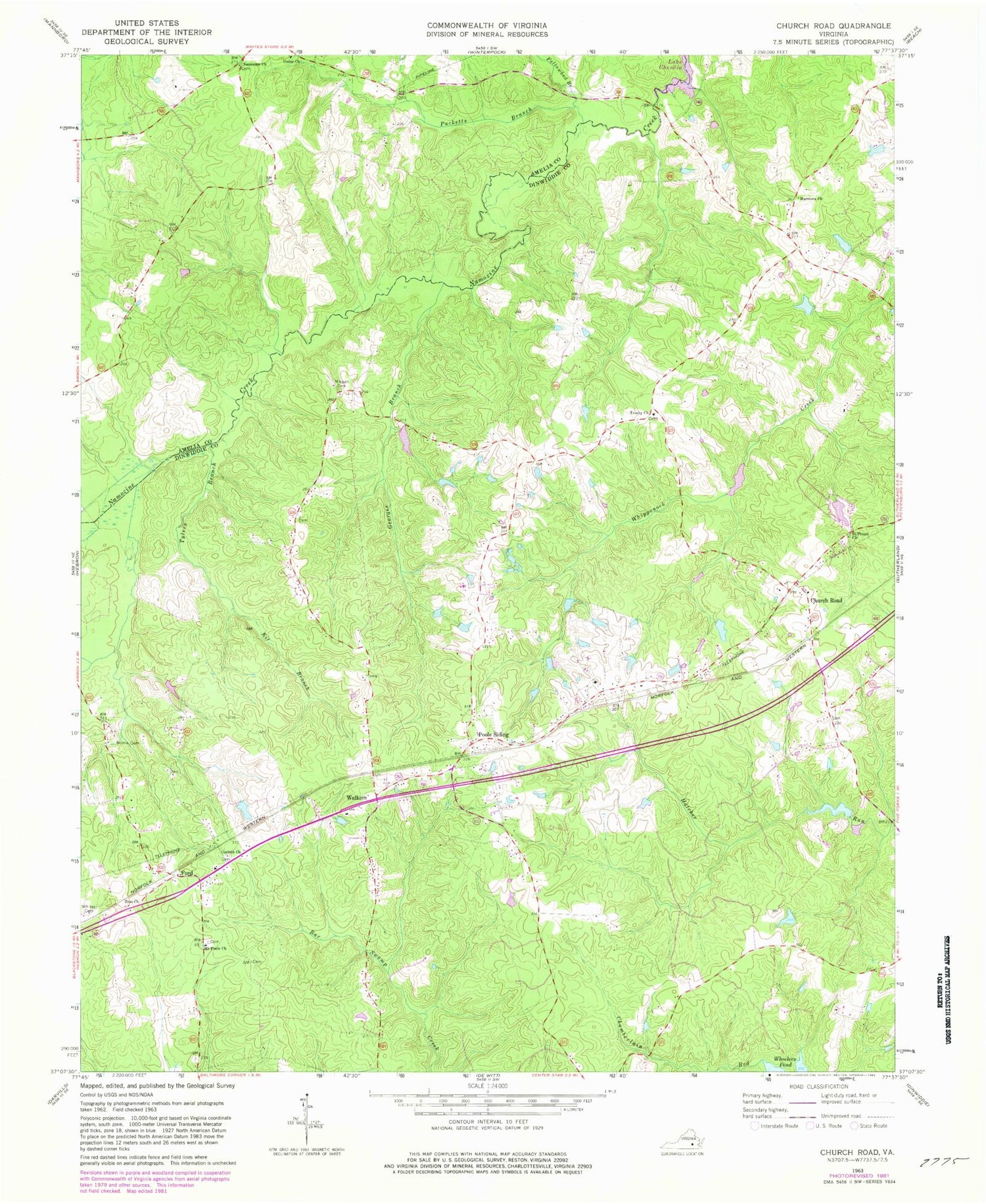
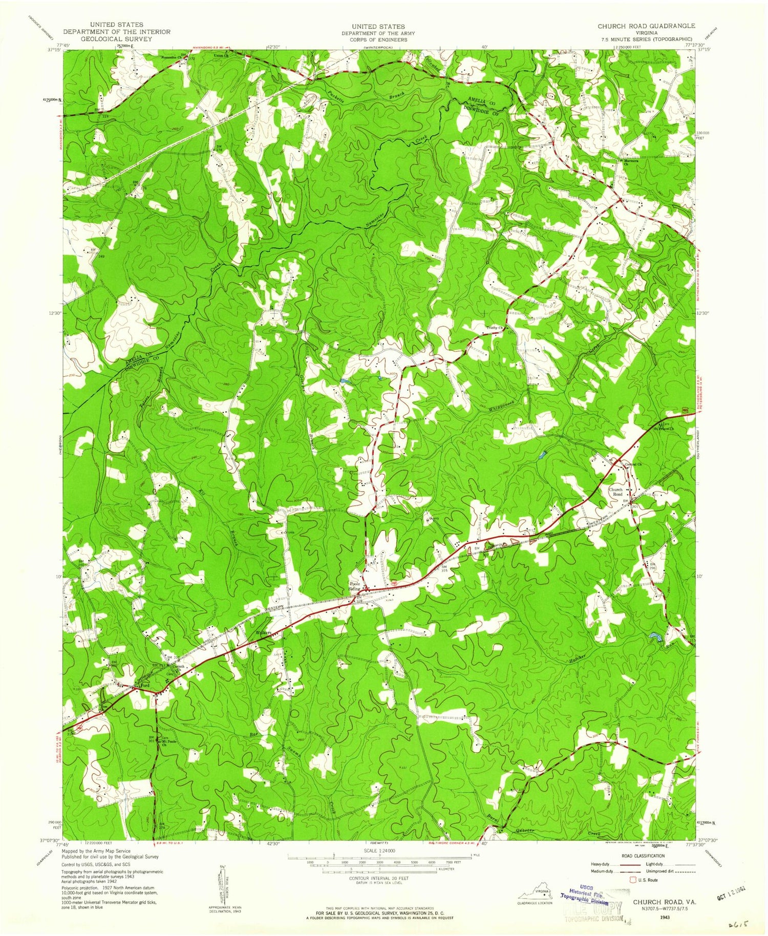
Classic USGS Church Road Virginia 7.5'x7.5' Topo Map
Couldn't load pickup availability
Historical USGS topographic quad map of Church Road in the state of Virginia. Map scale may vary for some years, but is generally around 1:24,000. Print size is approximately 24" x 27"
This quadrangle is in the following counties: Amelia, Dinwiddie.
The map contains contour lines, roads, rivers, towns, and lakes. Printed on high-quality waterproof paper with UV fade-resistant inks, and shipped rolled.
Contains the following named places: Central Baptist Church, Church Road, Church Road Post Office, Corinth Cemetery, Corinth Church, District 1, Eades Dam, Eades Pond, Fellowbed Branch, Ford, Ford Post Office, Ford Volunteer Fire Department Station 2, Georges Branch, Jones Dam, Jones Store, Kit Branch, Marmona, Marmora Church, Mispah Cemetery, Mount Poole Baptist Church Cemetery, Mount Poole Church, Mount Zion Baptist Church, Namozine, Namozine Bridge, Namozine Church, Norris Cemetery, Poole Christian Church, Poole Siding, Pucketts Branch, Saint Peters Church, Stokes Dam, Trinity Cemetery, Trinity Church, Tylers Branch, Union Church, Walkers, Watkins Farm, Whites Cemetery, Wilkersons Store, ZIP Code: 23833