MyTopo
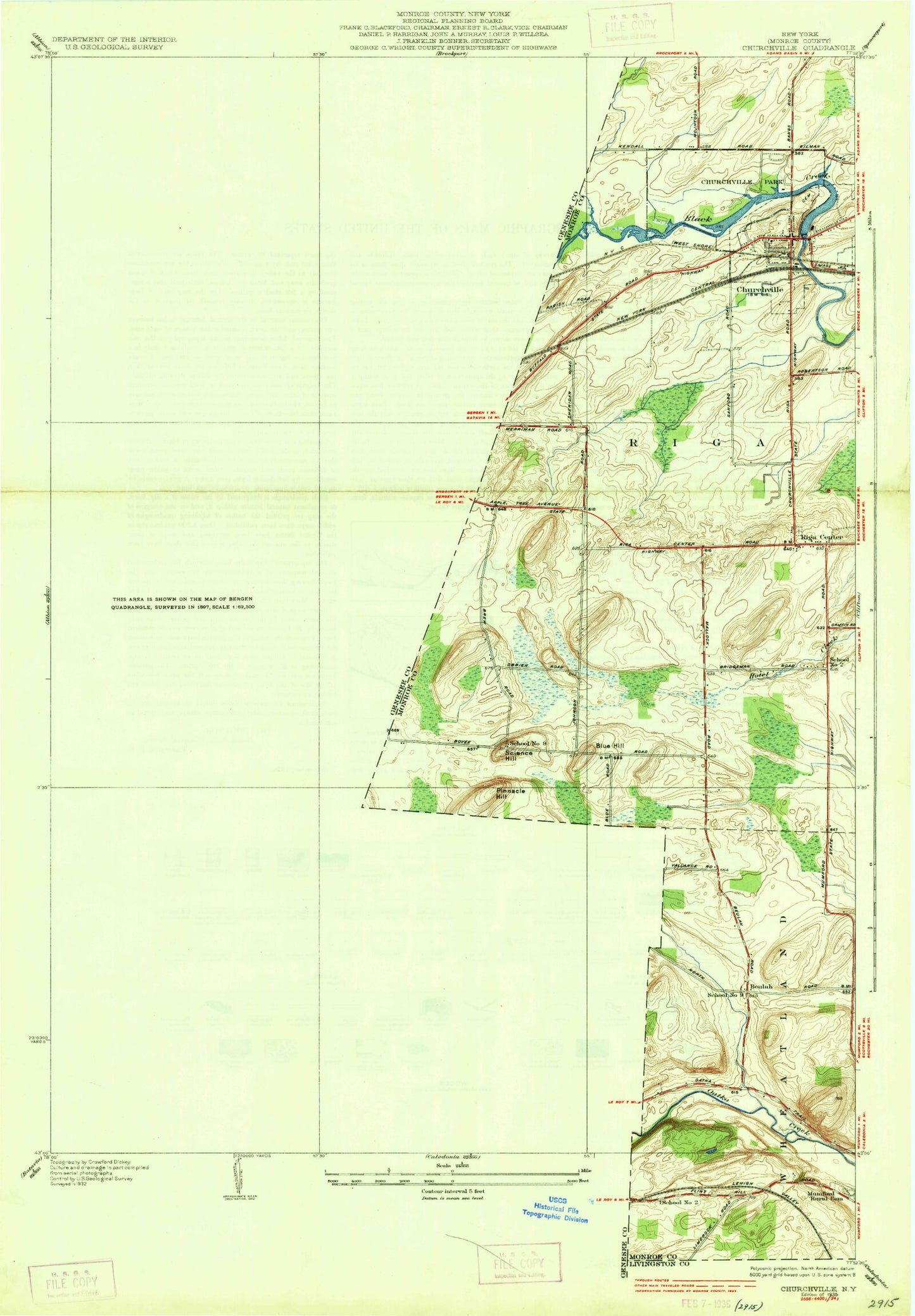
Classic USGS Churchville New York 7.5'x7.5' Topo Map
Couldn't load pickup availability
Historical USGS topographic quad map of Churchville in the state of New York. Map scale may vary for some years, but is generally around 1:24,000. Print size is approximately 24" x 27"
This quadrangle is in the following counties: Genesee, Monroe.
The map contains contour lines, roads, rivers, towns, and lakes. Printed on high-quality waterproof paper with UV fade-resistant inks, and shipped rolled.
Contains the following named places: Apple Tree Acres Corporate Park, Barbary Coast, Bergen, Bergen Post Office, Bergen United Methodist Church, Bergen Volunteer Fire Department, Beulah, Blue Hill, Buttermilk Falls, Calvary Chapel Agape, Churchville, Churchville Golf Course, Churchville Park, Churchville Post Office, Creekside Cemetery, East Bergen, East Bergen Cemetery, Ely Air Park, First Presbyterian Church, Fort Hill, Fort Hill Cemetery, Hidden Meadows, Jericon Corners, Lake Street Historic District, Lei - Ti - Too Campground, LeRoy Toll Plaza, McPherson Orchards, Mill Seat Solid Waste Landfill, Miller Brothers Farm, Mount Rest Cemetery, North Bergen Cemetery, North Branch Black Creek, North Le Roxy, Ontario Westbound Rest Area, Pinnacle Hill, Riga, Riga Cemetery, Robins Brook, Saint Bridget's Church, Saint Brigid Catholic Cemetery, School Number 2, School Number 3, School Number 4, School Number 9, Science Hill, Stein Farms, Stone Church, Stone Church Presbyterian Church, Stone Church Rural Cemetery, Timberline Lake Park Campground, Torpy Hill, Town of Bergen, Town of Riga, Village of Bergen, Village of Churchville, Zastrocky Farms, ZIP Code: 14416