MyTopo
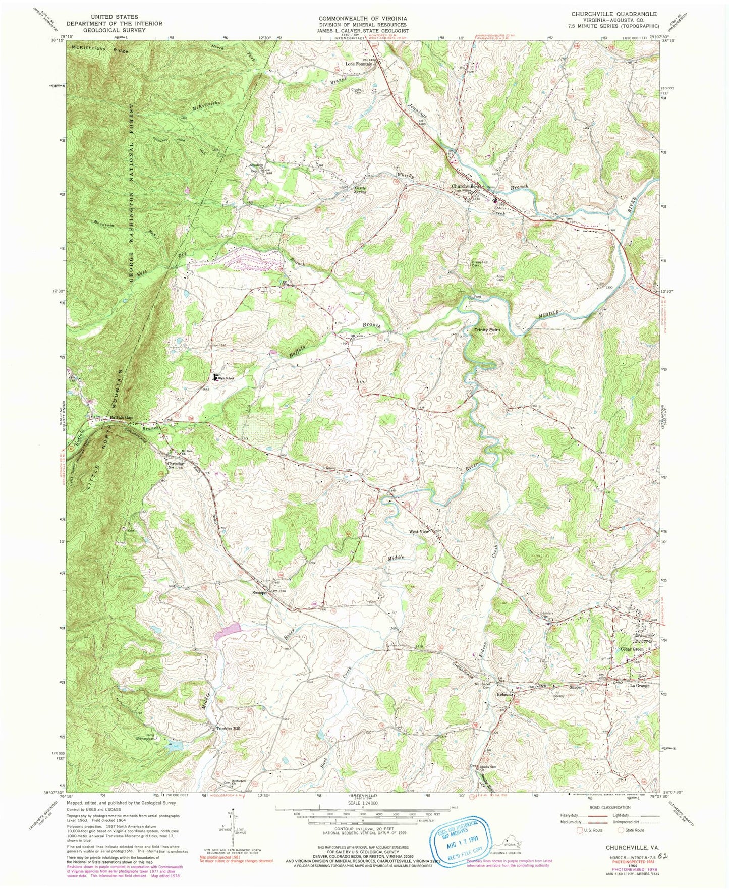
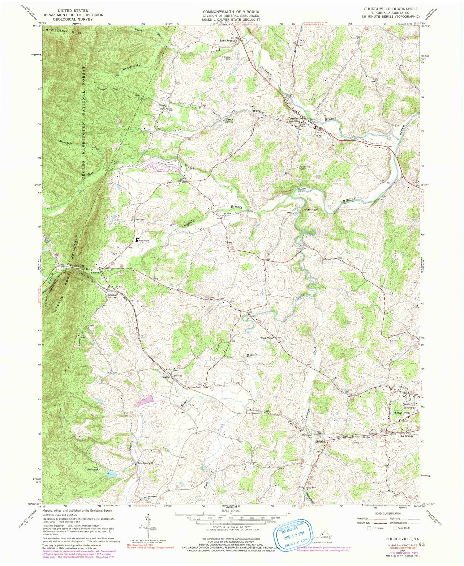
Classic USGS Churchville Virginia 7.5'x7.5' Topo Map
Couldn't load pickup availability
Historical USGS topographic quad map of Churchville in the state of Virginia. Map scale may vary for some years, but is generally around 1:24,000. Print size is approximately 24" x 27"
This quadrangle is in the following counties: Augusta.
The map contains contour lines, roads, rivers, towns, and lakes. Printed on high-quality waterproof paper with UV fade-resistant inks, and shipped rolled.
Contains the following named places: Allen Cemetery, Augusta County, Augusta County Training School, Back Creek, Bethlehem Church, Boy Scout Lake, Buffalo Branch, Buffalo Gap, Buffalo Gap High School, Camp Shenandoah, Camp Shenandoah Dam, Castle Spring, Cedar Green, Christian, Churchville, Churchville Census Designated Place, Churchville Elementary School, Churchville Post Office, Churchville Volunteer Fire Rescue Department Company 4 Rescue 4, Crosby Cemetery, East Dry Branch, Eidson Creek, Green Hill Cemetery, Hebron, Hebron Church, Hunter Cemetery, Jennings Branch, Jerusalem Church, La Grange, Lock Willow Presbyterian Church, Lone Fountain, McKittricks Branch, Mount Chapel Cemetery, Mount View Church, Mount Zion Church, Mountain Run, Nders Pond, North Fork McKittricks Branch, Saint Pauls Chapel, Smithleigh Dam, Smithleigh Lake, Smoky Row Church, Smoky Row Creek, Snyder, Swoope, Swoope Post Office, Swoope Volunteer Fire Department Company 14, Trimbles Mill, Trinity Point, West View, Whisky Creek, WNLR-AM (Churchville), Wood Dam, WSKO-FM (Buffalo Gap), ZIP Codes: 24421, 24479