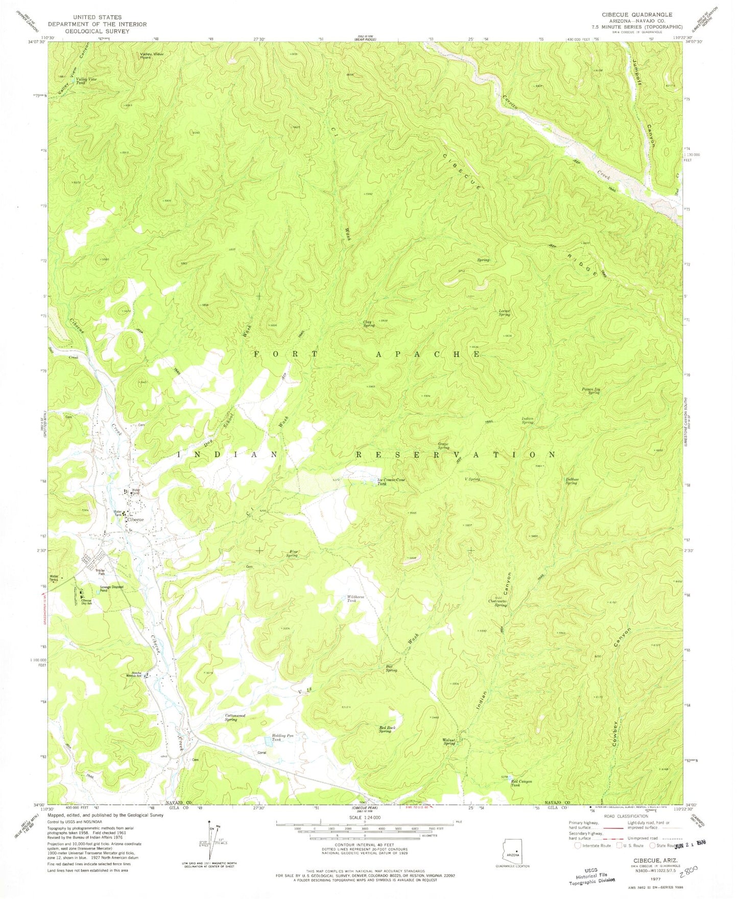
MyTopo
Classic USGS Cibecue Arizona 7.5'x7.5' Topo Map
Couldn't load pickup availability
Historical USGS topographic quad map of Cibecue in the state of Arizona. Map scale may vary for some years, but is generally around 1:24,000. Print size is approximately 24" x 27"
This quadrangle is in the following counties: Gila, Navajo.
The map contains contour lines, roads, rivers, towns, and lakes. Printed on high-quality waterproof paper with UV fade-resistant inks, and shipped rolled.
Contains the following named places: Apache Mission School, Box Spring, Bureau of Indian Affairs Ranger Station, C One Wash, Cibecue, Cibecue Airport, Cibecue Census Designated Place, Cibecue Chapter House, Cibecue Community School, Cibecue Health Center White River Service Unit, Cibecue Trading Post, Clay Spring, Clearwater Spring, Cottonwood Spring, Day School Wash, DeHose Spring, Grape Spring, Holding Pen Tank, Ice Cream Cone Tank, Indian Spring, Jumpoff Canyon, Locust Spring, Mud Creek, N Five Spring, Pine Spring, Poison Ivy Spring, Red Canyon Tank, Red Rock Spring, Salt Creek, V Eighteen Wash, V Spring, Valley View Point, Valley View Tank, Walnut Spring, White Mountain Apache Tribal Fire and Rescue Department Station 820 Cibecue, Wildhorse Tank