MyTopo
Classic USGS Cibola Arizona 7.5'x7.5' Topo Map
Regular price
$16.95
Regular price
Sale price
$16.95
Unit price
per
Couldn't load pickup availability
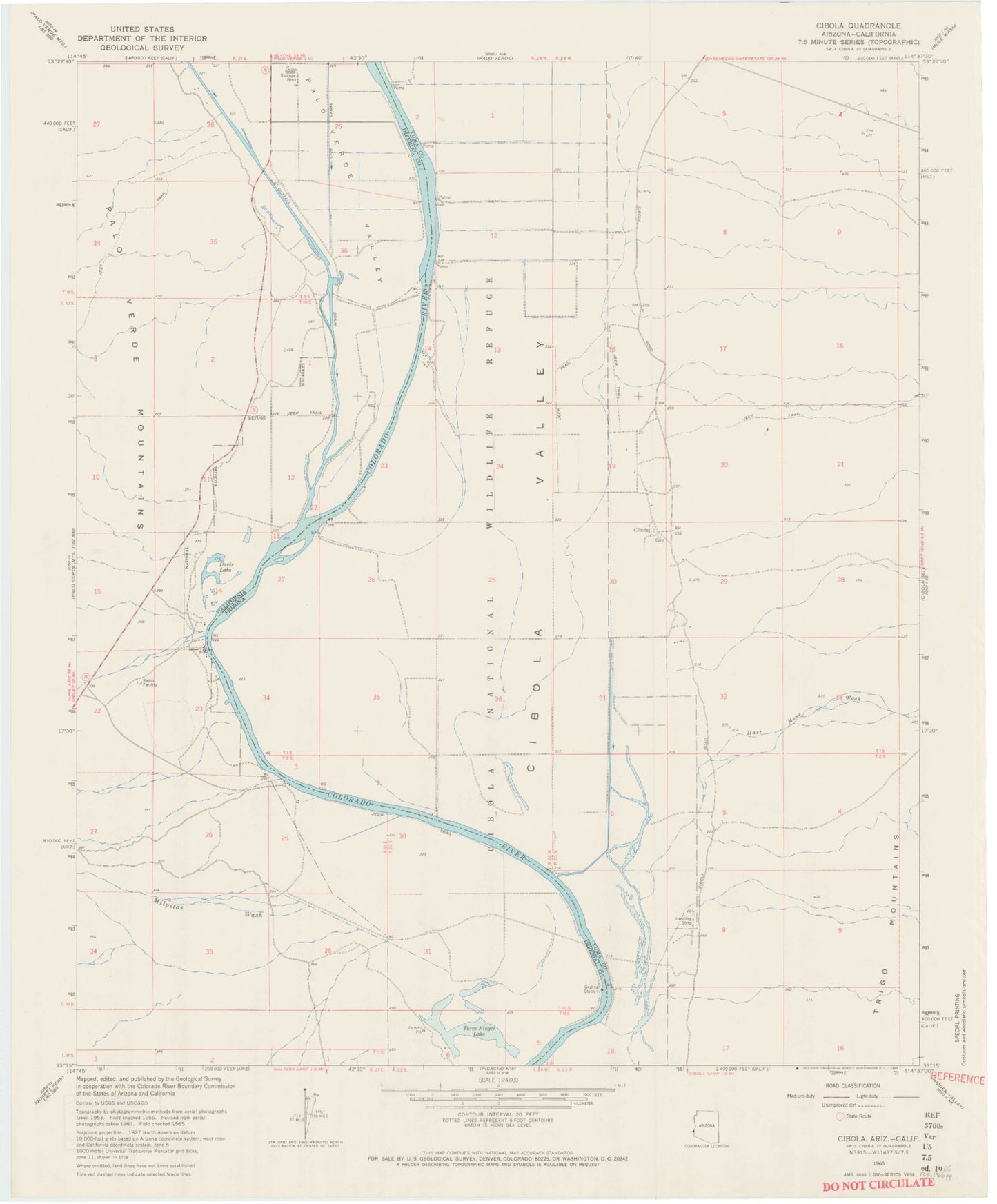
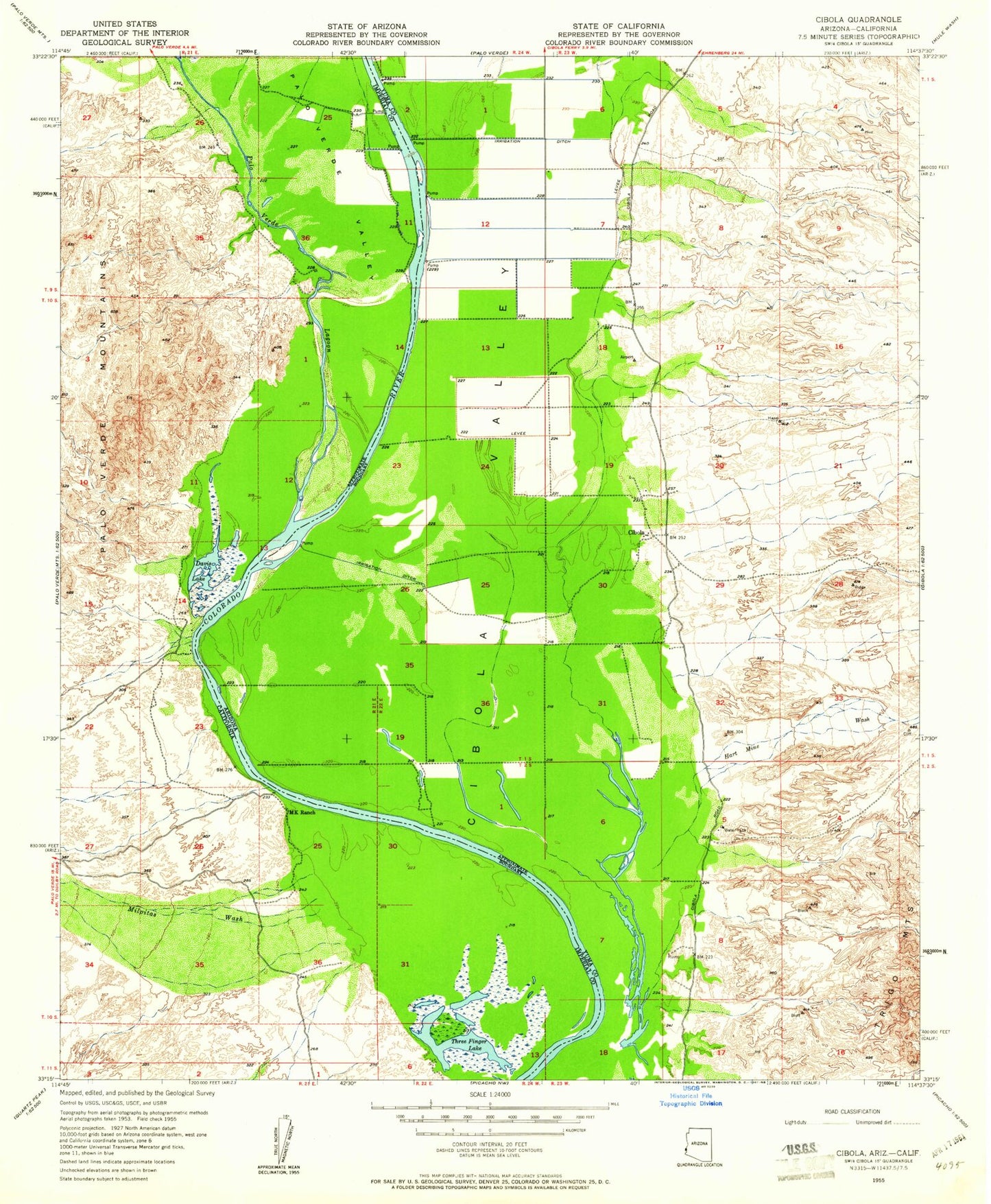
Historical USGS topographic quad map of Cibola in the states of Arizona, California. Map scale may vary for some years, but is generally around 1:24,000. Print size is approximately 24" x 27"
This quadrangle is in the following counties: Imperial, La Paz.
The map contains contour lines, roads, rivers, towns, and lakes. Printed on high-quality waterproof paper with UV fade-resistant inks, and shipped rolled.
Contains the following named places: Cibola, Cibola Census Designated Place, Cibola National Wildlife Refuge, Davis Lake, Great Colorado Valley, Hart Mine Wash, Long Bend, Milpitas Wash, Outfall Drain, Palo Verde Valley, Three Finger Lake