MyTopo
Classic USGS Cienega Ranch New Mexico 7.5'x7.5' Topo Map
Regular price
$16.95
Regular price
Sale price
$16.95
Unit price
per
Couldn't load pickup availability
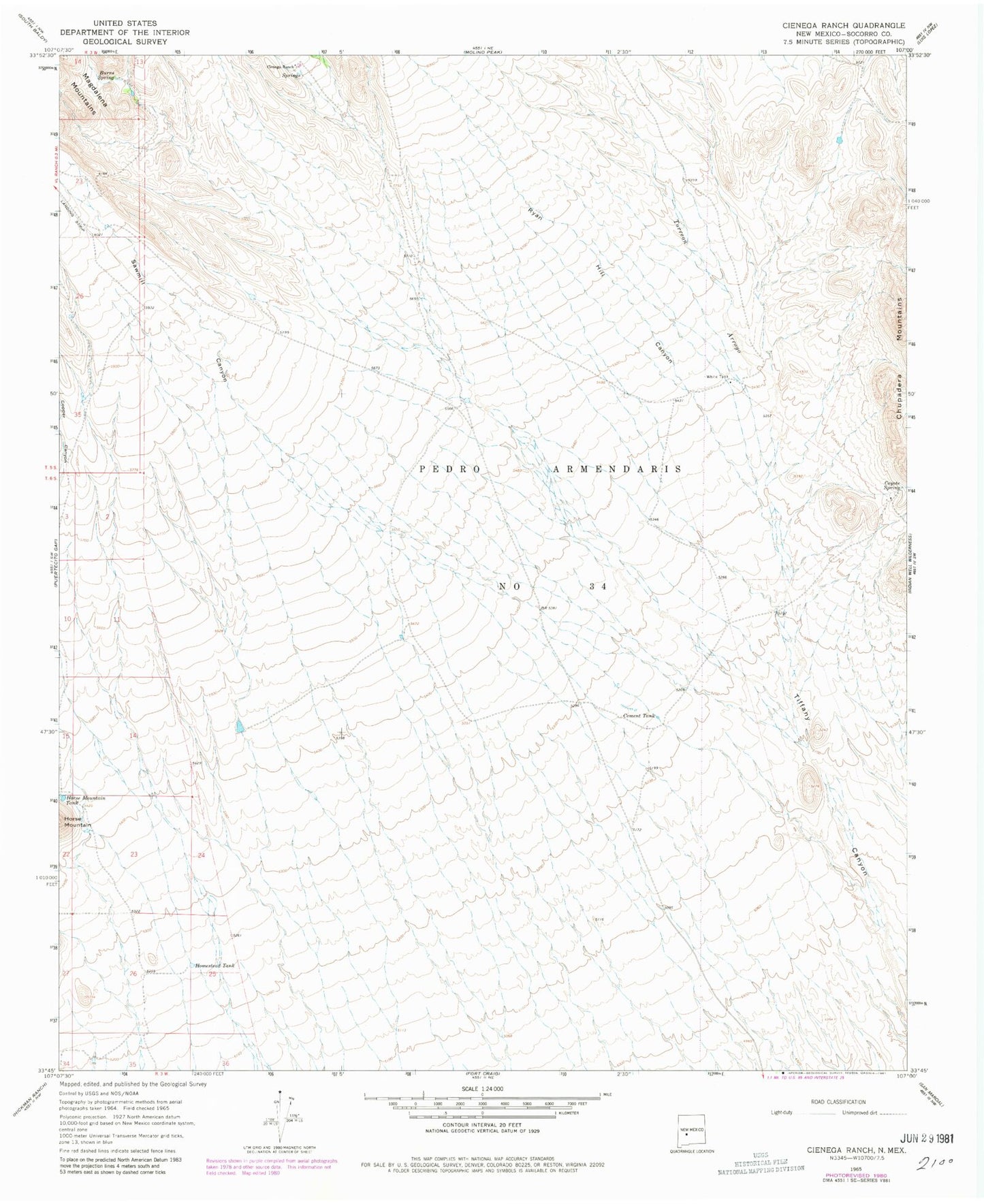
Historical USGS topographic quad map of Cienega Ranch in the state of New Mexico. Map scale may vary for some years, but is generally around 1:24,000. Print size is approximately 24" x 27"
This quadrangle is in the following counties: Socorro.
The map contains contour lines, roads, rivers, towns, and lakes. Printed on high-quality waterproof paper with UV fade-resistant inks, and shipped rolled.
Contains the following named places: Burro Spring, Cement Tank, Cienega Ranch, Copper Canyon, Coyote Spring, Homestead Tank, Horse Mountain Tank, Ryan Hill Canyon, Sawmill Canyon, Torreon Arroyo, White Tank