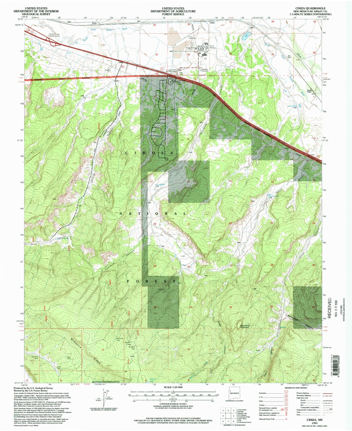
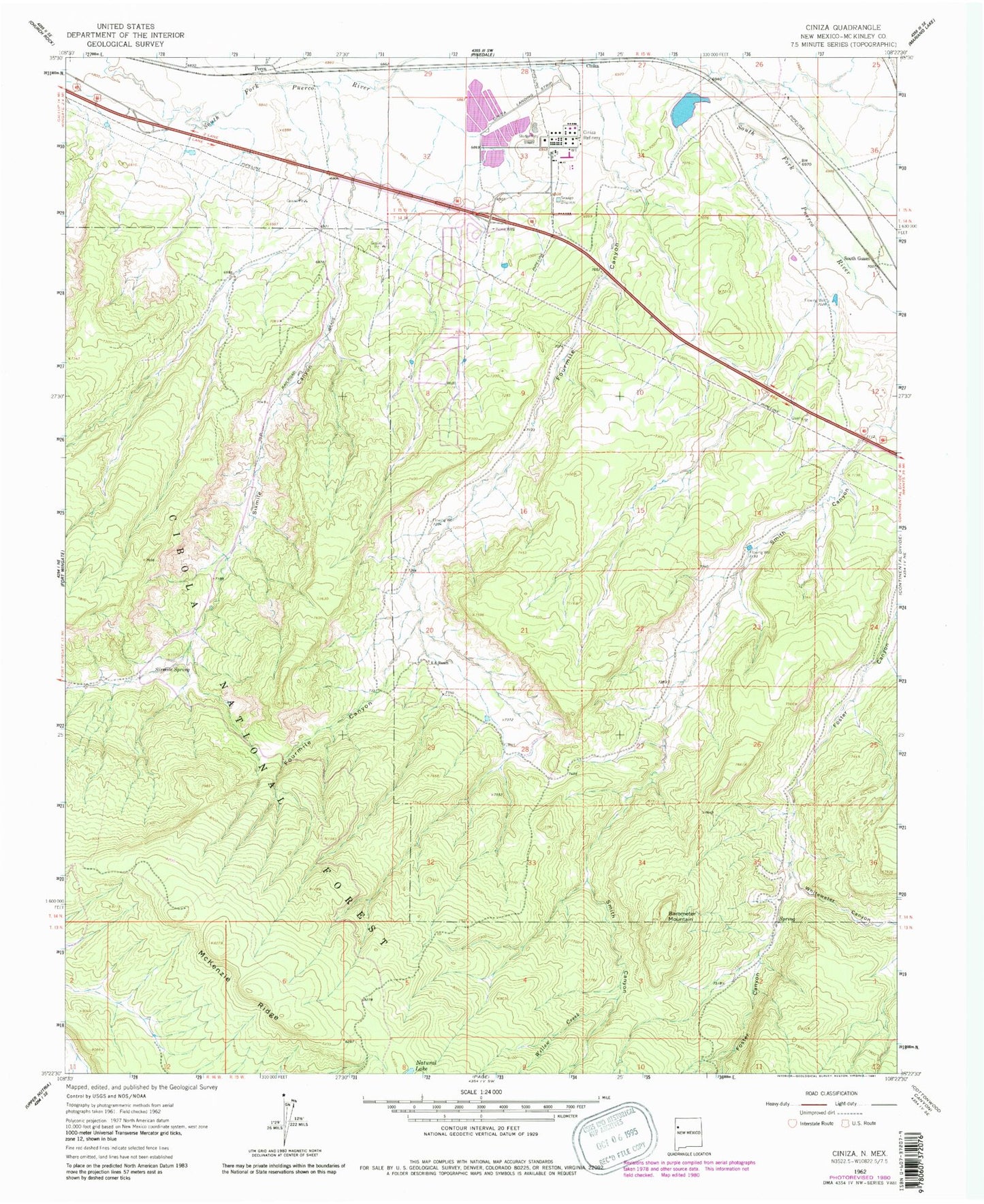
MyTopo
Classic USGS Ciniza New Mexico 7.5'x7.5' Topo Map
Couldn't load pickup availability
Historical USGS topographic quad map of Ciniza in the state of New Mexico. Map scale may vary for some years, but is generally around 1:24,000. Print size is approximately 24" x 27"
This quadrangle is in the following counties: McKinley.
The map contains contour lines, roads, rivers, towns, and lakes. Printed on high-quality waterproof paper with UV fade-resistant inks, and shipped rolled.
Contains the following named places: 10001 Water Well, 10005 Water Well, 87347, Barometer Mountain, Brushy-One Tank, Brushy-Two Tank, Ciniza, Ciniza Refinery, Deer Stock Tank, Foster Canyon Group, Fourmile Canyon, Grenko Mine, Jamestown, Jamestown Census Designated Place, North Tank, Perea Post Office, Section Six Tank, Six A Ranch, Sixmile Canyon, Sixmile Spring, South Guam, Whispering Cedars Volunteer Fire Department, Whitewater Canyon, Willow Creek, Windmill Tank, Yellow Stock Tank