MyTopo
Classic USGS Cinnabar Mountain Idaho 7.5'x7.5' Topo Map
Couldn't load pickup availability
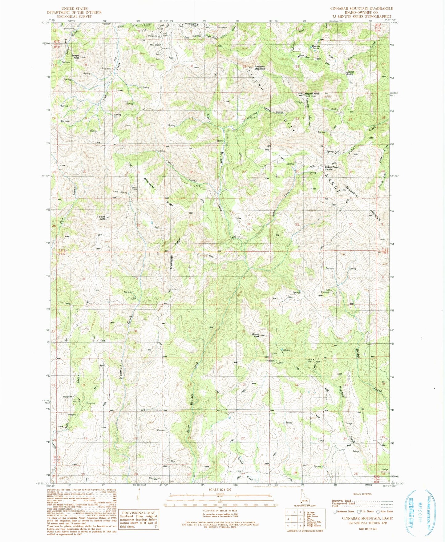
Historical USGS topographic quad map of Cinnabar Mountain in the state of Idaho. Map scale may vary for some years, but is generally around 1:24,000. Print size is approximately 24" x 27"
This quadrangle is in the following counties: Owyhee.
The map contains contour lines, roads, rivers, towns, and lakes. Printed on high-quality waterproof paper with UV fade-resistant inks, and shipped rolled.
Contains the following named places: Afterthought Mine, Boone Peak, Burnam Flat, China Butte, Cinnabar Mountain, Driscol Spring, Empire City, French Creek, Hayden Peak, Lightning Creek, Mammoth Ridge, Murphy Division, Owyhee Mountains, Pickett Creek Saddle, Quicksilver Mountain, Sawpit Peak, Silver City Range, Silver Cord Gulch, Snow Cabin, Snow Creek, Thomas Lakes, Turntable Mountain