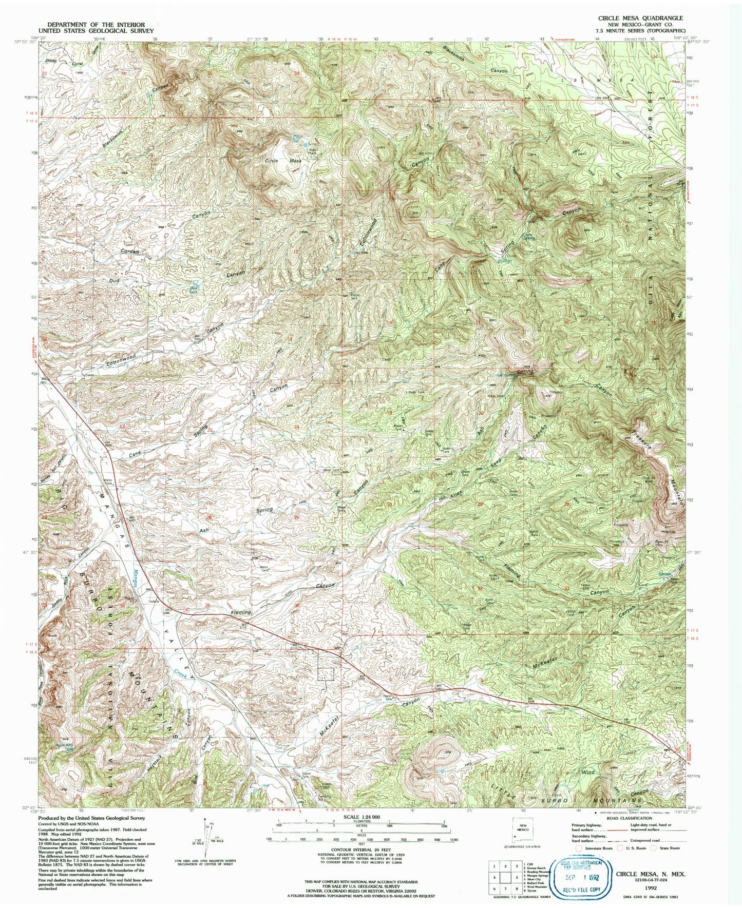
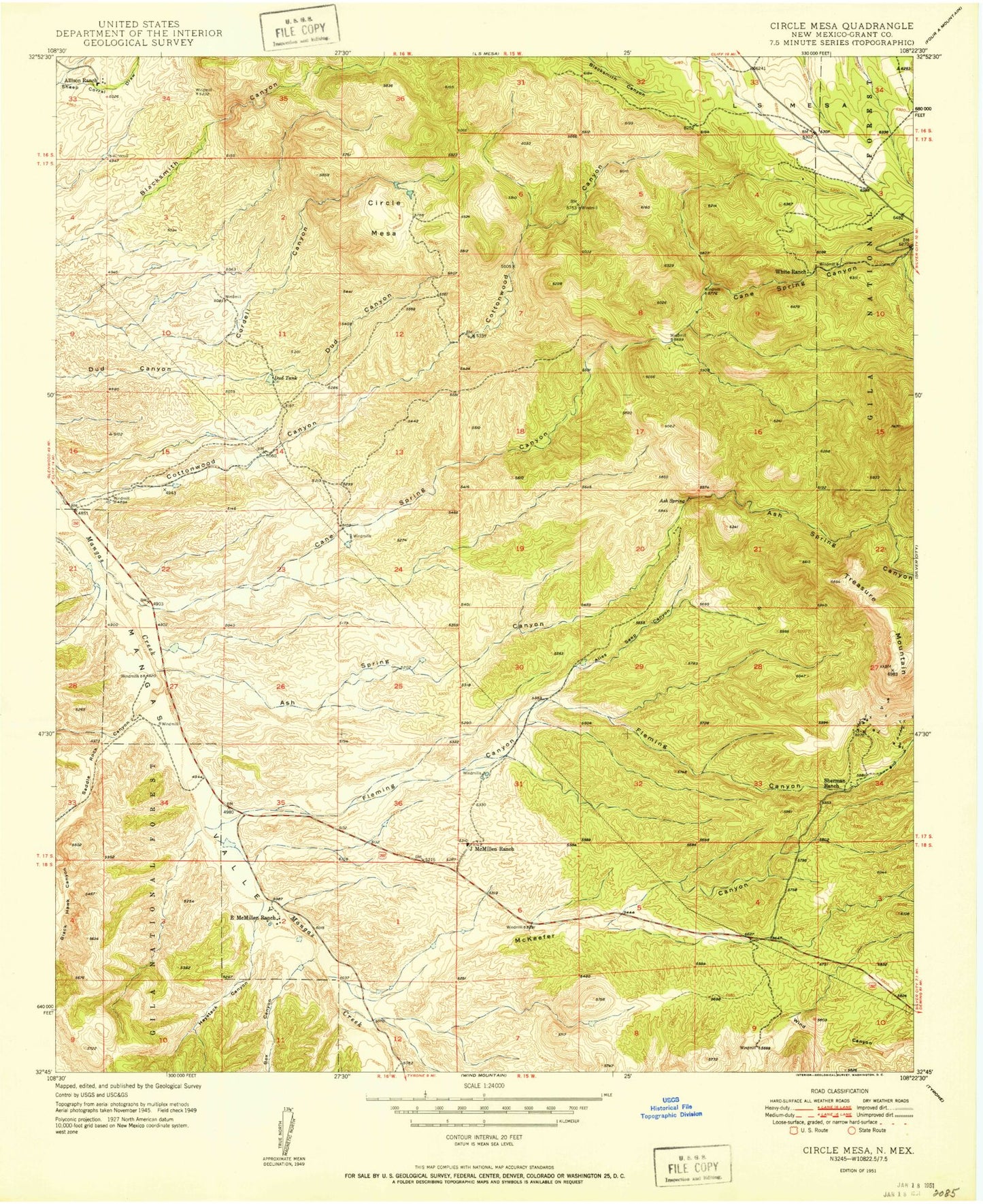
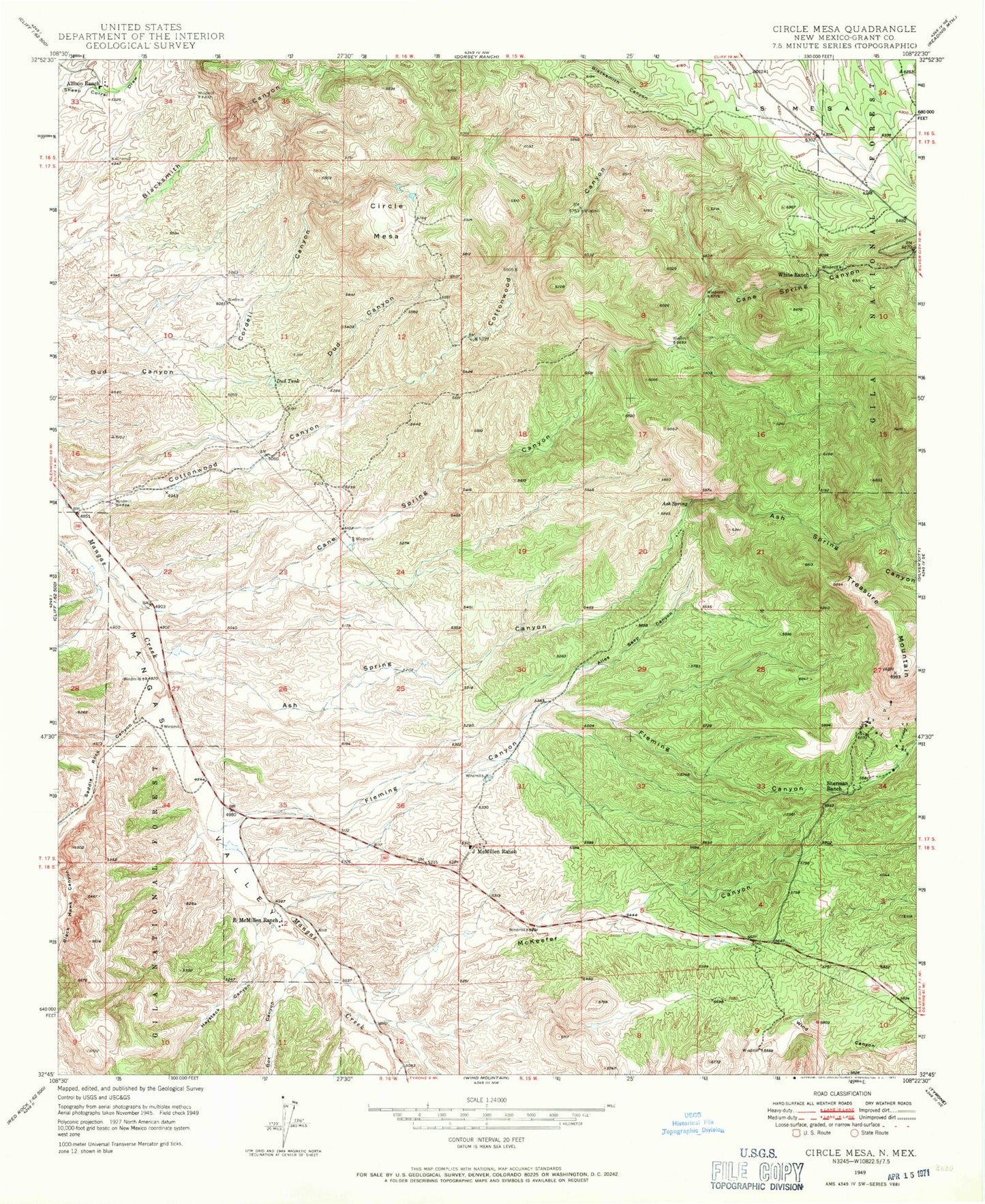
MyTopo
Classic USGS Circle Mesa New Mexico 7.5'x7.5' Topo Map
Couldn't load pickup availability
Historical USGS topographic quad map of Circle Mesa in the state of New Mexico. Map scale may vary for some years, but is generally around 1:24,000. Print size is approximately 24" x 27"
This quadrangle is in the following counties: Grant.
The map contains contour lines, roads, rivers, towns, and lakes. Printed on high-quality waterproof paper with UV fade-resistant inks, and shipped rolled.
Contains the following named places: Agua Alto Tank, Alice Mine, Alies Seep Canyon, Allison Ranch, Ash Spring, Ash Spring Canyon, Barney Kerr Canyon, Box Canyon, Cane Spring, Cane Spring Canyon, Circle Mesa, Cottonwood Canyon, Dorsey Mine, Dud Tank, E McMillen Ranch, Fleming Canyon, Franks 5 Water Well, Haystack Canyon, J McMillen Ranch, McKeefer Canyon, New England, Old Man Mine, Old Woman Mine, Pauline Mine, Saddle Rock Canyon, Sherman Ranch, Treasure Mountain, Wake-Up-Charlie Mine, White Ranch