MyTopo
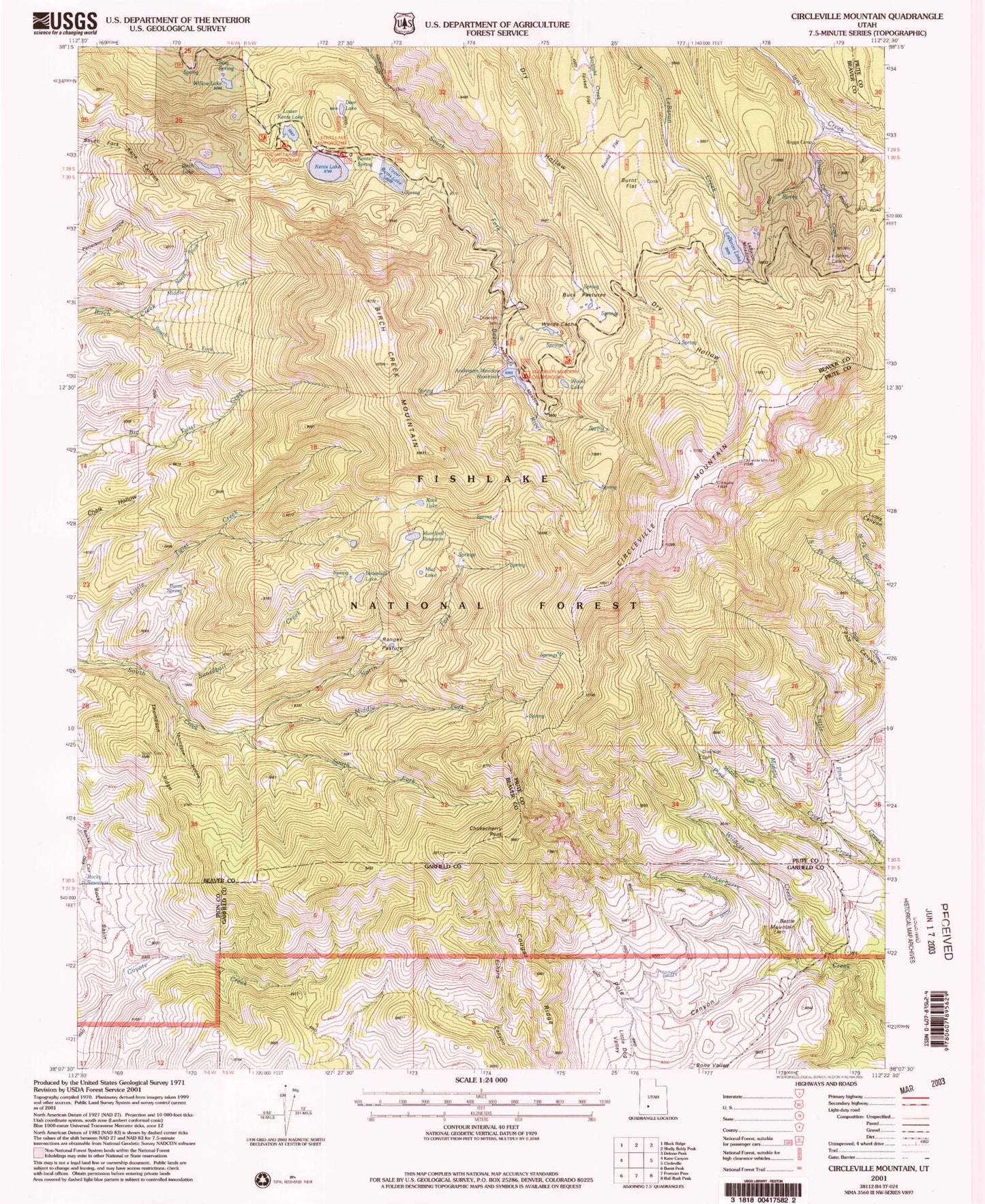
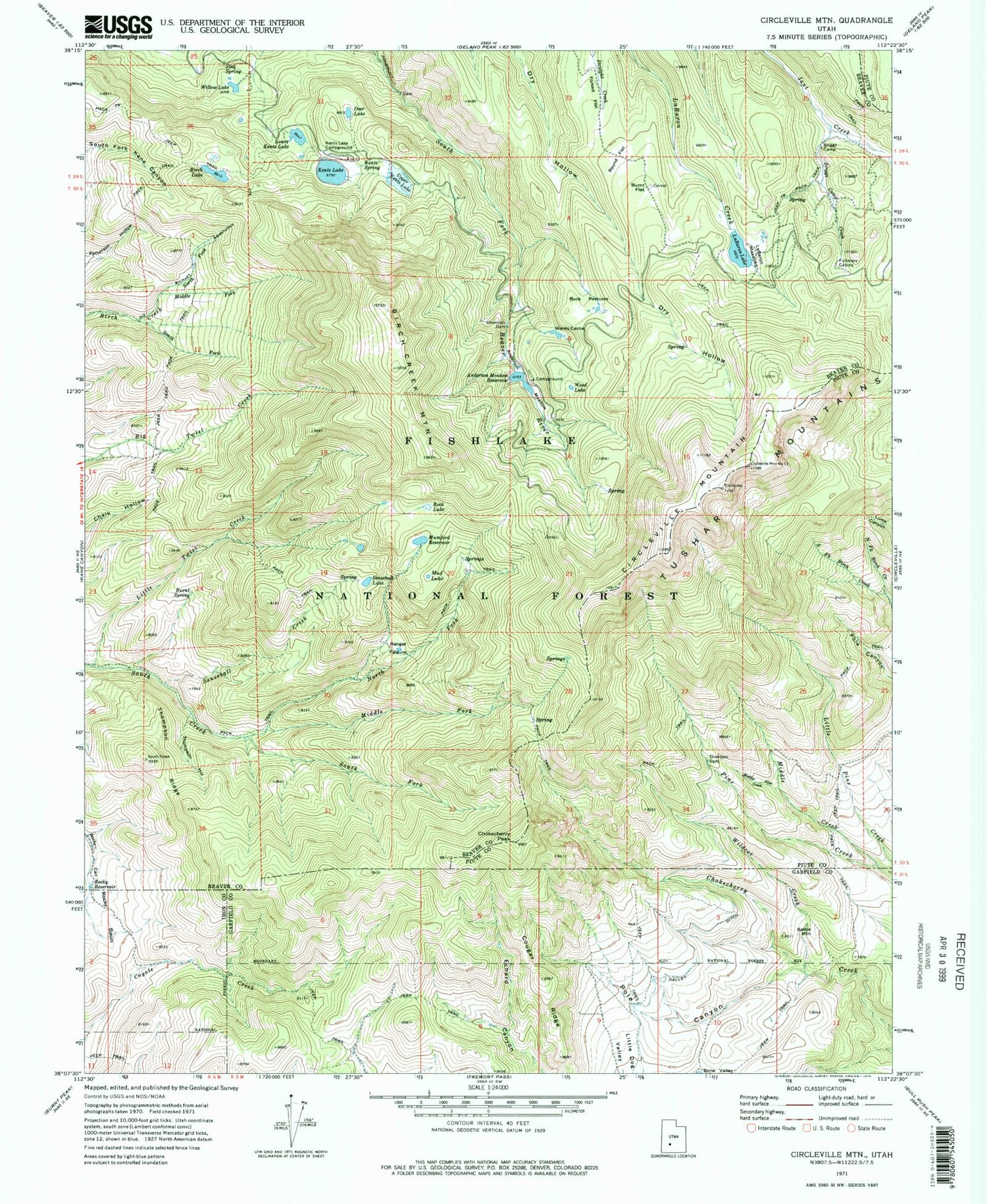
Classic USGS Circleville Mountain Utah 7.5'x7.5' Topo Map
Couldn't load pickup availability
Historical USGS topographic quad map of Circleville Mountain in the state of Utah. Typical map scale is 1:24,000, but may vary for certain years, if available. Print size: 24" x 27"
This quadrangle is in the following counties: Beaver, Garfield, Iron, Piute.
The map contains contour lines, roads, rivers, towns, and lakes. Printed on high-quality waterproof paper with UV fade-resistant inks, and shipped rolled.
Contains the following named places: Anderson Meadow Reservoir, Battle Mountain, Birch Creek Mountain, Birch Lake, Briggs Camp, Briggs Camp Creek, Buck Pastures, Burnt Flat, Burnt Spring, Chokecherry Peak, Circleville Mountain, Cougar Ridge, Dalley Ditch, Deer Lake, Fullmers Cabins, Kents Spring, Little Twist Creek, Lower Kents Lake, Middle Creek, Middle Fork Birch Creek, Middle Fork South Creek, Middle Pine Creek, Mud Lake, Mumford Reservoir, North Fork Birch Creek, North Fork Birch Creek, North Fork South Creek, Pole Canyon, Ranger Pasture, Rock Lake, Rocky Basin, Rocky Reservoir, Round Flat, Senseball Creek, Senseball Lake, South Fork Birch Creek, South Fork Birch Creek, South Fork South Creek, Stag Spring, Thompson Hollow, Thompson Ridge, Upper Kents Lake, Wards Cache, Wildcat Creek, Willow Lake, Wood Lake, Anderson Meadow Reservoir, Anderson Meadow Dam, Upper Kents Lake Number One Dam, Kents Lake, Middle Kents Lake Number Two Dam, Bone Valley, LaBaron Creek, Kents Lake Campground, LeBaron Meadows, LeBaron Lake, Anderson Campground