
MyTopo
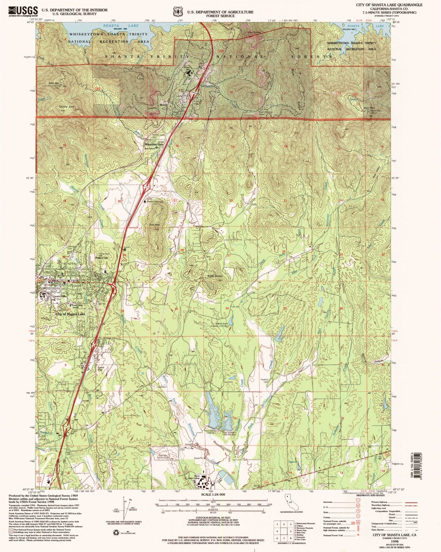
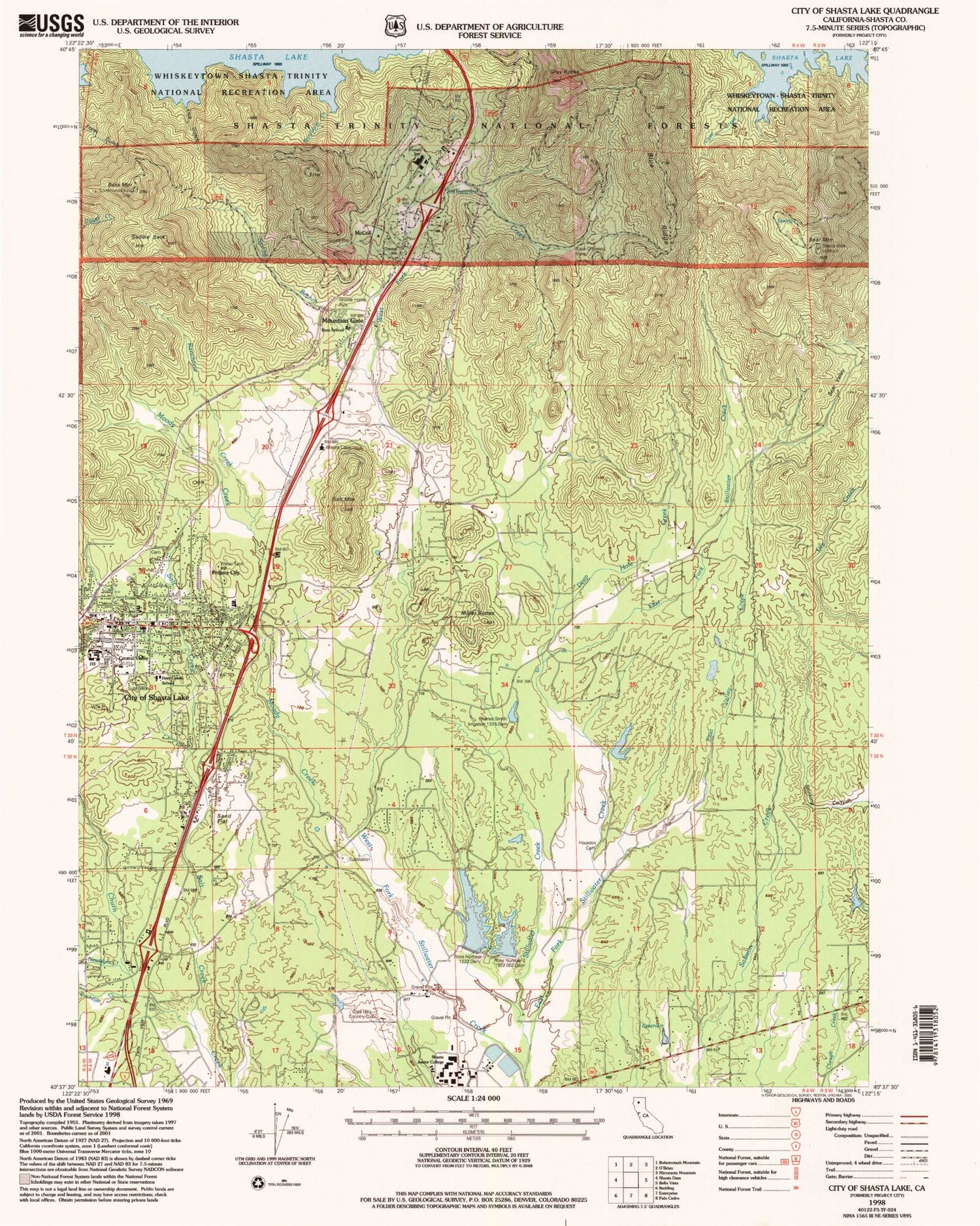
Classic USGS City of Shasta Lake California 7.5'x7.5' Topo Map
Couldn't load pickup availability
Historical USGS topographic quad map of City of Shasta Lake in the state of California. Map scale may vary for some years, but is generally around 1:24,000. Print size is approximately 24" x 27"
This quadrangle is in the following counties: Shasta.
The map contains contour lines, roads, rivers, towns, and lakes. Printed on high-quality waterproof paper with UV fade-resistant inks, and shipped rolled.
Contains the following named places: Bass Mountain, Bayha, Bear Mountain, Black Diamond Mine, Blue Ridge, Bontabile Creek, Buckeye Creek, California Highway Patrol Redding, Central Valley, Central Valley High School, Central Valley Intermediate School, Charles Smith Irrigation 1224 Dam, Cove Creek, Deep Hole Creek, Deer Creek Elementary School, East Fork Stillwater Creek, East Valley Creek, Falkenbury Shale Quarry, Fawndale Rock Quarry, Fish Mountain, Gold Hills Country Club, Grand Oaks Elementary School, Gray Rocks Quarry, Houston, Houston Cemetery, Lick Gulch, Lillienthal, McColl, Miller Buttes, Moody Creek, Mountain Gate, Mountain Gate Census Designated Place, Mountain Gate Mobile Home Park, Mountain Gate Quarry, Mountain Gate Volunteer Fire Department, Newtown Creek, North Woods Discovery School, Pine Grove, Portal Inn, Project City, Project City Cemetery, Project City Post Office, Rancheria Creek, Redding Lakeside Mobile Estates, Ross Number 1 1222 Dam, Ross Number 2 1222-002 Dam, Saddle Back, Salt Creek, Sand Flat, Shasta College, Shasta College Fire Department, Shasta County Sheriff's Office City of Shasta Lake, Shasta Lake, Shasta Lake Fire Protection District Station 1, Shasta Lake Fire Protection District Station 2, Shasta Lake Post Office, Shasta Lake Ranger Station, Spring Branch, Tews Field, Tunnel Inn, West Fork Stillwater Creek, Wonderland Mobile Home Park