MyTopo
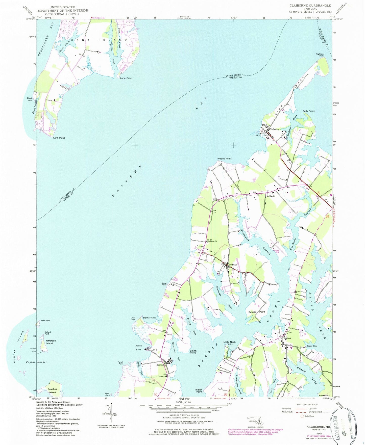
Classic USGS Claiborne Maryland 7.5'x7.5' Topo Map
Couldn't load pickup availability
Historical USGS topographic quad map of Claiborne in the state of Maryland. Map scale may vary for some years, but is generally around 1:24,000. Print size is approximately 24" x 27"
This quadrangle is in the following counties: Queen Anne's, Talbot.
The map contains contour lines, roads, rivers, towns, and lakes. Printed on high-quality waterproof paper with UV fade-resistant inks, and shipped rolled.
Contains the following named places: Asbury United Methodist Church, Asplundh Airport, Baie Holm, Bloody Point, Bozman, Bozman Post Office, Briary Cove, Brightwood, Broad Creek Farms, Cabin Cove, Caulk Cove, Chews Creek, Chews Manor, Claiborne, Claiborne Post Office, Claiborne United Methodist Church, Claiborne-Romancoke Ferry, Coaches Island, Cove Creek, Cove Creek Club, Crescendo, Crosswinds, Cummings Creek, Eastern Bay, Edgar Cove, Ferry Cove, Goat Island, Grace Creek, Great Marsh Point, Harbor Cove, Hidden Creek, Holligans Snooze Inlet, Indian Harbor, Indian Point, James Church, Jefferson Island, John Wesley Methodist Church Cemetery, John Wesley United Methodist Church, Kent Fort Manor, Kent Fort Manor Airport, Kent Point, Kent Point Farm, Kent Point Manor, Little Neck Point, Long Point, Lowes Point, Lowes Wharf, Mallard Point, Martin Airport, McDaniel, McDaniel Post Office, McDaniel Station, Mount Pleasant, Mount Pleasant Landing, North Point, North Pond, Northeast Branch Harris Creek, Northwest Branch Harris Creek, Nutcracker Point, Poplar Harbor, Poplar Island Narrows, Punch Point, Rabbit Point, Rich Neck, Rolles Beach, Saint James Cemetery, Saint Johns Church, Scaffold Creek, Seth Point, Sherwood, Sherwood Post Office, Sherwood United Methodist Church, Smith Point, Tanners Creek, Tanners Point, Tilghman Creek, Tilghman Creek Landing, Tilghman Point, Tower Gardens of the Bay, Tunis, Valliant Point, Wades Point, Waterhole Cove, Wells Cove, Wittman, Wittman Park, Wittman Post Office, Wittman School, ZIP Codes: 21612, 21624, 21647, 21665, 21676


