MyTopo
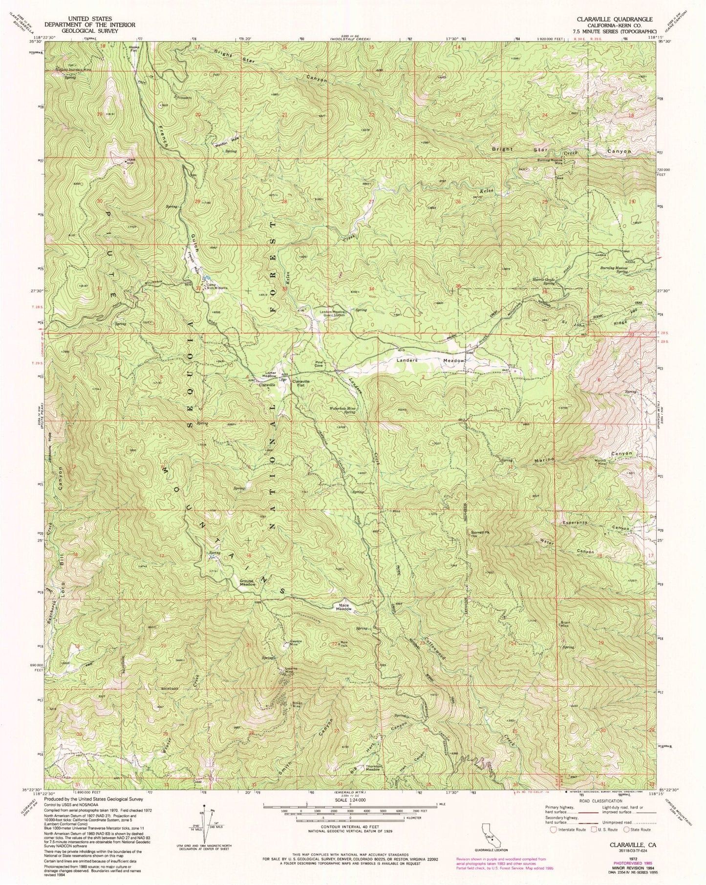
Classic USGS Claraville California 7.5'x7.5' Topo Map
Couldn't load pickup availability
Historical USGS topographic quad map of Claraville in the state of California. Map scale may vary for some years, but is generally around 1:24,000. Print size is approximately 24" x 27"
This quadrangle is in the following counties: Kern.
The map contains contour lines, roads, rivers, towns, and lakes. Printed on high-quality waterproof paper with UV fade-resistant inks, and shipped rolled.
Contains the following named places: Alaska Flat, Bryan Mine, Burning Moscow Mine, Burning Moscow Spring, Camp Nick Williams, Claraville, Claraville Flat, Claraville Post Office, Dear Born Mine, Don Levy Mine, Evergreen Mine, Four Oaks Mine, French Gulch, French Meadow, Gallup Camp, Gallup Mine, Gold Standard Mine, Grouse Meadow, Gwynne Mine, Gwynnette Mine, Harris Grade Spring, Harris Mine, Inmans, Jerry Mine, Landers Creek, Landers Meadow, Landers Meadow Guard Station, Locarno Mine, Lomar Meadow, Mace Meadow, Mack Mine, Marino Canyon, Marino Mine, Pine Cove, Piute Lookout, Saddie Mine, Saint John Ridge, Shady Rest, Simon Mine, Sorrell Peak, The George Lodge, Thornton Meadow, Virginia Mine, Water Canyon, Waterhole Mine, Waterhole Mine Spring, Weldon Meadow