MyTopo
Classic USGS Clarence Center New York 7.5'x7.5' Topo Map
Couldn't load pickup availability
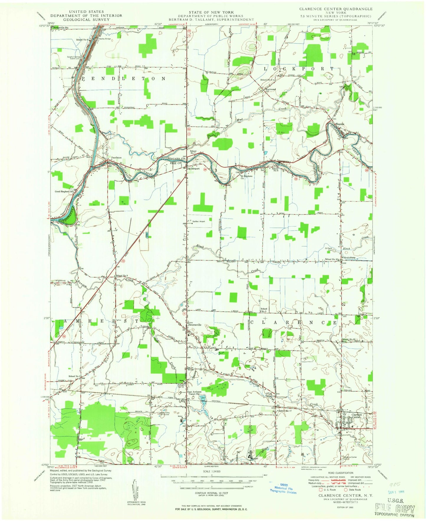
Historical USGS topographic quad map of Clarence Center in the state of New York. Map scale may vary for some years, but is generally around 1:24,000. Print size is approximately 24" x 27"
This quadrangle is in the following counties: Erie, Niagara.
The map contains contour lines, roads, rivers, towns, and lakes. Printed on high-quality waterproof paper with UV fade-resistant inks, and shipped rolled.
Contains the following named places: Amherst Alliance Church, Amherst Church of Christ, Amherst Museum, Amherst Public Library Clearfield Branch, Asbury United Methodist Church, Badding Brothers Farm, Black Creek, Bristol Village Assisted Living Facility, Casey Middle School, Christian Faith Chapel, Clarence Aerodrome, Clarence Center, Clarence Center Cemetery, Clarence Center Census Designated Place, Clarence Center Elementary School, Clarence Center Post Office, Clarence Center United Methodist Church, Clarence Center Volunteer Fire Company, Dodge Elementary School, Donner Brook, East Amherst, East Amherst Post Office, East Amherst Volunteer Fire Department Station 1, ElderWood Assisted Living at Heathwood, Glen Oak Golf Course, Good Shepherd Cemetery, Good Shepherd Church, Good Shepherd School, Got Creek, Greenwood Golf Course, Hawley Bridge, Millersport, Mud Creek, Nike Site BU-09C, Nike Site BU-09L, Nite-Way Drive-In, North Buffalo Suburban Airport, North Forest Acres, Pendleton, Pendleton Cemetery, Pendleton Community Church, Potoczak Airport, Queen of Heaven Cemetery, Ransom Creek Community Church, Rapids, Rapids Bible Church, Rapids Census Designated Place, Rapids Mobile Home Park, Rapids Volunteer Fire Company Station 1, Raymond, Raymond Community Church, Saint Augustines Church, Saint Marys Cemetery, Saint Mary's Church, Saint Marys School, Saint Pauls Cemetery, Saint Pauls Church, Saint Stephen's United Church of Christ, School Number 10, School Number 12, School Number 17, School Number 4, School Number 5, School Number 6, School Number 7, School Number 8, School Number 9, Suburban Acres Mobile Home Park, Sulphur Springs Guard Lock, Swormville, Swormville Fire Company, Szulis Greenhouse, The Woodlands Mobile Home Park, Therings Garden and Greenhouse, Town of Clarence, Transit Drive-In, Transit Middle School, Transit Valley Country Club, Trinity Lutheran Church, Universal School, Wendelville Volunteer Fire Company Station 3, Williamsville East High School, Williamsville North High School, Wolcottsburg, Woodstream Farms, Zion Lutheran Church, ZIP Codes: 14032, 14051