MyTopo
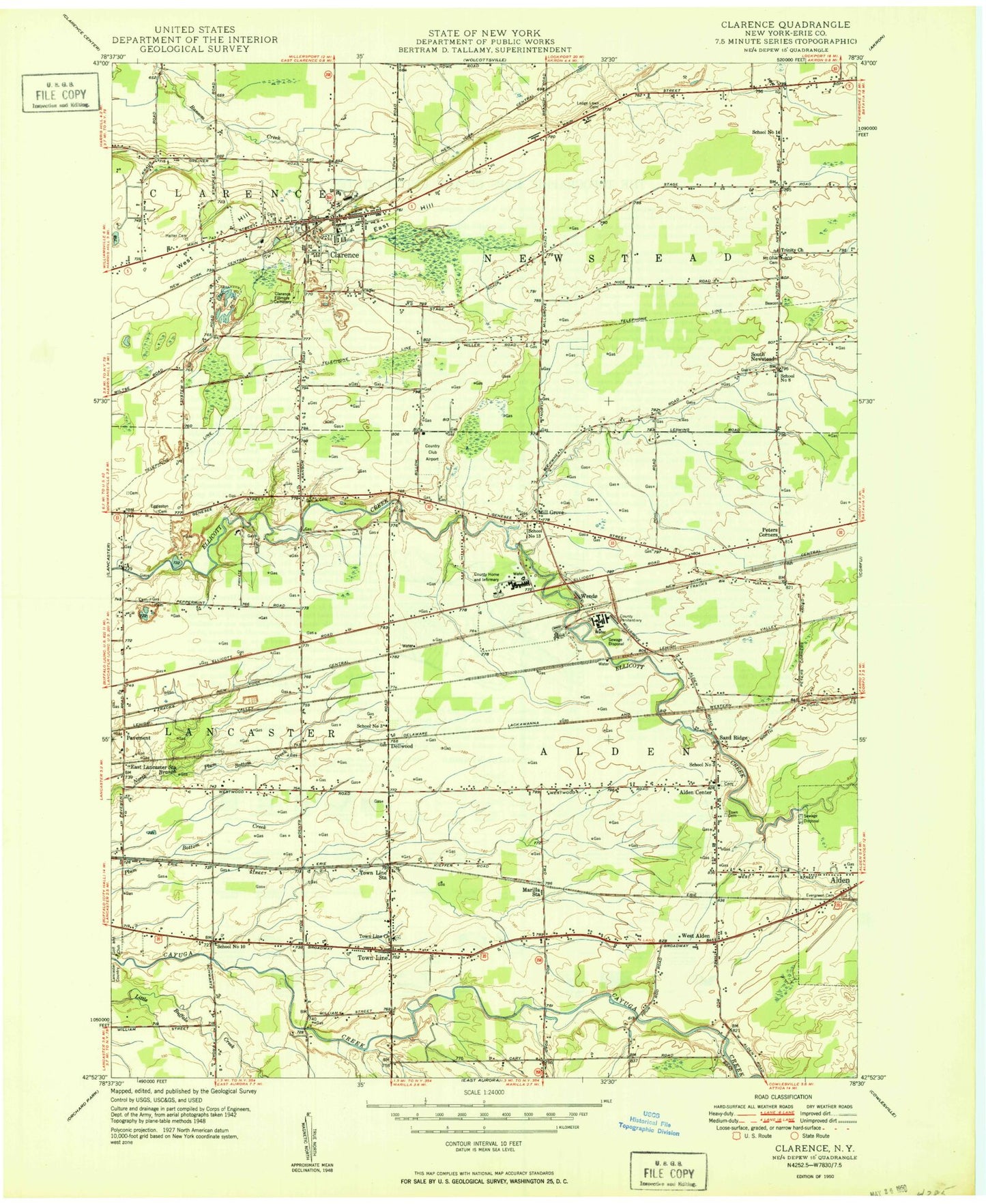
Classic USGS Clarence New York 7.5'x7.5' Topo Map
Couldn't load pickup availability
Historical USGS topographic quad map of Clarence in the state of New York. Map scale may vary for some years, but is generally around 1:24,000. Print size is approximately 24" x 27"
This quadrangle is in the following counties: Erie.
The map contains contour lines, roads, rivers, towns, and lakes. Printed on high-quality waterproof paper with UV fade-resistant inks, and shipped rolled.
Contains the following named places: Alden Center, Alden Christian School, Alden Evergreen Cemetery, Alden Fire Department Station 2, Alden Mennonite Church, Alden Primary School at Townline, Alden Town Cemetery, Alden Town Hall, Alden Village Wastewater Treatment Plant, Bonny Lake, Buffalo Tournament Club, Buffalo-Lancaster Regional Airport, Cedar Swamp, Clarence, Clarence Census Designated Place, Clarence Fillmore Cemetery, Clarence Fire District 1, Clarence Middle School, Clarence Post Office, Clarence Rest Area, Clarence United Methodist Church, Country Club Airport, Country Meadows Mobile Home Park, Dellwood, East Hill, East Lancaster Station, Erie County Home and Infirmary, Faith Fellowship Church, Fox Valley Club, Genesee Pit, Halter Cemetery, Holy Mother of the Rosary Cathedral, Hull Family Cemetery, Lake Jerome, Lancaster Community Baptist Church, Lancaster Golf and Country Club, Lancaster Police Department, Ledge Lawn Cemetery, Living Free Christian Center, Looneyville, Marilla Station, Millgrove, Millgrove Bible Church, Millgrove Volunteer Fire Department, Mount Olive Cemetery, New York State Police Troop A Zone 2 Alden Station, New York State Police Troop A Zone 2 Clarence Station, Nike Site BU-18C, Nike Site BU-18L, Our Lady of Peace Roman Catholic Church, Our Lady of Peace School, Pavement, Peters Corners, Pine Meadows Greens, Powers Cemetery, Quarry Hill Estates Mobile Home Park, Rock Oak Estates Mobile Home Park, Sacred Heart Home, Saint Adalbert's Cemetery, Saint Aidans Episcopal Church, Saint John the Baptist School, Saint Johns Roman Catholic Church, Saint Paul's United Church, Sand Ridge, School Number 3, School Number 5, School Number 6, School Number 8, Schopf Pioneer Cemetery, South Newstead, The Church of Jesus Christ of Latter Day Saints, The Great Pumpkin Farm, Town Line, Town Line Census Designated Place, Town Line Lutheran Cemetery, Town Line Lutheran Church, Town Line Station, Town Line Volunteer Fire Company Main Station, Town of Alden, Tree of Life Church, Trinity Evangelical Lutheran Church, Ulbrichs Tree Farm, Wende, Wende Correctional Facility, West Alden, West Alden Station, West Hill, ZIP Codes: 14004, 14031