MyTopo
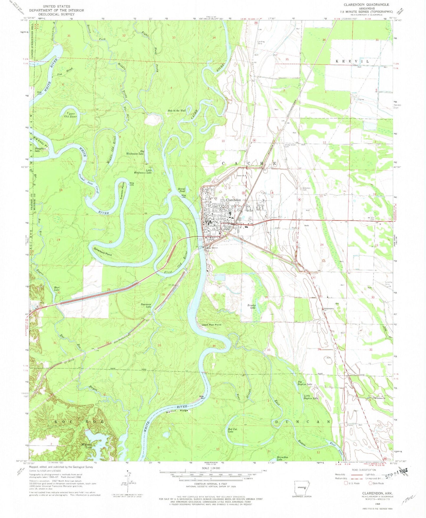
Classic USGS Clarendon Arkansas 7.5'x7.5' Topo Map
Couldn't load pickup availability
Historical USGS topographic quad map of Clarendon in the state of Arkansas. Typical map scale is 1:24,000, but may vary for certain years, if available. Print size: 24" x 27"
This quadrangle is in the following counties: Monroe, Prairie.
The map contains contour lines, roads, rivers, towns, and lakes. Printed on high-quality waterproof paper with UV fade-resistant inks, and shipped rolled.
Contains the following named places: Bateman Cemetery, Bear Slough, Bethlehem Church, Big Eddy Point, Crooked Point Cut-off, Dead Man Point, East Bayou, Fish Slough, Franklin Point, Grove Church, Middle Prong, Philadelphia Church, Right Hand Prong, Shady Grove Cemetery, Sycamore Point, The Horn, Walnut Ridge, Jeffries, Holly Tree Bend, Ramsey Mill Site, Otter Lake, Burma (historical), Clarendon High School, Clarendon Elementary School, Lenoir (historical), Township of Cache, Big Baptize Lake, Big Weidmann Lake, Brushy Lake, First Old River, Hart Lake, Hole in the Wall, Little Baptize Lake, Little Weidmann Lake, Middle Old River, Midway Lake, Passmore Lake, Red Cat Lake, Round Pond, Upper Old River, Cache River National Wildlife Refuge, Cache River, Clarendon, Midway Lake Dam, Clarendon Post Office, Clarendon Volunteer Fire Department, Monroe County Sheriff's Office, 1st Judicial District Drug Task Force, Clarendon Police Department, City of Clarendon