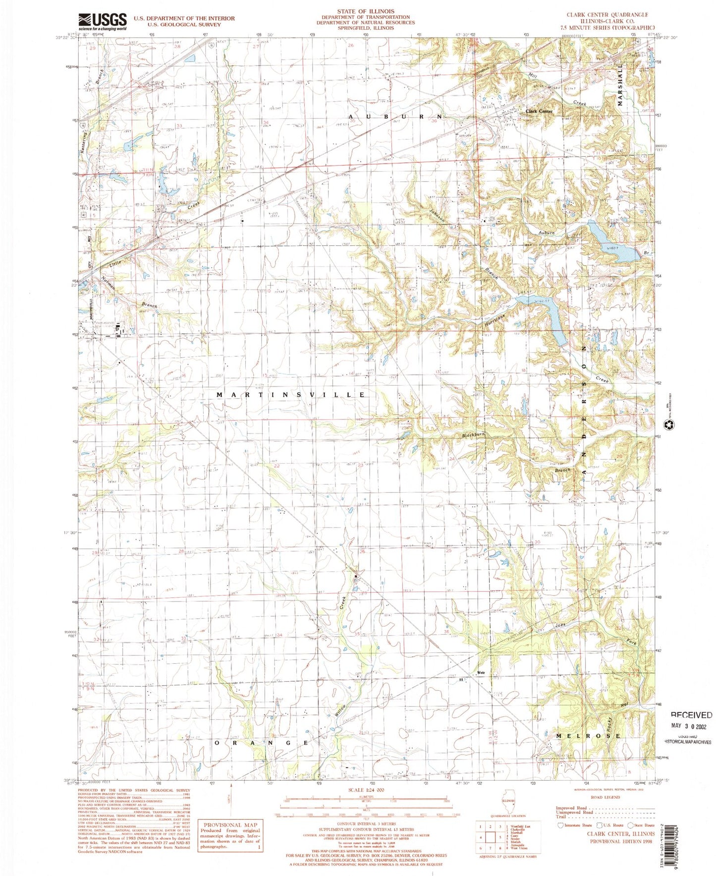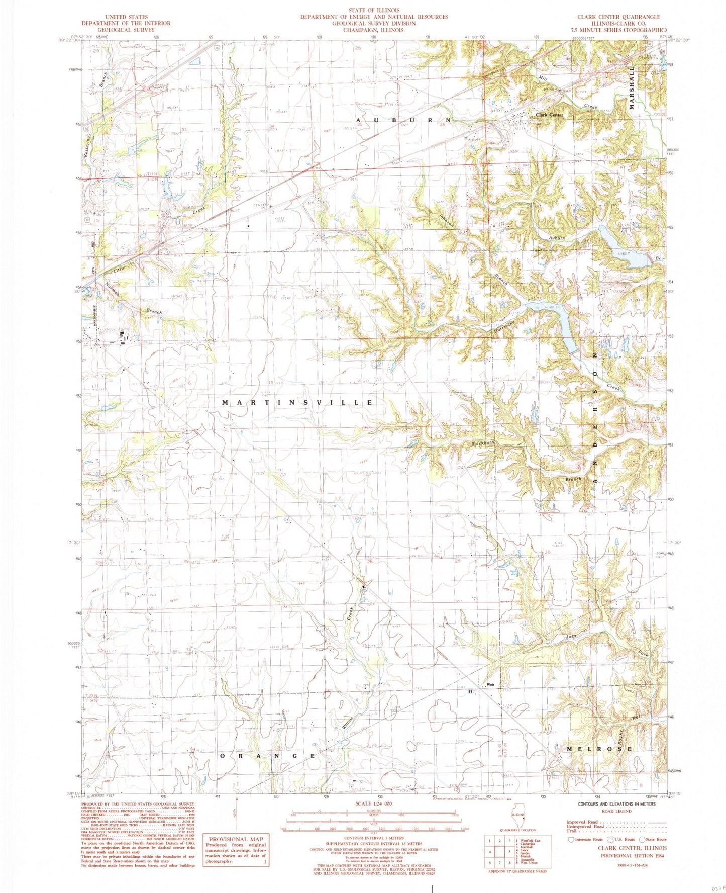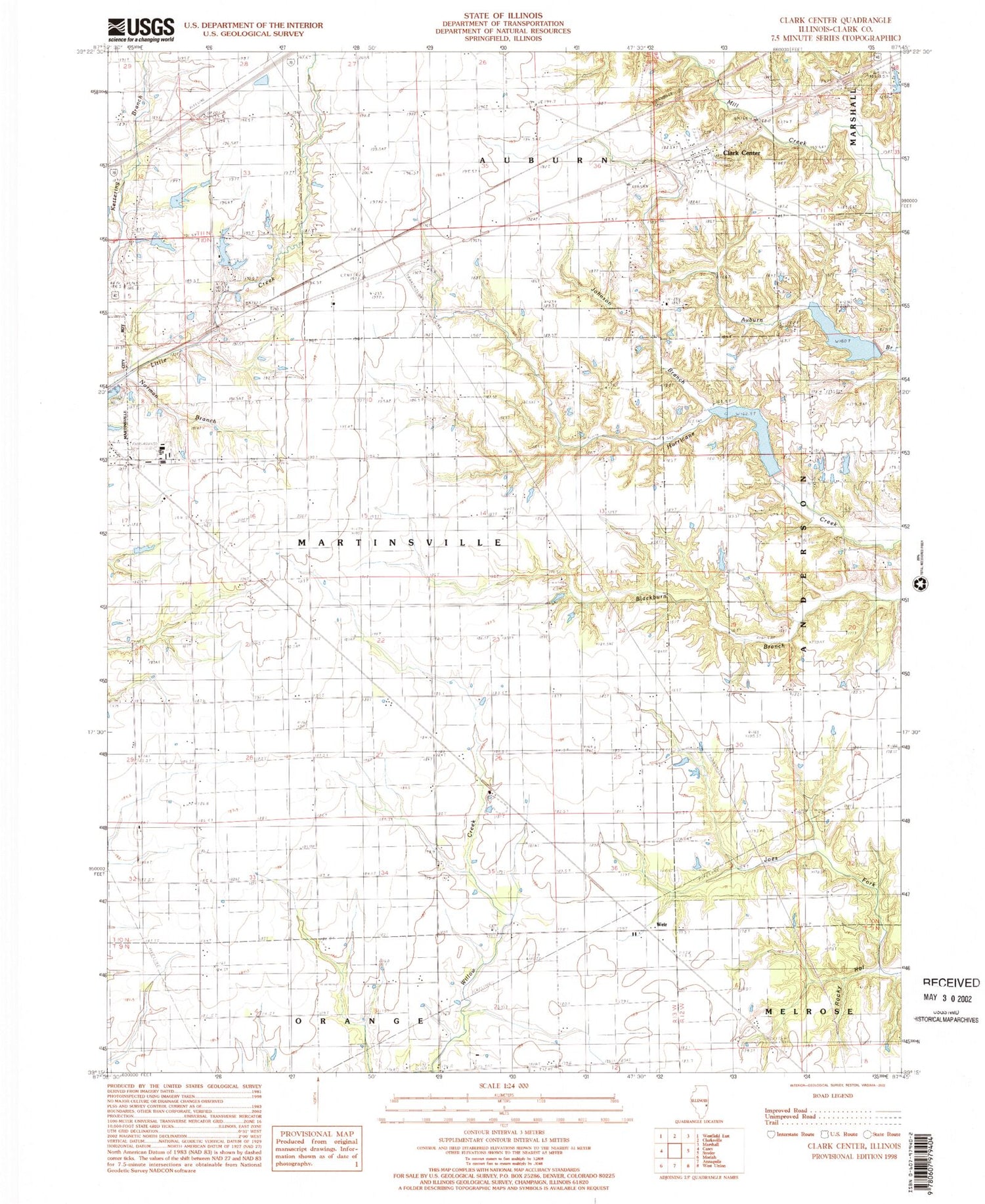

MyTopo
Classic USGS Clark Center Illinois 7.5'x7.5' Topo Map
Couldn't load pickup availability
Historical USGS topographic quad map of Clark Center in the state of Illinois. Map scale may vary for some years, but is generally around 1:24,000. Print size is approximately 24" x 27"
This quadrangle is in the following counties: Clark.
The map contains contour lines, roads, rivers, towns, and lakes. Printed on high-quality waterproof paper with UV fade-resistant inks, and shipped rolled.
Contains the following named places: Adenmoor, Auburn Cemetery, Baird Cemetery, Bethel School, Clark Center, Clark County, Five Points Christian Church, Freedom Baptist Church, Freedom School, Frog Pond School, Island Grove Cemetery, Island Grove Church, Jackson School, Jeff Davis School, Johnson Branch, Mill Creek Watershed Impoundment Reservoir, Mill Creek Watershed Structure Number 6 Dam, Mill Creek Watershed Structure Number 7 Dam, Mount Pleasant Cemetery, Mount Pleasant Church, Newmans Lake, Newmans Lake Dam, Norman Branch, Norton Cemetery, Possum Ridge School, Prairie School, Rocky Hollow, Saint Paul Church, School Number 1, Shiloh Church, Township of Auburn, Township of Martinsville, Weir, WMMC-FM (Marshall), Woodlawn School, ZIP Code: 62442