MyTopo
Classic USGS Clark Mountain California 7.5'x7.5' Topo Map
Couldn't load pickup availability
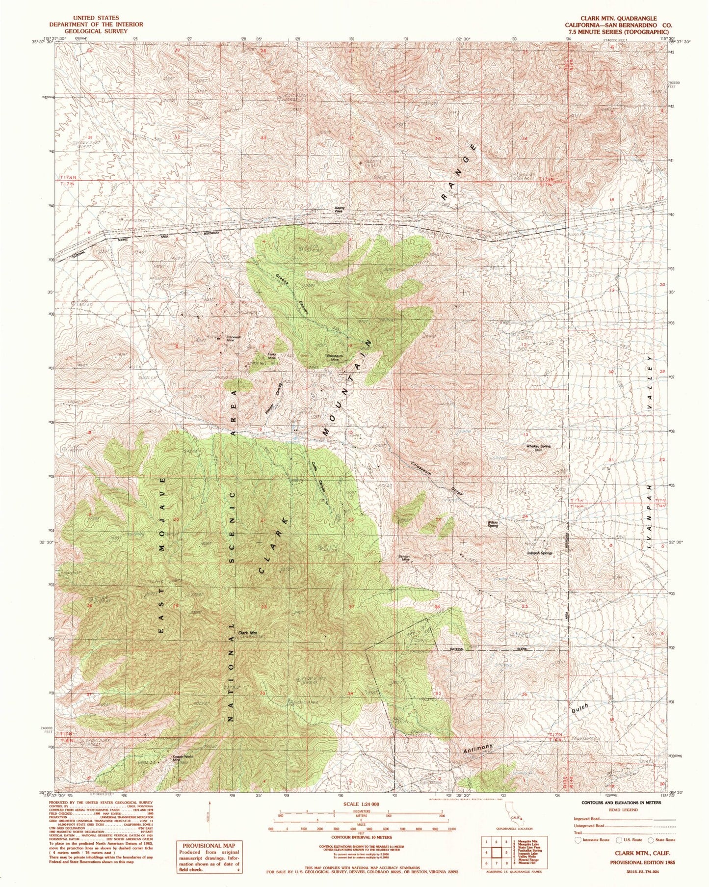
Historical USGS topographic quad map of Clark Mountain in the state of California. Map scale may vary for some years, but is generally around 1:24,000. Print size is approximately 24" x 27"
This quadrangle is in the following counties: San Bernardino.
The map contains contour lines, roads, rivers, towns, and lakes. Printed on high-quality waterproof paper with UV fade-resistant inks, and shipped rolled.
Contains the following named places: Antimony Mine, Benson Mine, Burro Spring, Clark Mountain, Clark Mountain Natural Arch, Clark Mountain Range, Colosseum Gorge, Colosseum Mine, Copper World Mine, Curtis Canyon, Greens Canyon, Greens Mine, Greens Well, Ivanpah Springs, Keany Pass, Kiwisar Canyon, Stonewall Mine, Taylor Mine, Whiskey Spring, Whitfield Spring, Willow Spring