MyTopo
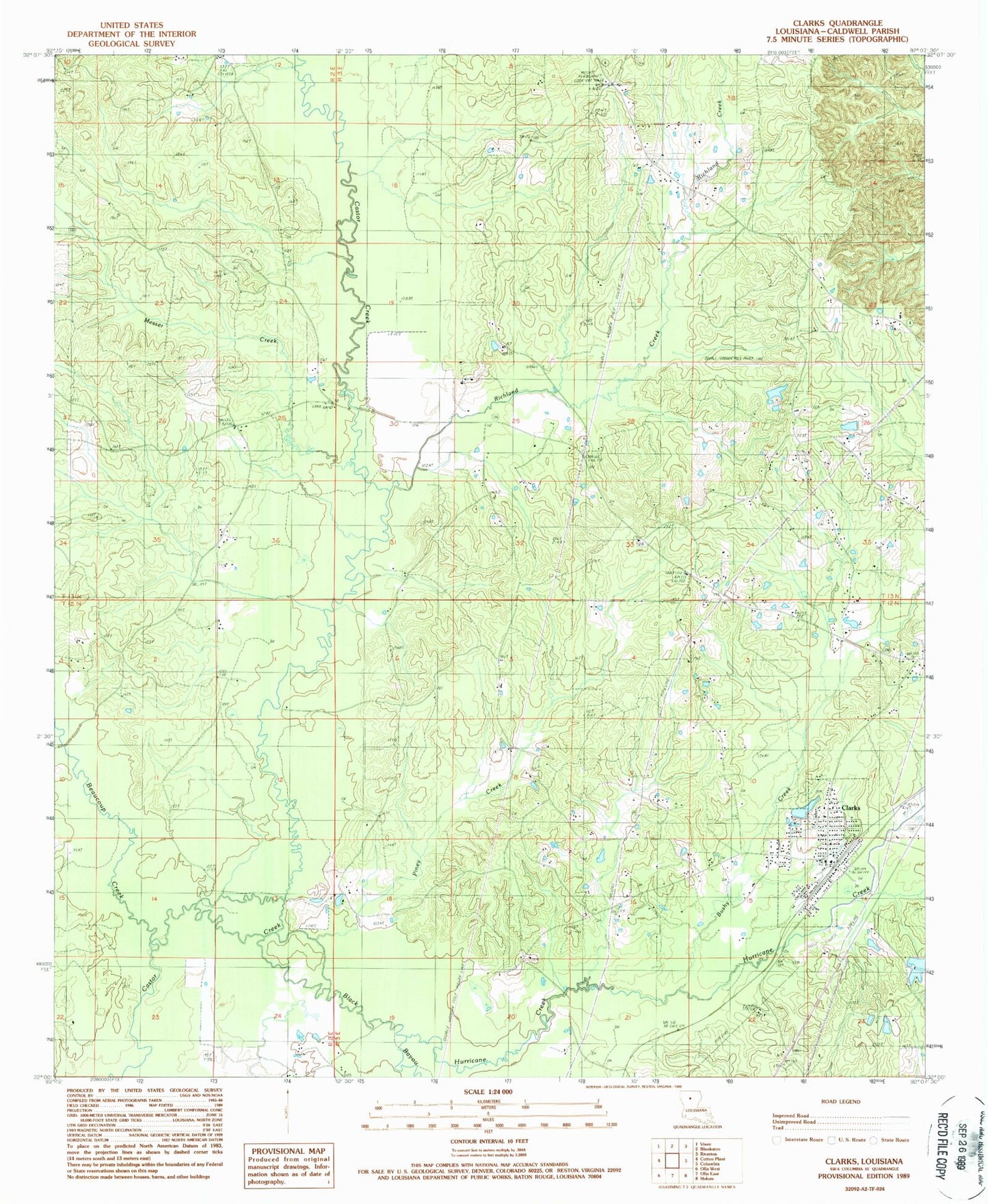
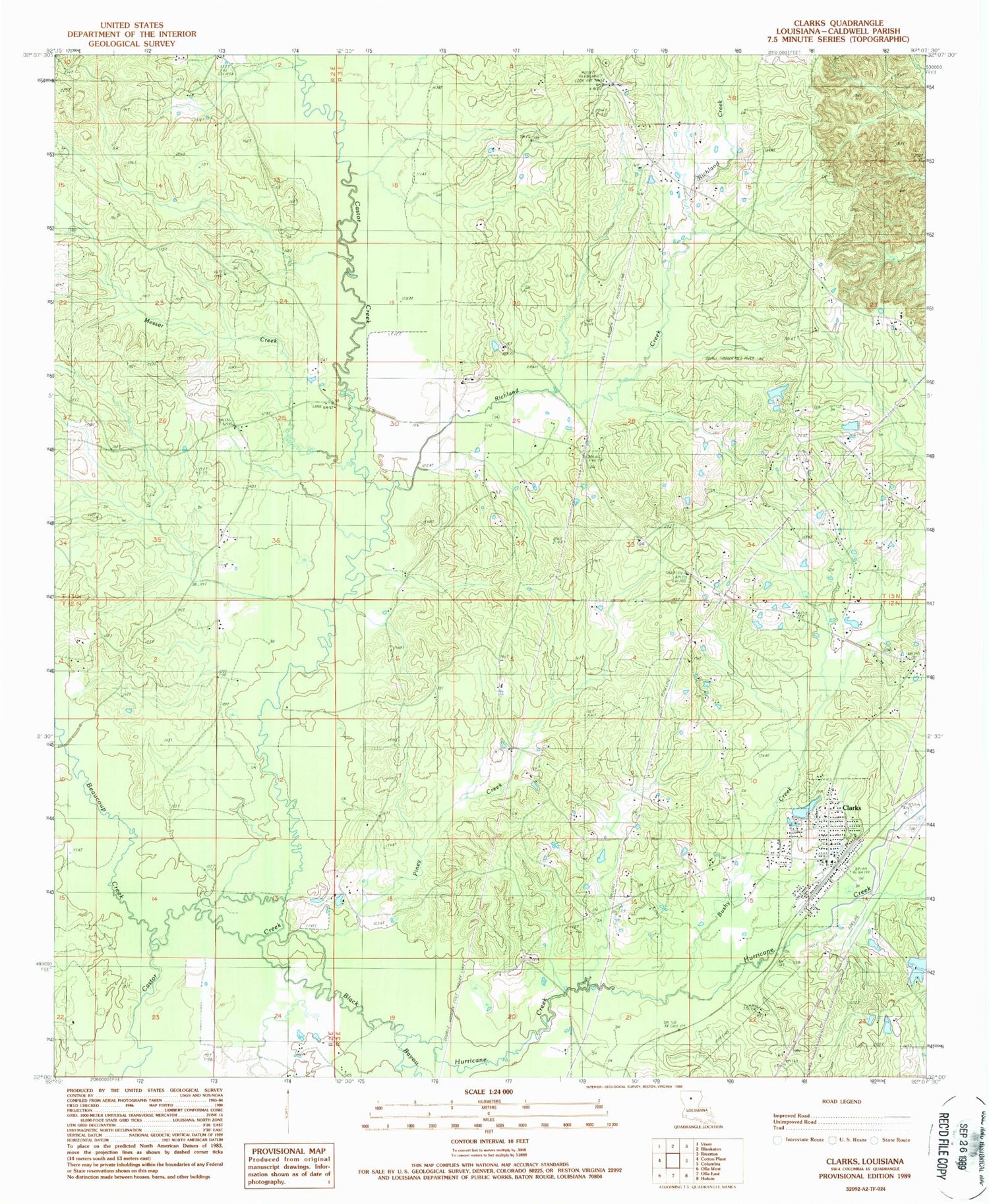
Classic USGS Clark Louisiana 7.5'x7.5' Topo Map
Couldn't load pickup availability
Historical USGS topographic quad map of Clark in the state of Louisiana. Map scale may vary for some years, but is generally around 1:24,000. Print size is approximately 24" x 27"
This quadrangle is in the following counties: Caldwell.
The map contains contour lines, roads, rivers, towns, and lakes. Printed on high-quality waterproof paper with UV fade-resistant inks, and shipped rolled.
Contains the following named places: Banks Springs Gas Field, Beaucoup Creek, Bethel Church Gas Field, Black Bayou, Bushy Creek, Caldwell Parish Correctional Center, Clarks, Clarks Post Office, Clarks Volunteer Fire Department, Cooper, Cross Roads Baptist Church, Cross Roads Cemetery, East Columbia Volunteer Fire Department, Hurricane Creek, KARD-TV (West Monroe), Kelly School Gas Field, Messer Creek, Mount Pleasant Lookout Tower, New Bethel Cemetery, North Clarks Gas Field, Oak Grove School, Old Bethel Baptist Church, Old Bethel Cemetery, Old Bethel Christian Academy School, Parish Governing Authority District 3, Parish Governing Authority District 6, Piney Creek, Richland Creek, Village of Clarks, Ward Nine, Ward Seven, Ward Two, West Clarks Gas Field, ZIP Code: 71435