MyTopo
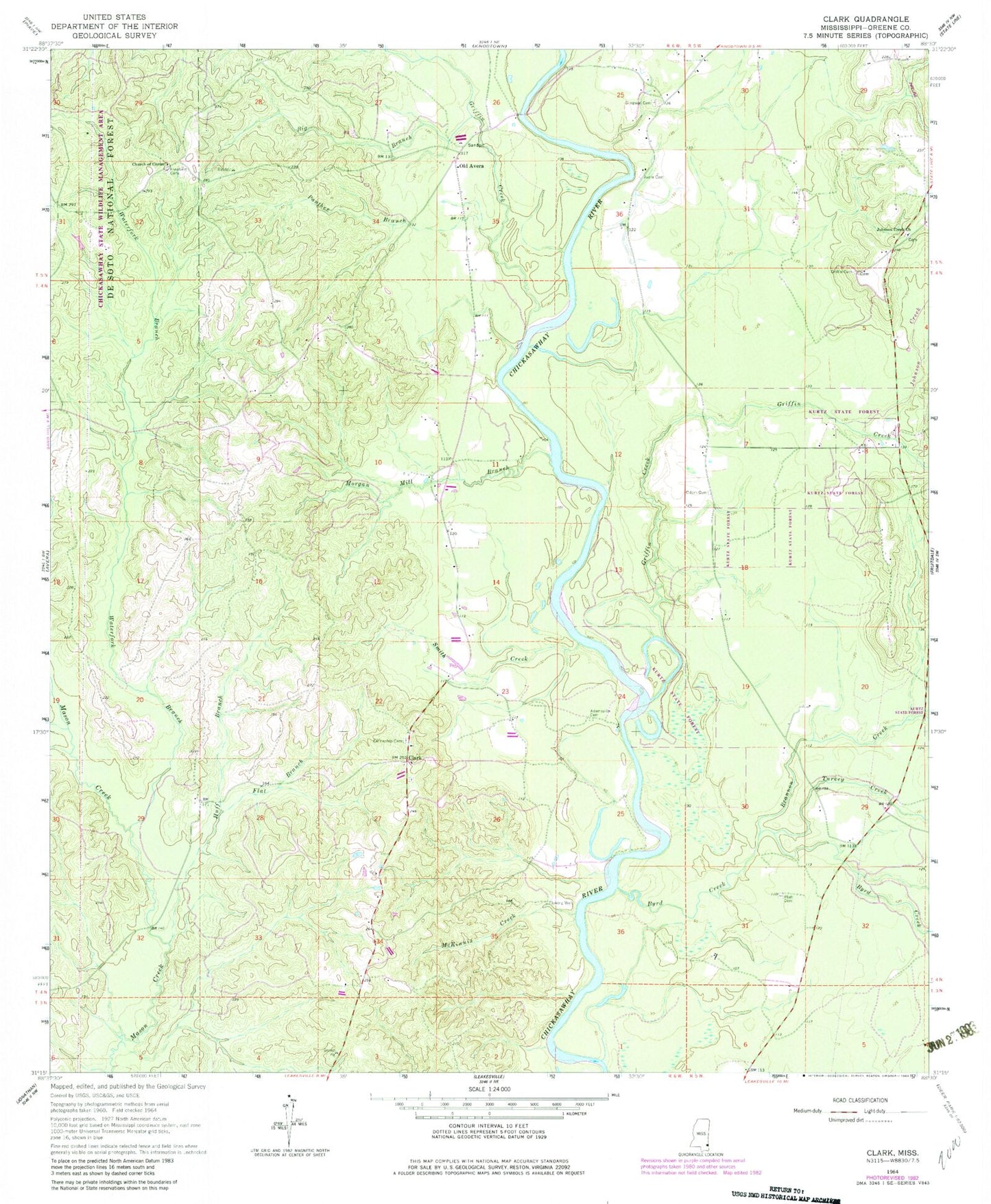
Classic USGS Clark Mississippi 7.5'x7.5' Topo Map
Couldn't load pickup availability
Historical USGS topographic quad map of Clark in the state of Mississippi. Map scale may vary for some years, but is generally around 1:24,000. Print size is approximately 24" x 27"
This quadrangle is in the following counties: Greene.
The map contains contour lines, roads, rivers, towns, and lakes. Printed on high-quality waterproof paper with UV fade-resistant inks, and shipped rolled.
Contains the following named places: Adamsville, Adamsville Cemetery, Avera Cemetery, Big Branch, Brannon Creek, Byrd Creek, Church of Christ, Clark, Fellowship Cemetery, Fellowship Freewill Baptist Church, Flat Branch, Freefield Cemetery, Griffin Cemetery, Griffin Creek, Huff Branch, Johnson Creek, Johnson Creek Baptist Church, Johnson Creek Cemetery, McKinnis Creek, Morgan Mill Branch, Odom Cemetery, Old Avera, Painters Branch, Panther Branch, Platt Cemetery, Robertson Creek, Simpson Cemetery, Smith Creek, Supervisor District 2, Turkey Creek, Waterfork Branch