
MyTopo
Classic USGS Clarkesville NE Georgia 7.5'x7.5' Topo Map
Couldn't load pickup availability
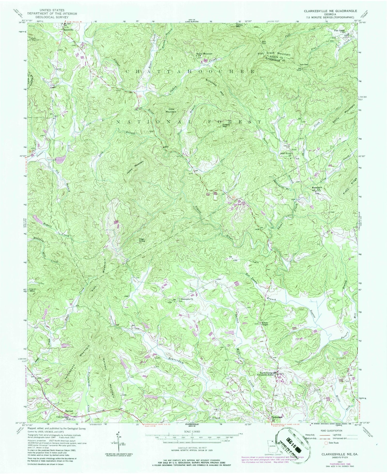
Historical USGS topographic quad map of Clarkesville NE in the state of Georgia. Typical map scale is 1:24,000, but may vary for certain years, if available. Print size: 24" x 27"
This quadrangle is in the following counties: Habersham, Rabun, White.
The map contains contour lines, roads, rivers, towns, and lakes. Printed on high-quality waterproof paper with UV fade-resistant inks, and shipped rolled.
Contains the following named places: Alley Creek, Amos Creek, Ann Gap, Ben Tatum Branch, Cove Branch, Deep Creek, Harvest, High Knob, Ivy Branch, Long Branch, Low Gap, Macedonia Church, Macedonia School, Moates Branch, Nerve Branch, North Georgia Technical College, Oakey Creek, Oakey Mountain Church, Porters Mill Branch, Raper Creek, Seed, Seed Unity Church, Shoal Branch, Shoal Creek, Stonepile Church, Whitworth Branch, Yellowbank Mountain, Pigeon, Alec Mountain, Crow Mountain, Grassy Mountain, Irwin Mountain, Mack Mountain, Sillycook Mountain, Yellow Mountain, Yoemans Dam, Yoemans Lake, Soque Creek Structure 13 Dam, Reservoir 13, Sautee Creek Structure 22 Dam, Reservoir 22, Sautee Creek Structure 18 Dam, Reservoir 18, Beaverdam Creek Structure 42 Dam, Reservoir 42, Alleys Chapel Methodist Cemetery, Bethlehem Baptist Cemetery, Boys Mountain View Camp, College Park, Cool Springs United Methodist Church Cemetery, Emma Griffin Hardman Bridge, Habersham County, Harvest Christian Church Cemetery, Harvest Christian Church, Macedonia Baptist Cemetery, North Habersham Middle School, Oakey Mountain Baptist Church, Oakey Mountain Cemetery, Porters Mill (historical), Providence Baptist Church, Riverside School (historical), Stonepile Cemetery, Unity Cemetery, Flat Creek School (historical), Alleys Chapel, Batesville, Bethlehem Church, Cool Springs Church, Flat Creek Church, Flat Creek Mountain, Harvest Mountain, Sautee-Nacoochee Valley, Sautee Valley, Clarkesville Division, Black Bear Creek, Habersham County Fire Department Station 8, Habersham County Fire Department Station 15, Wildcat Volunteer Fire Department Station 11, Arrendale Forest Airport


