
MyTopo
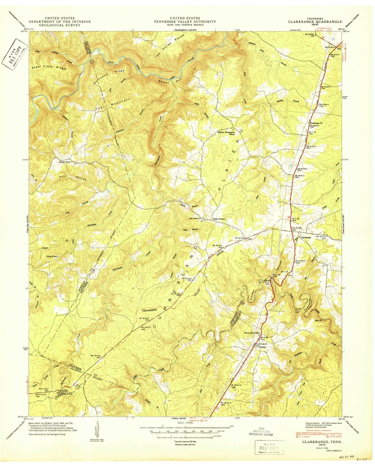
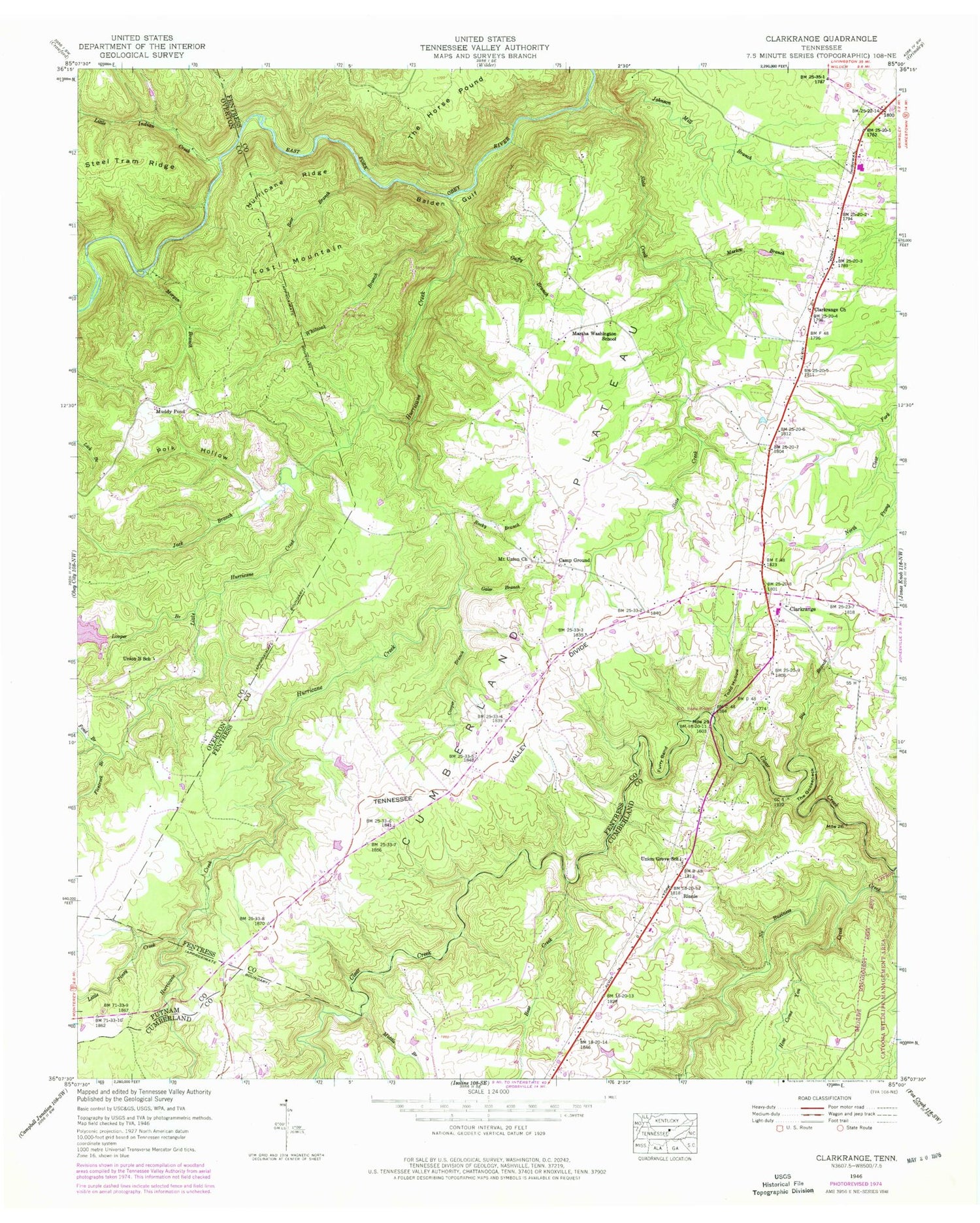
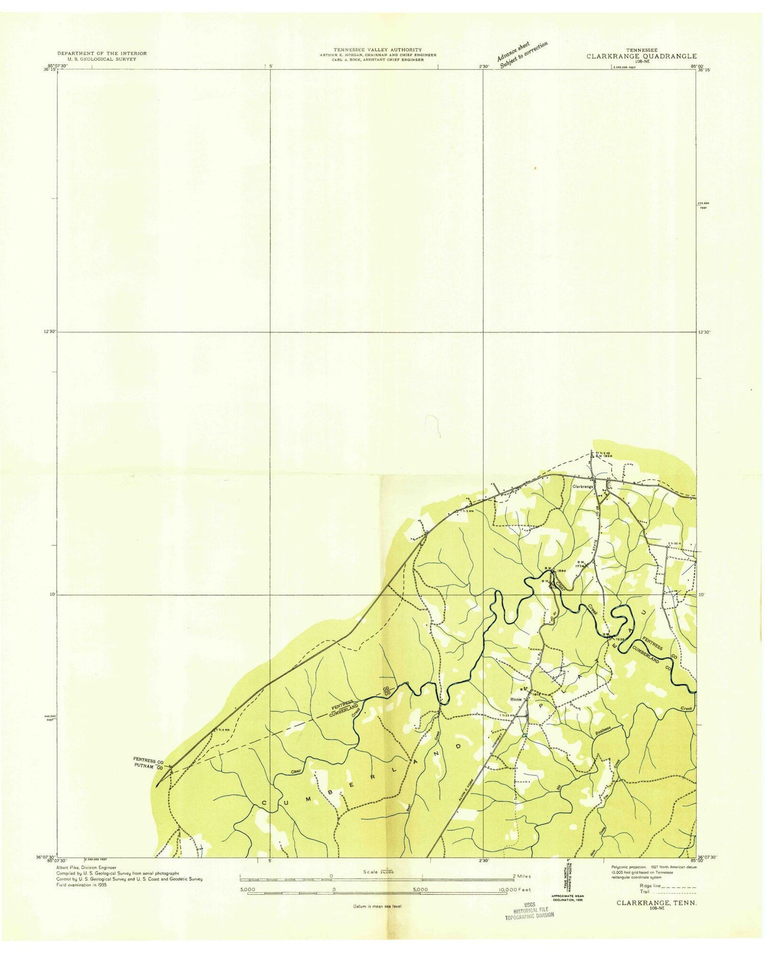
Classic USGS Clarkrange Tennessee 7.5'x7.5' Topo Map
Couldn't load pickup availability
Historical USGS topographic quad map of Clarkrange in the state of Tennessee. Map scale may vary for some years, but is generally around 1:24,000. Print size is approximately 24" x 27"
This quadrangle is in the following counties: Cumberland, Fentress, Overton, Putnam.
The map contains contour lines, roads, rivers, towns, and lakes. Printed on high-quality waterproof paper with UV fade-resistant inks, and shipped rolled.
Contains the following named places: Balden Gulf, Bear Branch, Bear Creek, Big Branch, Camp Ground, Clarkrange, Clarkrange Baptist Church, Clarkrange Cemetery, Clarkrange Census Designated Place, Clarkrange Church, Clarkrange Elementary School, Clarkrange High School, Clarkrange Post Office, Clarkrange United Methodist Church, Commissioner District 4, Cooper Branch, D O Beaty Bridge, Elmore Cemetery Number One, Fentress County Volunteer Fire Department Station 7 Clarkrange, Flintrock Branch, Fond Branch, Furry Bend, Galer Branch, Guffy Branch, Hickory Corner, How Come You Creek, Hudsonburg, Hurricane Creek, Hurricane Ridge, Jack Branch, Johnson Mill Branch, Key Hollow, Little Hurricane Creek, Little Indian Creek, Little Piney Creek, Looper Branch, Lost Mountain, Marlow Branch, Martha Washington School, Maynard Hollow, Middle Branch, Morgan Branch, Mount Union Cemetery, Mount Union Church, Muddy Pond, Muddy Pond Cemetery, Muddy Pond School, No Business Creek, North Cumberland Elementary School, Peachstone Camp Hollow, Pine Ridge Lake Dam, Polk Hollow, Rinnie, Rinnie Cemetery, Rinnie Freewill Baptist Church, Rocky Branch, Slate Creek, Steel Tram Ridge, The Gooseneck, Todd Hollow, Union B School, Union Grove School, Whiteoak Branch, ZIP Code: 38553


