MyTopo
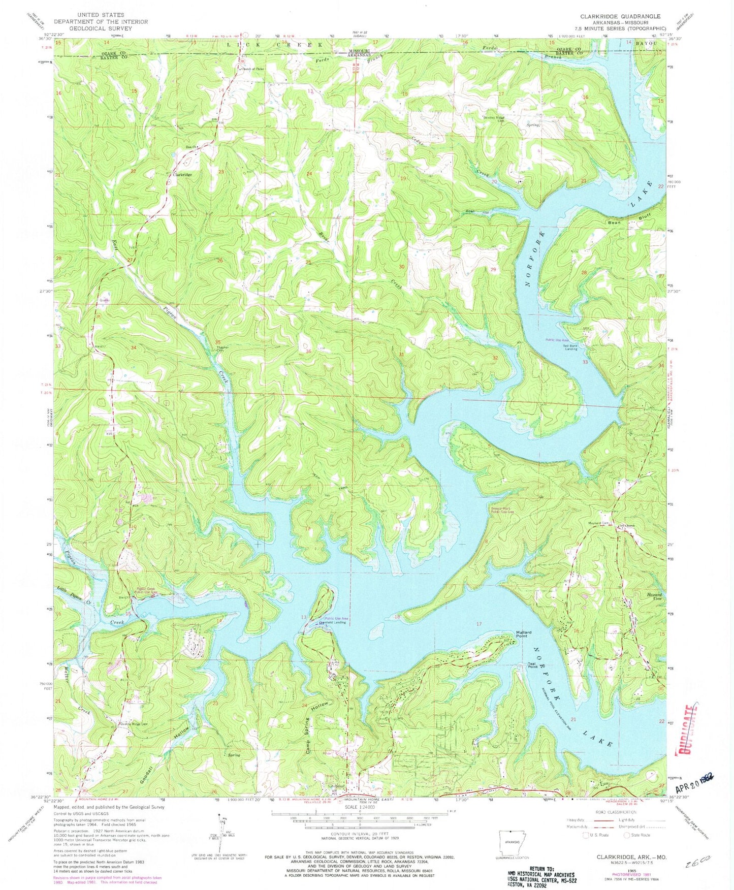
Classic USGS Clarkridge Arkansas 7.5'x7.5' Topo Map
Couldn't load pickup availability
Historical USGS topographic quad map of Clarkridge in the state of Arkansas. Map scale may vary for some years, but is generally around 1:24,000. Print size is approximately 24" x 27"
This quadrangle is in the following counties: Baxter, Ozark.
The map contains contour lines, roads, rivers, towns, and lakes. Printed on high-quality waterproof paper with UV fade-resistant inks, and shipped rolled.
Contains the following named places: 101 Gamaliel Volunteer Fire Protection District, 72623, Bean Bluff, Bentley Ridge Cemetery, Biems Ford, Briar Creek, Camp Spring Hollow, Cedar Creek, Church of Christ, Clarkridge, Clarkridge Post Office, Clarkridge Volunteer Fire Department, Clarkridge Volunteer Fire Department Station 3, Clarkridge Volunteer Fire Department Substation 1, Cranfield Landing, Cranfield Use Area, Dogwood Park, East Pigeon Creek, Fawn Park, Fords Branch, Goodall Hollow, Granfiled Ferry, Kingswood Estates, Lakeside Terrace, Little Pigeon Creek, Mallard Point, Maynard Cemetery, Norfork Lake, One Hundred One Church, Pigeon Creek, Pigeon Creek Public Use Area, Quality Ridge Cemetery, Quality Ridge School, Red Bank Landing, Red Bank Use Area, Rose Hollow, Seward Point Public Use Area, Teal Point, Thacker Cemetery, Township of Pigeon, Walker Creek, Zion Church