MyTopo
Classic USGS Clarks Hill South Carolina 7.5'x7.5' Topo Map
Couldn't load pickup availability
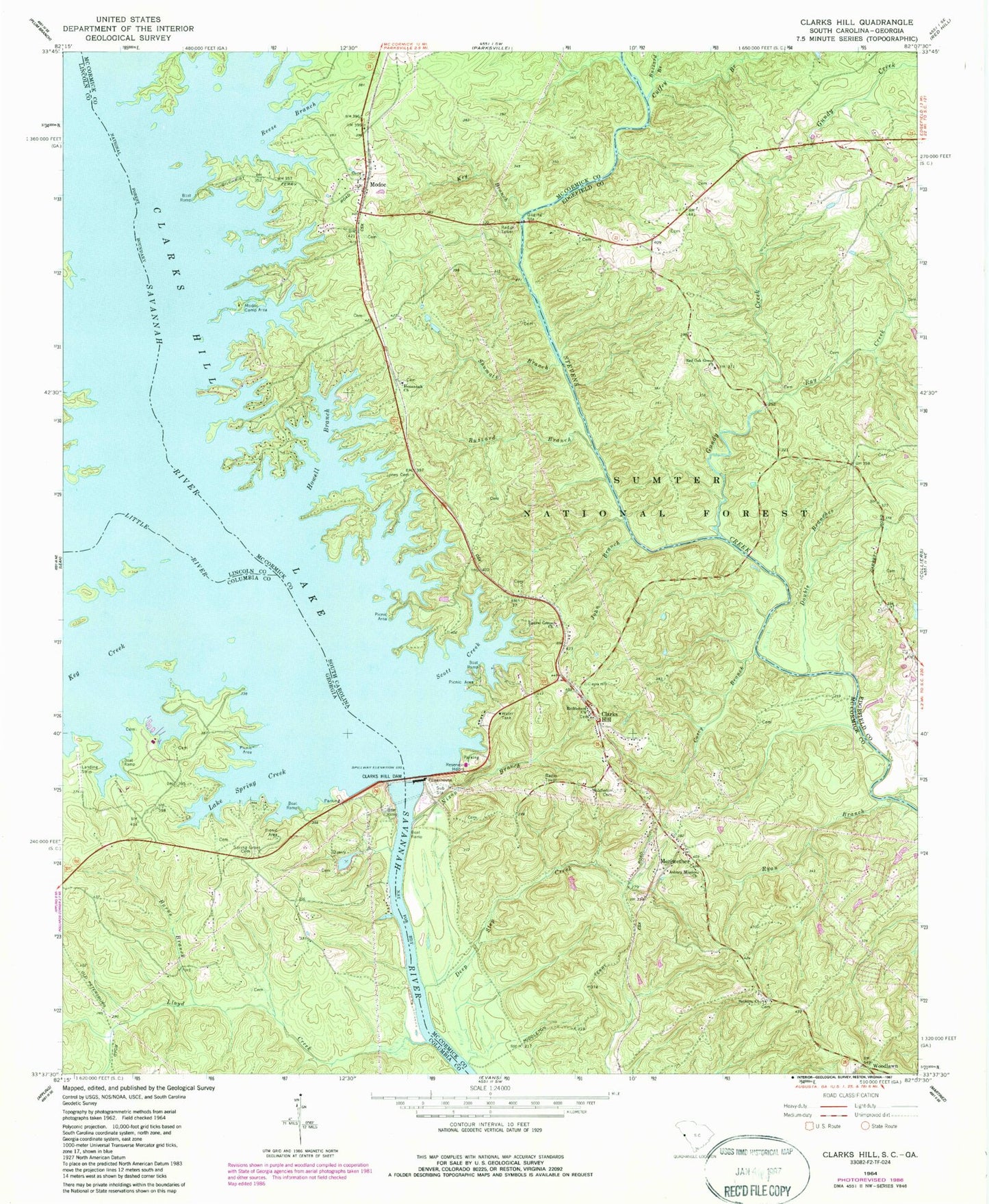
Historical USGS topographic quad map of Clarks Hill in the states of South Carolina, Georgia. Map scale may vary for some years, but is generally around 1:24,000. Print size is approximately 24" x 27"
This quadrangle is in the following counties: Columbia, Edgefield, Lincoln, McCormick.
The map contains contour lines, roads, rivers, towns, and lakes. Printed on high-quality waterproof paper with UV fade-resistant inks, and shipped rolled.
Contains the following named places: Asbury Mission Church, Ashbury Cemetery, Below Dam Recreation Area, Bethany Church, Bethany School, Bethelehem Cemetery, Bethlehem Church, Burns Branch, Buzzard Branch, Civilian Conservation Corps Camp F-11, Clark Hill Powerhouse, Clarks Hill, Clarks Hill - Lost Wilderness Fire Department Station 70, Clarks Hill Census Designated Place, Clarks Hill Recreation Area, Cosey Branch, Cuffey Branch, Deep Step Creek, Dents Ferry, Dorn School, Double Branches, Flat Rock School, Gilchrist Ferry, Gundy Creek, Hamilton Brach Campground, Hamilton Branch Campground, Hosannah Church, Hosannah School, Howell Branch, J. Strom Thurmond Dam, John Branch, Jones Cemetery, Keg Creek, Key Branch, Lake Spring Creek, Laura Chapel, Laurel Grove Church, Laurel Grove School, Little River, Lloyd Creek, Madoc Bridge, Meriwether, Middleton Cemetery, Middletons Ferry, Modoc, Modoc Baptist Church, Modoc Camp Area, Modoc Cemetery, Modoc Census Designated Place, Modoc Volunteer Fire Department, Nixon Branch, Paces Ferry, Poplar Springs School, Price Island, Ray Creek, Red Oak Grove Church, Red Oak Grove School, Reese Branch, Ryan Branch, Scott Creek, Scotts Ferry, Shumate Branch, Spring Grove Cemetery, The Point, Westside Fire Department Westside Substation, Woodlawn, ZIP Code: 29838