MyTopo
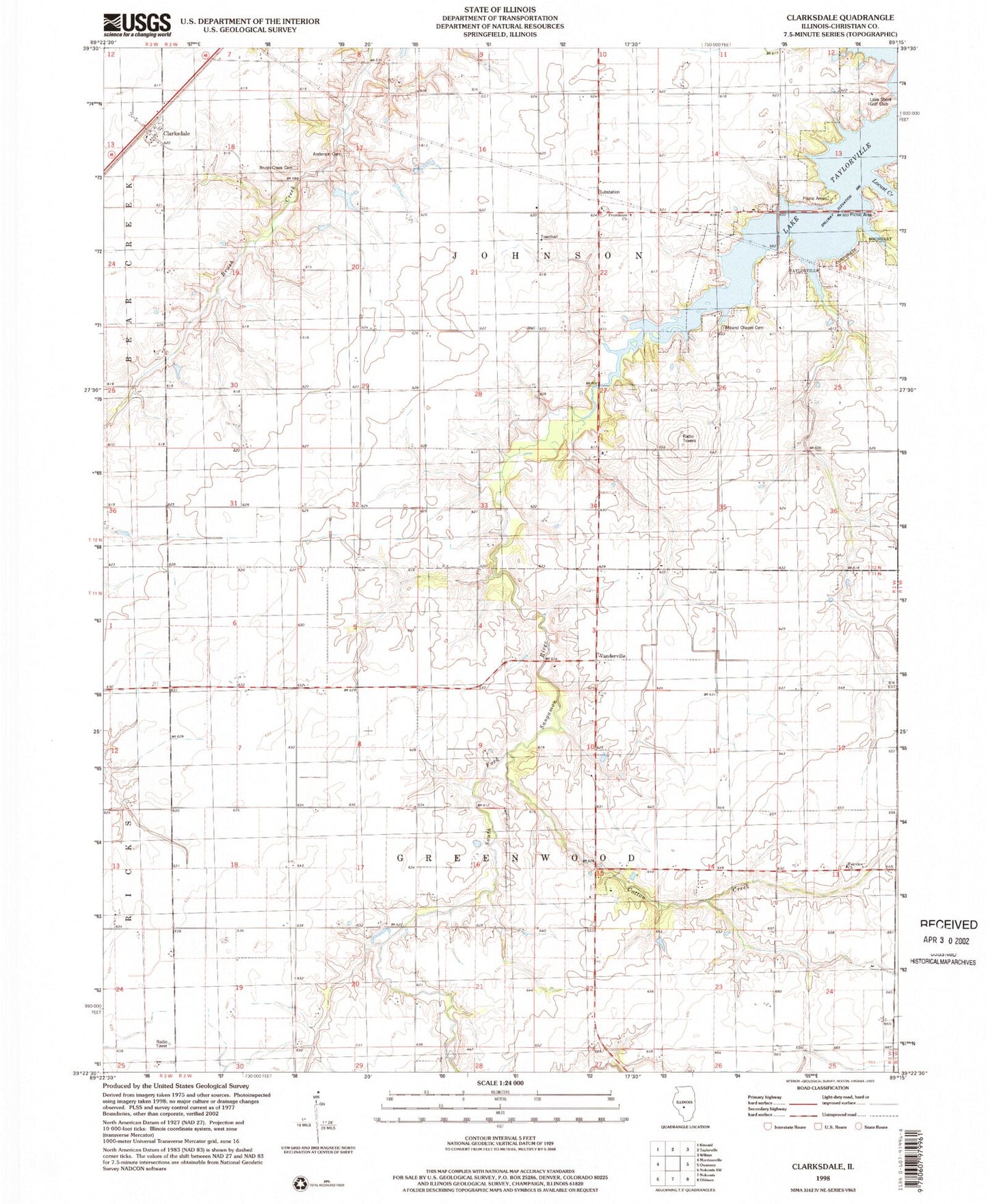
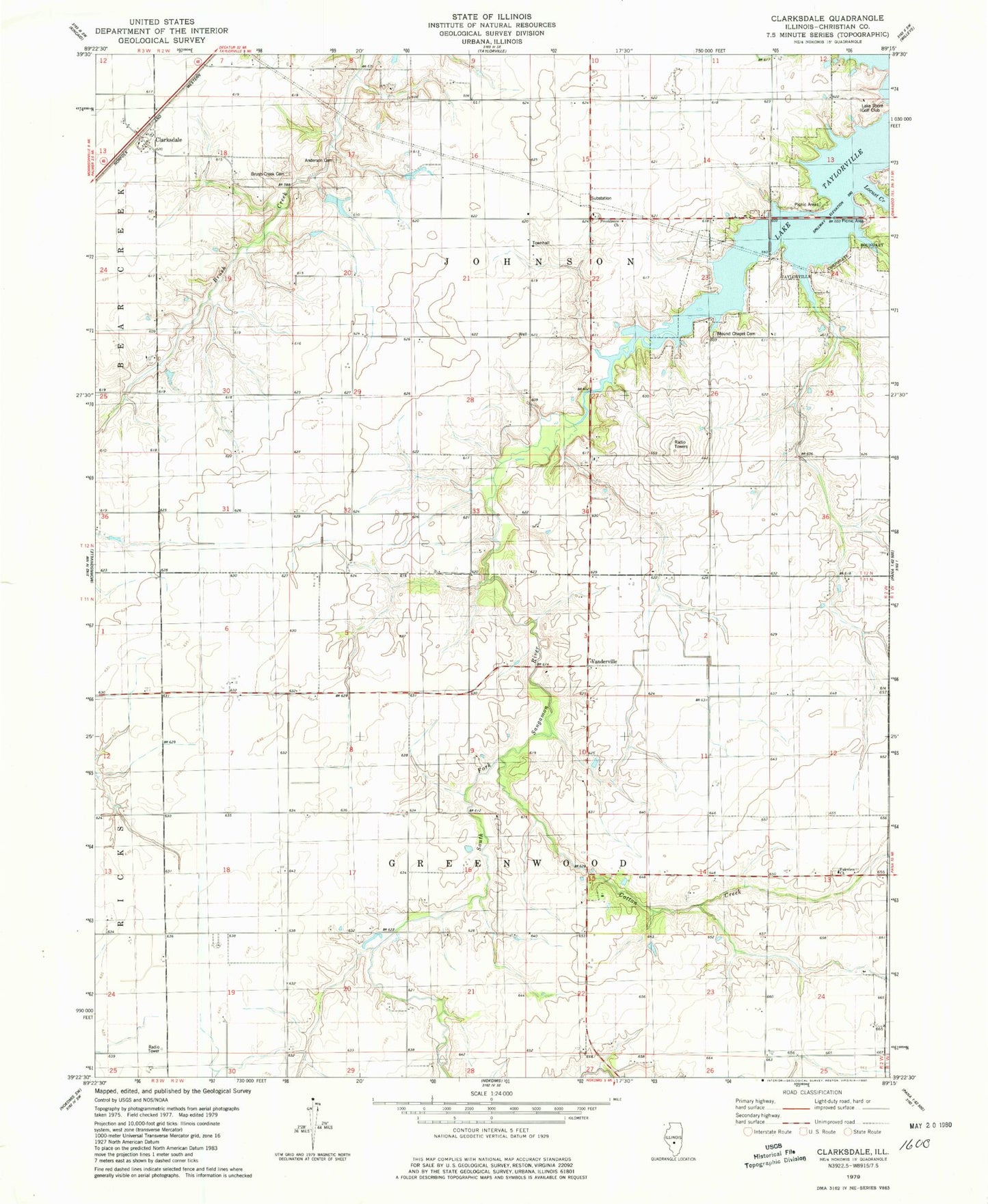
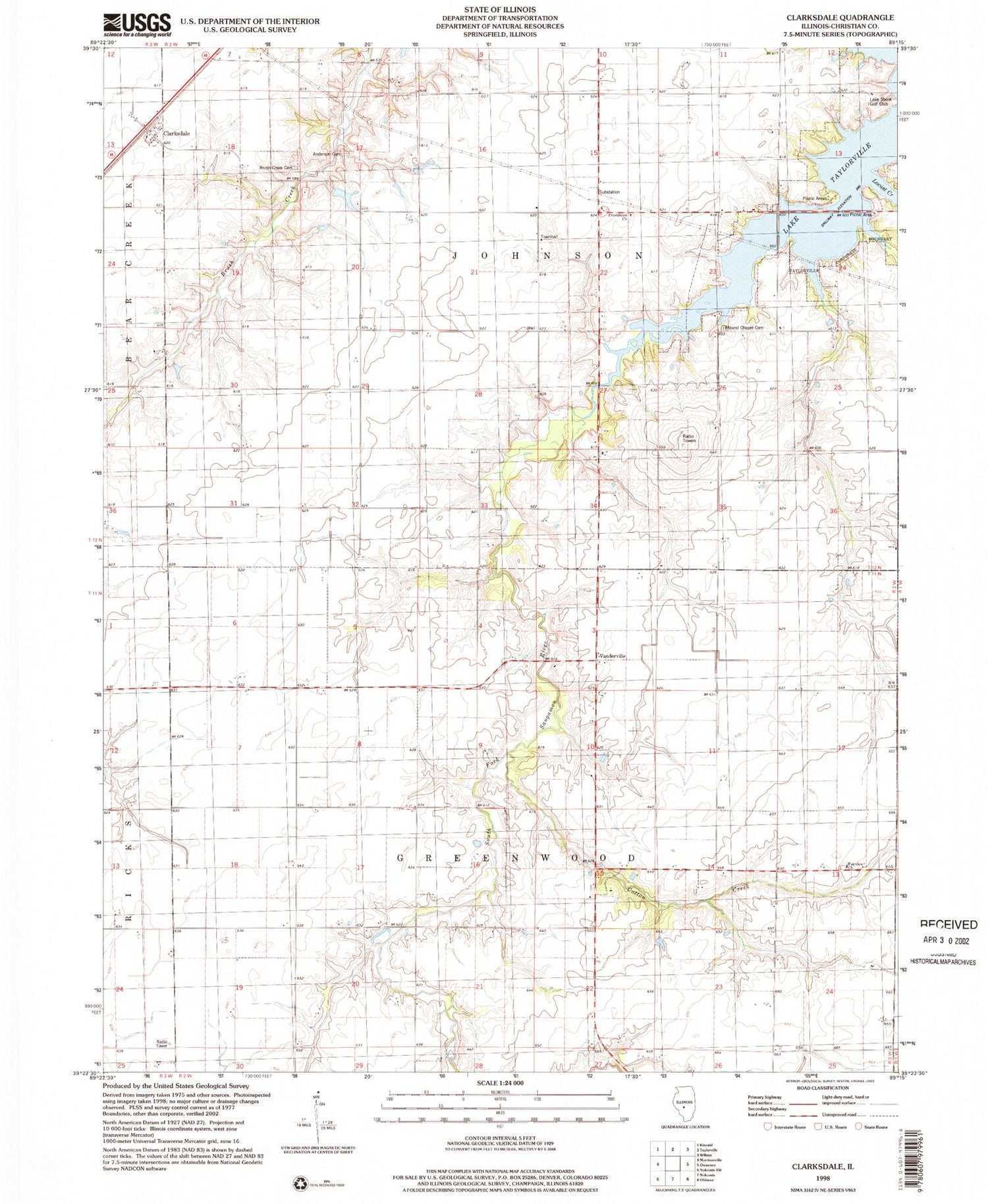
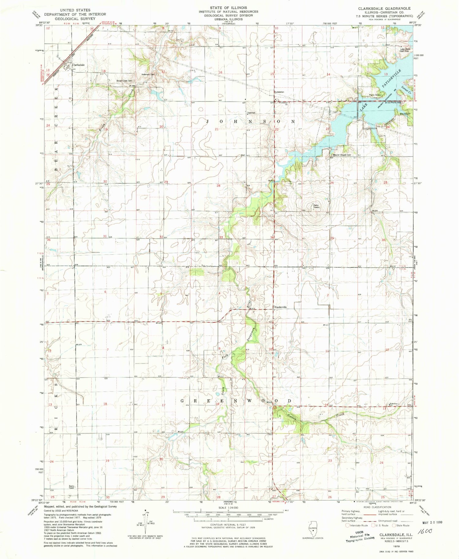
Classic USGS Clarksdale Illinois 7.5'x7.5' Topo Map
Couldn't load pickup availability
Historical USGS topographic quad map of Clarksdale in the state of Illinois. Map scale may vary for some years, but is generally around 1:24,000. Print size is approximately 24" x 27"
This quadrangle is in the following counties: Christian.
The map contains contour lines, roads, rivers, towns, and lakes. Printed on high-quality waterproof paper with UV fade-resistant inks, and shipped rolled.
Contains the following named places: Anderson Cemetery, B P Flower Farm, Brush Creek Cemetery, Center School, Clarksdale, Cotton Creek, Douglas School, Fairview Cemetery, Fairview Church, Hazel Green School, Johnson Townhall, Kleinik RLA Airport, Lake Shore Golf Club, Lake Taylorville, Locust Creek, Lusters Lake, Lusters Lake Dam, Mound Chapel, Mound Chapel Cemetery, Mound School, Oak Ridge School, Providence Church, Sassafras School, Skinner School, Superior School, Taylorville Lake, Township of Greenwood, Township of Johnson, Vanderville, Wenzler School