MyTopo
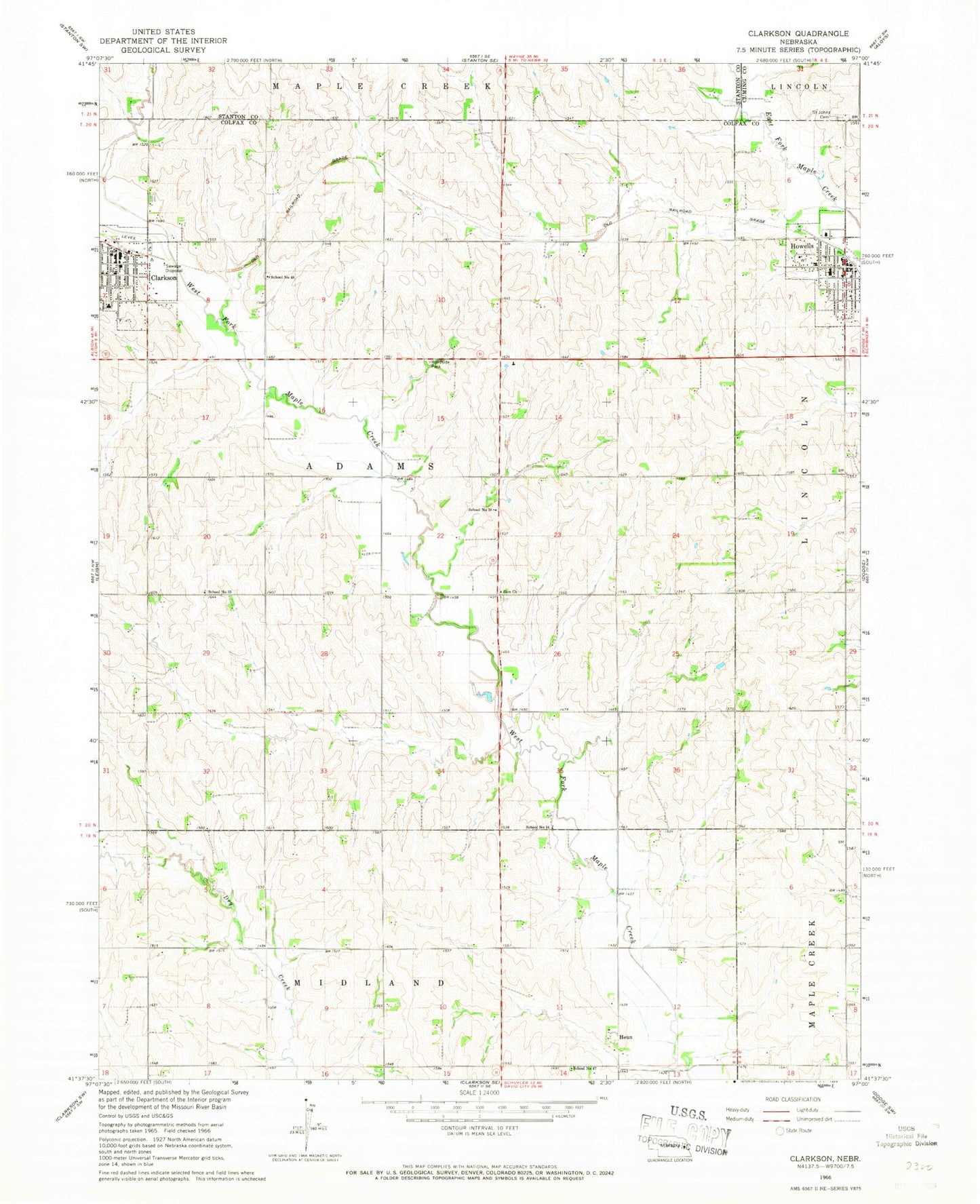
Classic USGS Clarkson Nebraska 7.5'x7.5' Topo Map
Couldn't load pickup availability
Historical USGS topographic quad map of Clarkson in the state of Nebraska. Map scale may vary for some years, but is generally around 1:24,000. Print size is approximately 24" x 27"
This quadrangle is in the following counties: Colfax, Cuming, Stanton.
The map contains contour lines, roads, rivers, towns, and lakes. Printed on high-quality waterproof paper with UV fade-resistant inks, and shipped rolled.
Contains the following named places: Adams Election Precinct, City of Clarkson, Clarkson, Clarkson City Park, Clarkson City Park Campground, Clarkson Historical Museum, Clarkson Medical Clinic, Clarkson Memorial Library, Clarkson Police Department, Clarkson Post Office, Clarkson Public Schools, Clarkson Volunteer Fire and Rescue, Colonial Manor, Farmers Union Co-op Supply Company Elevator, Heun, Heun Post Office, Holy Trinity Catholic Church, Howells, Howells Chiropractic Clinic, Howells Community Catholic School - Center One, Howells Community Catholic School - Center Two, Howells Community Health Center, Howells Museum, Howells Police Department, Howells Post Office, Howells Public Library, Howells Public Park, Howells Public Park Campground, Howells Public Schools, Howells Rescue Squad, Howells Retirement Center, Howells Volunteer Fire Department, Memorial Park, Saint John Nepomucene Catholic Church, Saint John's Nepomucene Catholic Cemetery, Saints Peter and Paul Catholic Church, School Number 14, School Number 38, School Number 47, School Number 48, School Number 53, Township of Adams, Trinity Lutheran Church, Village of Howells, Zion Church, ZIP Code: 68641