MyTopo
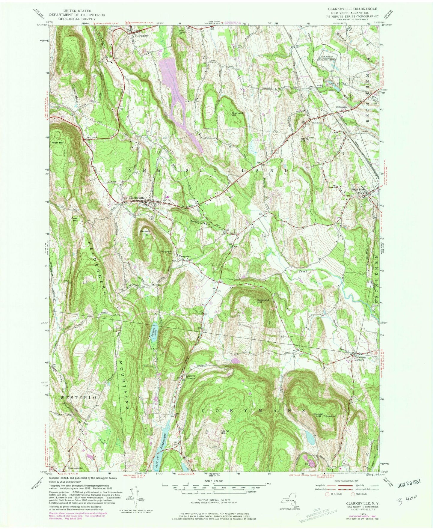
Classic USGS Clarksville New York 7.5'x7.5' Topo Map
Couldn't load pickup availability
Historical USGS topographic quad map of Clarksville in the state of New York. Typical map scale is 1:24,000, but may vary for certain years, if available. Print size: 24" x 27"
This quadrangle is in the following counties: Albany.
The map contains contour lines, roads, rivers, towns, and lakes. Printed on high-quality waterproof paper with UV fade-resistant inks, and shipped rolled.
Contains the following named places: Bennett Hill, Blodget Hill, Callanans Corners, Cass Hill, Clarksville, Copeland Hill, Delmar State Game Farm (historical), Diamond Hill, Dunbar Hollow, Feura Bush, Keefers Corners, Koong Hill, Lawson Lake, Mount Pleasant Cemetery, New Salem, Onesquethaw Cemetery, Stony Hill, Tarrytown, Unionville, Wolf Hill, Albany County, Peck Airport (historical), Town of New Scotland, Five Rivers Environmental Education Center, Stony Hill, School Number 5 (historical), School Number 9 (historical), Cedar Grove School (historical), School Number 2 (historical), Clarksville Elementary School, Unionville Reformed Church, Onesquethaw Volunteer Fire Company Station 2 Feura Bush, Onesquethaw Volunteer Fire Company Station 1, Onesquethaw Volunteer Fire Company Station 3 Unionville, Feura Bush Post Office, Clarksville Post Office