MyTopo
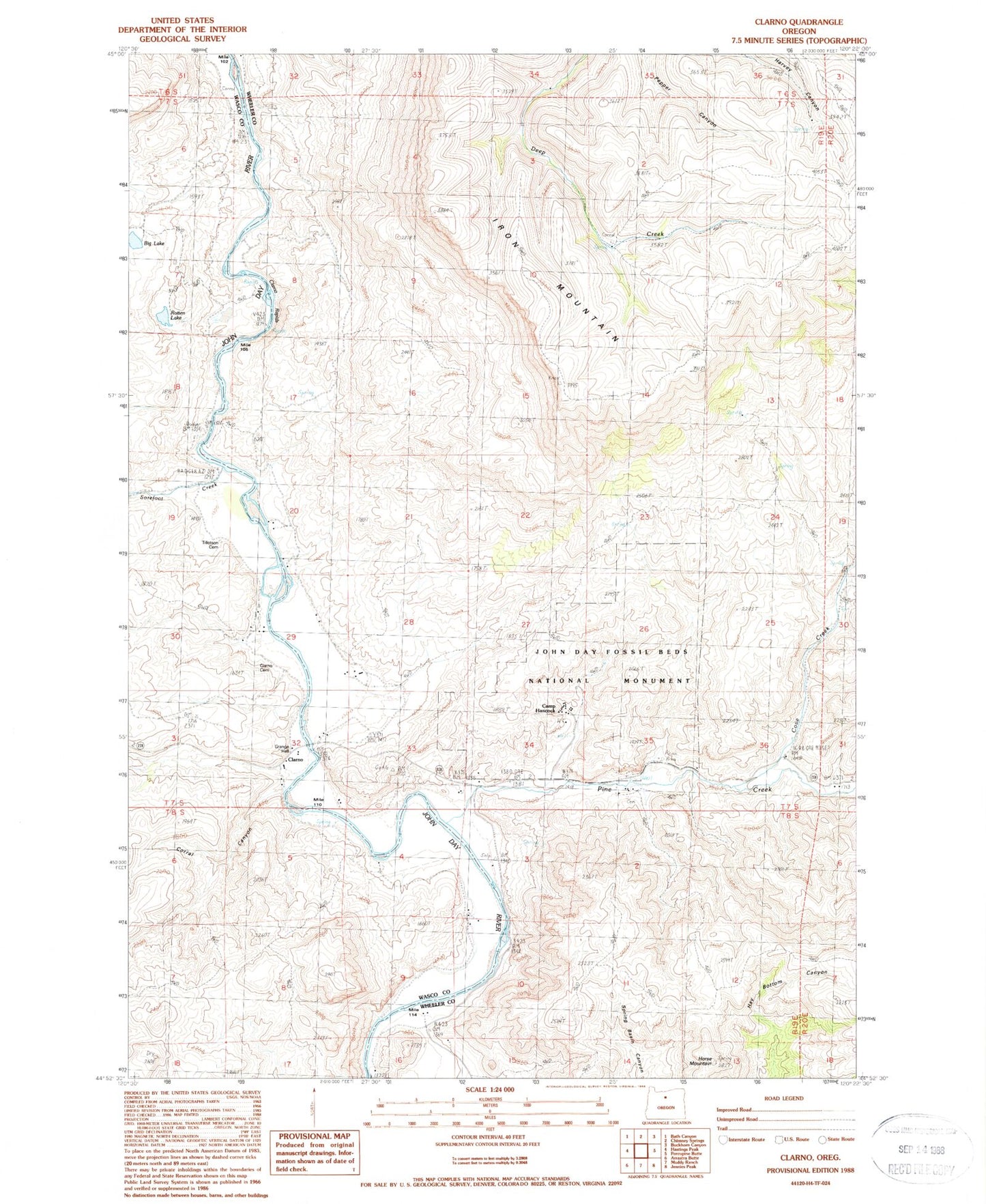
Classic USGS Clarno Oregon 7.5'x7.5' Topo Map
Couldn't load pickup availability
Historical USGS topographic quad map of Clarno in the state of Oregon. Map scale may vary for some years, but is generally around 1:24,000. Print size is approximately 24" x 27"
This quadrangle is in the following counties: Wasco, Wheeler.
The map contains contour lines, roads, rivers, towns, and lakes. Printed on high-quality waterproof paper with UV fade-resistant inks, and shipped rolled.
Contains the following named places: Black Spur, Camp Hancock, Clarno, Clarno Cemetery, Clarno Post Office, Clarno Rapids, Clarno State Recreation Site Boat Launch, Claron Arch, Corral Canyon, Cove Creek, Crown Rock, Crown Rock Post Office, Equisetum Canyon, Francisville Post Office, Hancock Canyon, Horse Mountain, Huntley Post Office, Indian Canyon, Iron Mountain, Lower Pine Creek School, Pine Creek, Red Hill, Rotten Lake, Sorefoot Creek, The Palisades, Tillotson Cemetery, Whitecap Knoll, Willow Branch, Willow Branch Spring