MyTopo
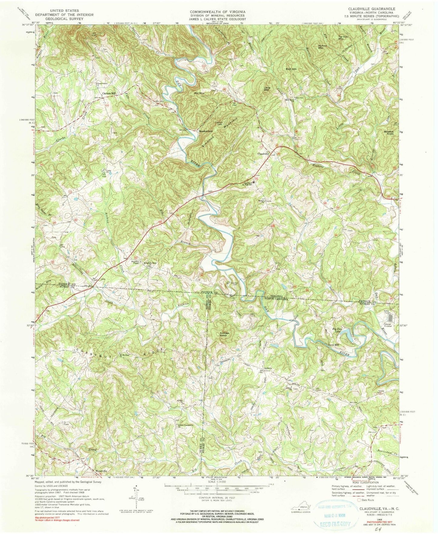
Classic USGS Claudville Virginia 7.5'x7.5' Topo Map
Couldn't load pickup availability
Historical USGS topographic quad map of Claudville in the states of Virginia, North Carolina. Map scale may vary for some years, but is generally around 1:24,000. Print size is approximately 24" x 27"
This quadrangle is in the following counties: Patrick, Stokes, Surry.
The map contains contour lines, roads, rivers, towns, and lakes. Printed on high-quality waterproof paper with UV fade-resistant inks, and shipped rolled.
Contains the following named places: Albion, Albion Cemetery, Albion Community Church, Albion Primitive Baptist Church, Archies Creek, Archies Knob, Asbury, Asbury Church, Back Creek, Bethel Church, Big Branch, Big Dan Lake, Bowens Knob, Brim, Brims Mill, Browns Dan River, Burges Branch, Carters Mill, Circle R Farm, Clarks Creek Church, Clarks School, Claudville, Claudville Post Office, Collinstown - Claudville - Drypond - Five Forks Volunteer Fire and Rescue Department Station 2, Dan River District, Fall Creek, Gammons Mill, Harris Creek, Hatcher Cemetery, Hatchers Chapel, Hatchers School, Hill Grove Church, Hookers Creek, Joyce Mill, Knob School, Lickskillet Branch, Little Dan River, Little Mountain, Locust Grove School, Meadowfield, Mill Mountain, Mills School, Mount Calvary Church, Mount Herman, Mount Herman Cemetery, Mount Herman Methodist Church, Mountain View Church, Nunns Mountain, Pig Creek, Red Bank Junior High School, Rich Hill, Silverleaf Creek, Simmons Mountain, Squirrel Creek, Tar Kiln Mountain, Township of Westfield, Trinity Church, Unity Church, Unity Presbyterian Church Cemetery, Woodville, Woodville Baptist Church, Woodville Baptist Church Cemetery, ZIP Code: 24076