MyTopo
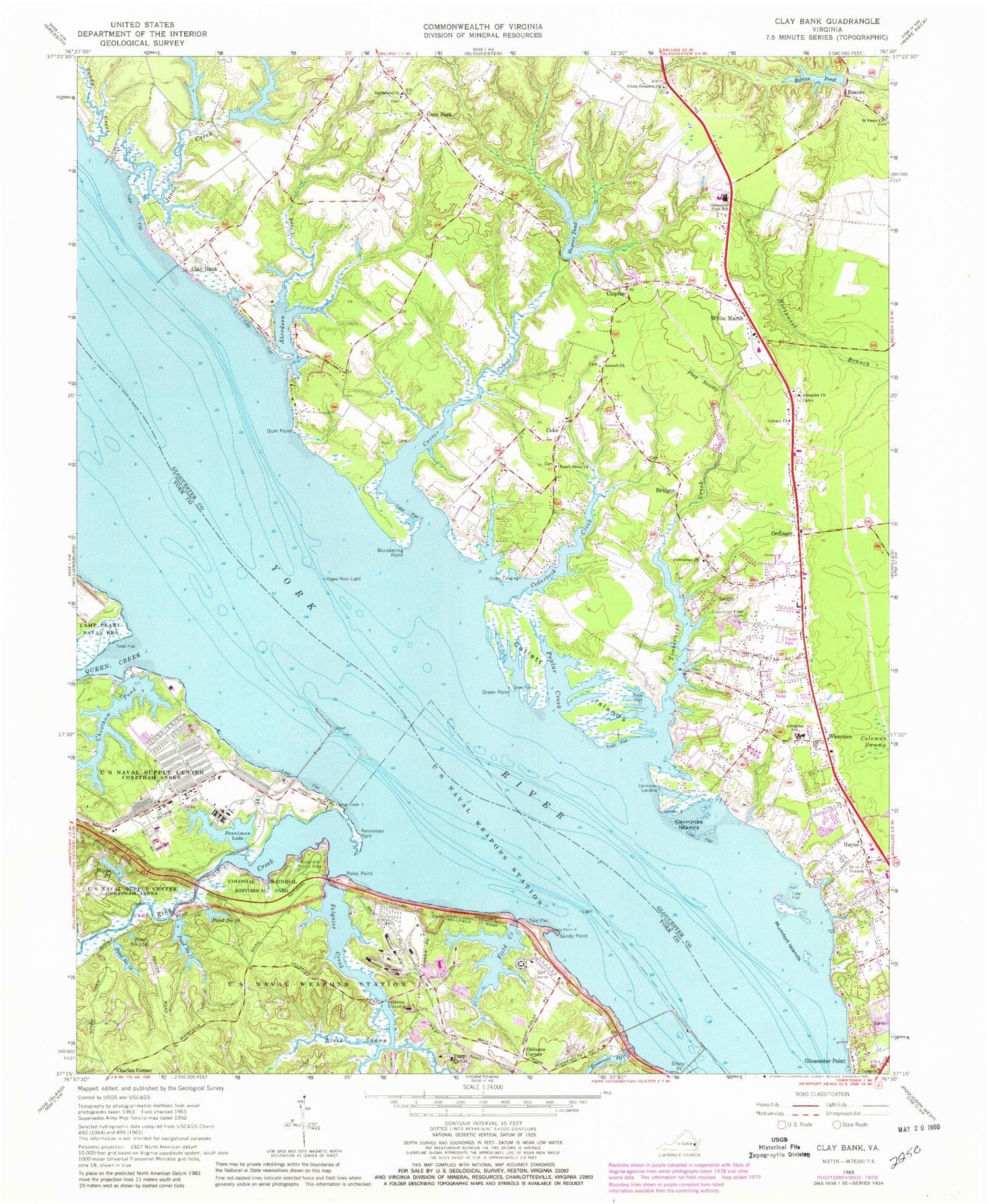
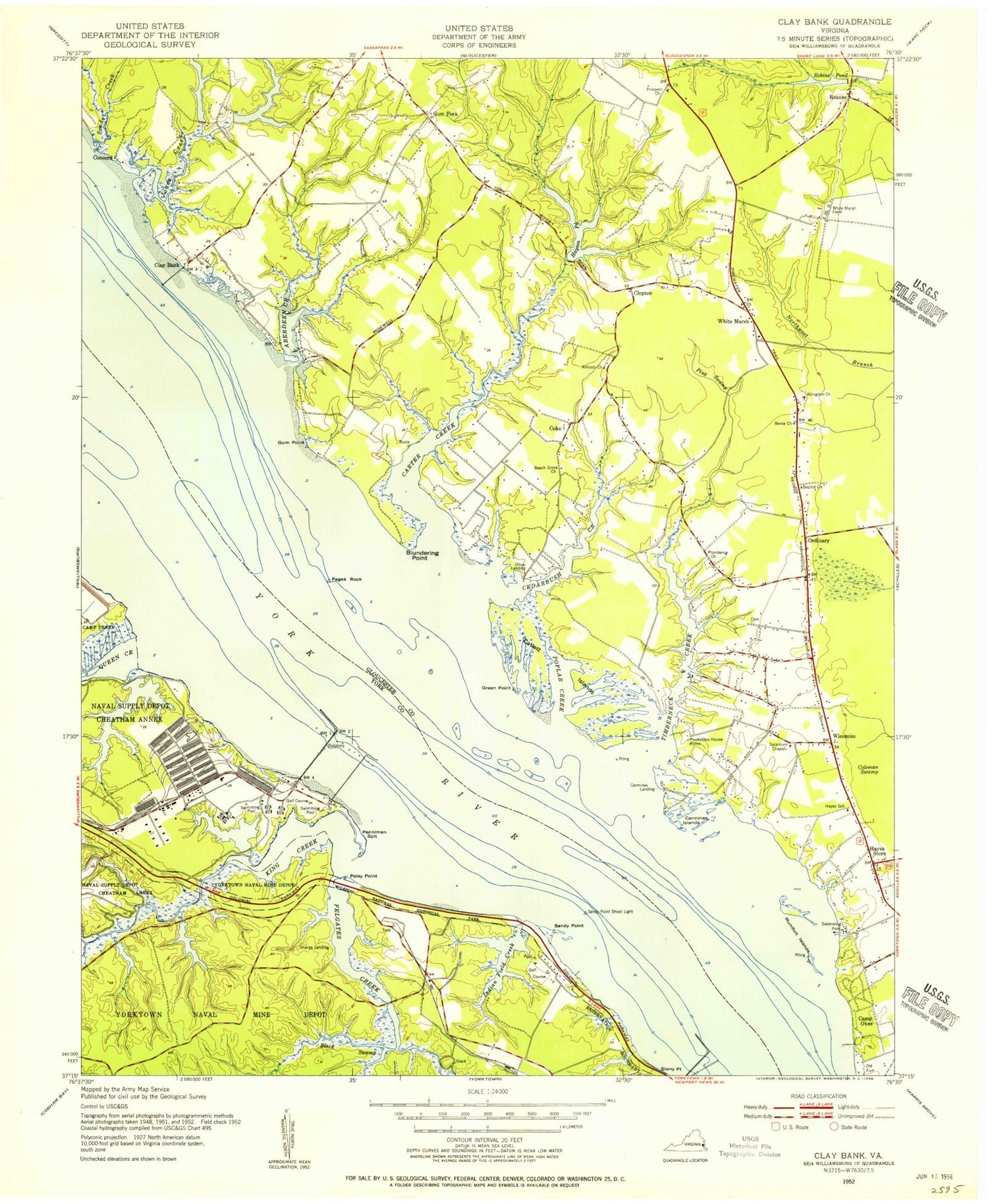
Classic USGS Clay Bank Virginia 7.5'x7.5' Topo Map
Couldn't load pickup availability
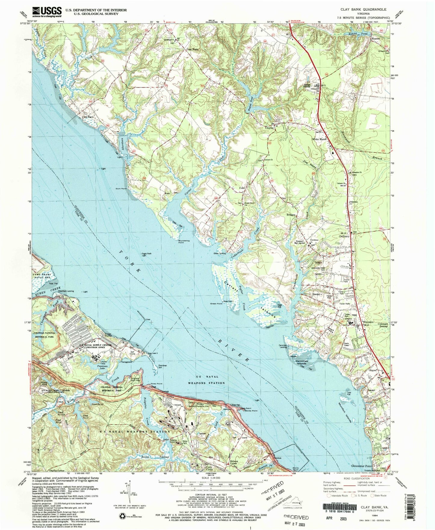
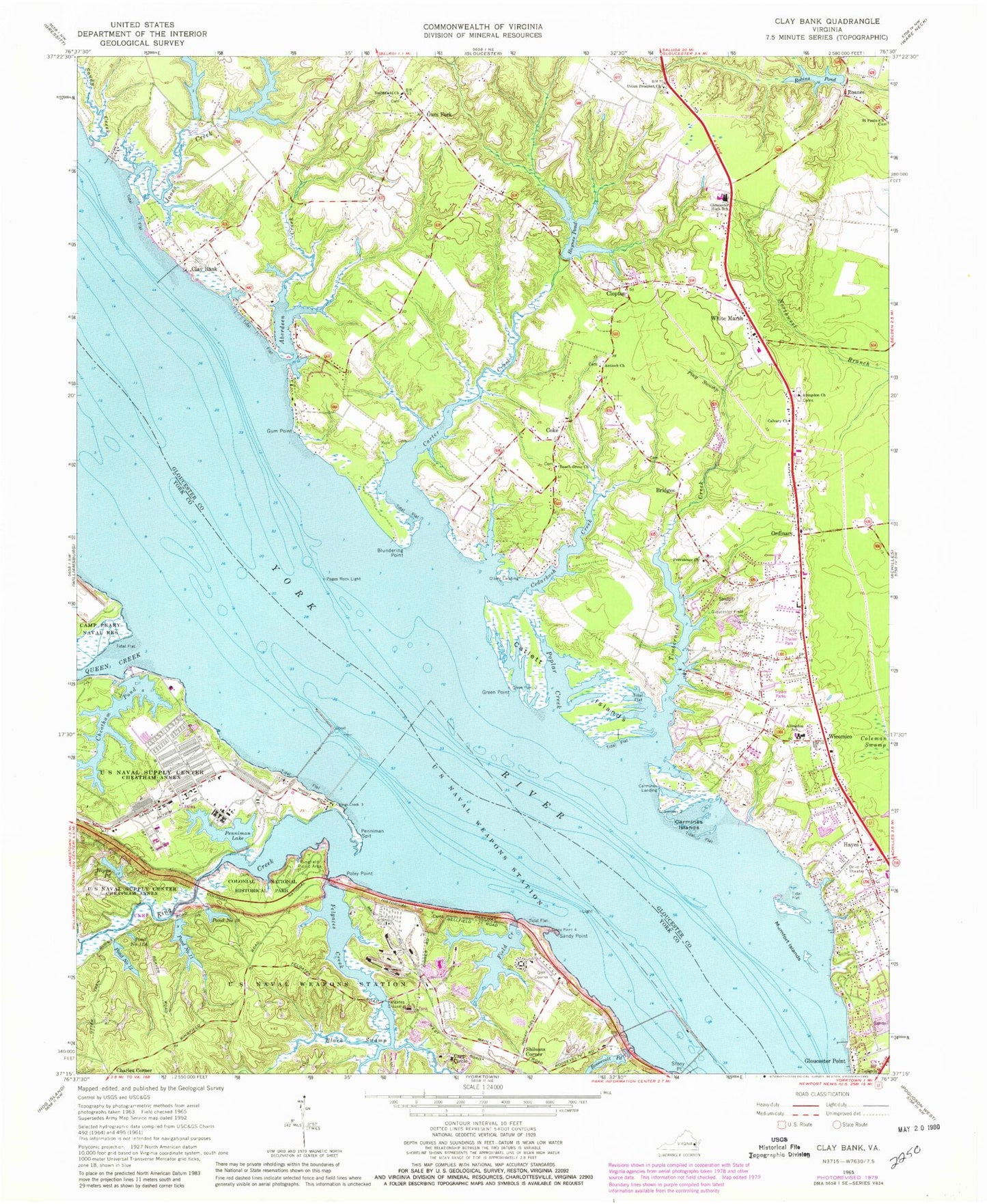
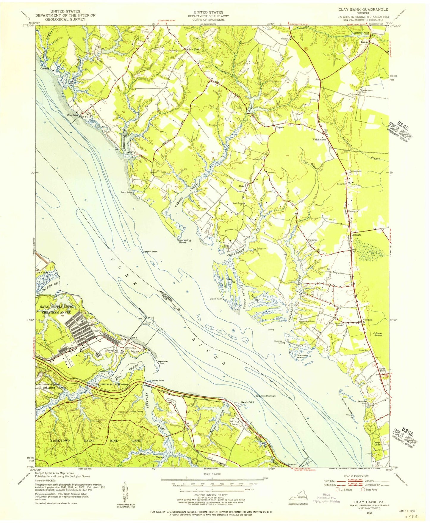
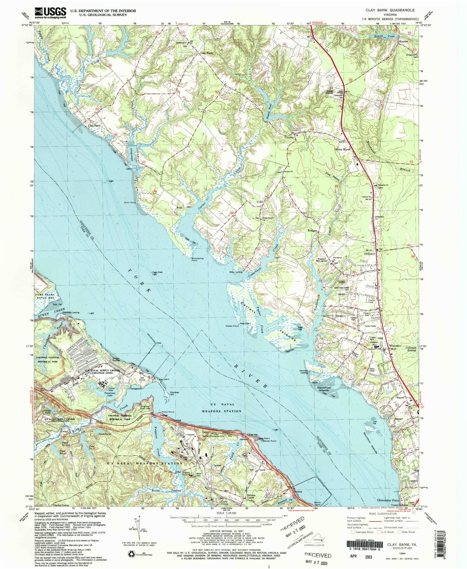
Historical USGS topographic quad map of Clay Bank in the state of Virginia. Typical map scale is 1:24,000, but may vary for certain years, if available. Print size: 24" x 27"
This quadrangle is in the following counties: Gloucester, York.
The map contains contour lines, roads, rivers, towns, and lakes. Printed on high-quality waterproof paper with UV fade-resistant inks, and shipped rolled.
Contains the following named places: Aberdeen Creek, Abingdon Church, Abingdon Elementary School, Antioch Church, Beach Grove Church, Black Swamp, Blundering Point, Bridges, Calvary Church, Carmines Islands, Carp Circle, Carter Creek, Catlett Islands, Cedarbush Creek, Coke, Felgates Creek, Gloucester Field Cemetery, Gloucester School, Green Point, Gum Point, Haynes Pond, Hipps Pond, Indian Field Creek, Jones Creek, King Creek, Mumfort Islands, Penniman Spit, Piny Swamp, Poley Point, Poplar Creek, Providence Church, Queen Creek, Ringfield Picnic Area, Roosevelt Pond, Sandy Creek, Sandy Point, Smithfield Church, Timberneck Creek, Union Prospect Church, White Marsh, Wicomico, Charles Corner, Clopton, Gum Fork, Roanes, Shilsons Corner, Cheatham Annex, Concord, Rosewell, Colonial National Historical Parkway, Woodberry Farm Dam, Woodberry Farm Pond, Weaver Dam, Weaver Pond, Haynes Dam, Robins Dam, Cheatham Dam, Penniman Dam, Penniman Lake, Pond Number 11 Dam, Roosevelt Pond Dam, Pages Rock Light, Pond Number 10, Pond Number 11, Pond Number 11A, Pond Number 12, Carmines Landing, Clay Bank, Felgates Crossing, Hayes, Oliver Landing, Ordinary, Naval Weapons Station-Yorktown Helipad, Cheatham Pond, Robins Pond, Aberdeen Landing, Abingdon Cemetery, Clay Bank Landing, Concord (historical), Fields Landing, Gloucester Church, Hayes Stores Shopping Center, Ordinary Post Office, Powhatan Point, Providence Cemetery, Rosewell Manor, Rosewell Memorial Garden, Town and Country Shopping Center, White Marsh Post Office, White Marsh Shopping Center, Wicomico Post Office, Oakdale, Bellfield Plantation Site, Sharps Landing, Gloucester Point District, Abingdon Volunteer Fire and Rescue Station 3, Abingdon Volunteer Fire and Rescue Station 5, Big Mumfort Island, Little Mumfort Island, Gloucester Business Park, Carters Cove, Clay Bank Acres, Clopton Heights, Country Village, Creekwood Cove Estates, Harbor Hills, Hermitage, Hermitage Banks, Millwood, Neva Terrace, Olivers Estates, Powhatan Shores, Robert Heights, Rosewell Harbor, York River Pines, York View, Jones Lake, Victory Academy, Chesapeake Marine Training Institute, Naval Supply Center Cheatham Annex, Cedar Bush Olivers Landing Boat Ramp, Fields Landing Boat Ramp, United States Naval Supply Center Pier, Industrial Resource Technology Industrial Park, Seventeen Plaza Shopping Center, Stagecoach Market Shopping Center, Rock Church, R and L Mobile Home Park, Wicomico Mobile Village, Deer Cove Golf Course, Holly Oaks Golf Course, Lighthouse Worship Center, New Life Church of God, New Quarter Farm Airport, Virginia Marine Police - Middle Area Office, Aberdeen Creek, Abingdon Church, Abingdon Elementary School, Antioch Church, Beach Grove Church, Black Swamp, Blundering Point, Bridges, Calvary Church, Carmines Islands, Carp Circle, Carter Creek, Catlett Islands, Cedarbush Creek, Coke, Felgates Creek, Gloucester Field Cemetery, Gloucester School, Green Point, Gum Point, Haynes Pond, Hipps Pond, Indian Field Creek, Jones Creek, King Creek, Mumfort Islands, Penniman Spit, Piny Swamp, Poley Point, Poplar Creek, Providence Church, Queen Creek, Ringfield Picnic Area, Roosevelt Pond, Sandy Creek, Sandy Point, Smithfield Church, Timberneck Creek, Union Prospect Church, White Marsh, Wicomico, Charles Corner, Clopton, Gum Fork, Roanes, Shilsons Corner, Cheatham Annex, Concord, Rosewell, Colonial National Historical Parkway, Woodberry Farm Dam, Woodberry Farm Pond, Weaver Dam, Weaver Pond, Haynes Dam, Robins Dam, Cheatham Dam, Penniman Dam, Penniman Lake, Pond Number 11 Dam, Roosevelt Pond Dam, Pages Rock Light, Pond Number 10, Pond Number 11, Pond Number 11A, Pond Number 12, Carmines Landing, Clay Bank, Felgates Crossing, Hayes, Oliver Landing, Ordinary, Naval Weapons Station-Yorktown Helipad, Cheatham Pond, Robins Pond, Aberdeen Landing, Abingdon Cemetery, Clay Bank Landing, Concord (historical), Fields Landing, Gloucester Church, Hayes Stores Shopping Center, Ordinary Post Office, Powhatan Point, Providence Cemetery, Rosewell Manor, Rosewell Memorial Garden, Town and Country Shopping Center, White Marsh Post Office, White Marsh Shopping Center, Wicomico Post Office, Oakdale, Bellfield Plantation Site, Sharps Landing, Gloucester Point District, Abingdon Volunteer Fire and Rescue Station 3, Abingdon Volunteer Fire and Rescue Station 5, Big Mumfort Island, Little Mumfort Island, Gloucester Business Park, Carters Cove
