MyTopo
Classic USGS Clay Center SE Kansas 7.5'x7.5' Topo Map
Couldn't load pickup availability
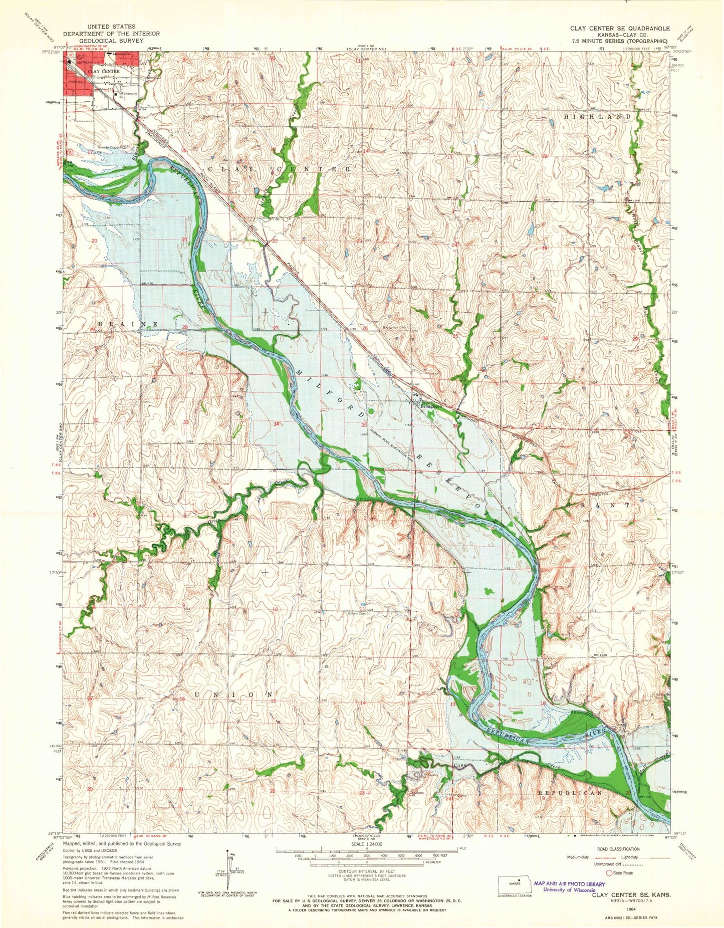
Historical USGS topographic quad map of Clay Center SE in the state of Kansas. Map scale may vary for some years, but is generally around 1:24,000. Print size is approximately 24" x 27"
This quadrangle is in the following counties: Clay.
The map contains contour lines, roads, rivers, towns, and lakes. Printed on high-quality waterproof paper with UV fade-resistant inks, and shipped rolled.
Contains the following named places: Broughton, Broughton Cemetery, Cane Creek, Clay Center Sewage Plant, Clay County Fairgrounds, Clay County Farm, Country Gardens Mobile Home Park, Dexter Park, Finney Creek, Gatesville, Gatesville Cemetery, Gilbert Cemetery, Green Rural Fire Department Station 3, Kansas National Guard Armory Clay Center, KCLY-FM (Clay Center), Lincoln Creek, Lincoln Elementary School, Mall Creek, Otter Creek, Township of Union