MyTopo
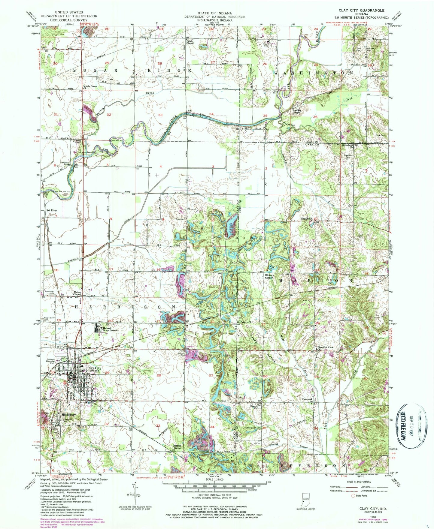
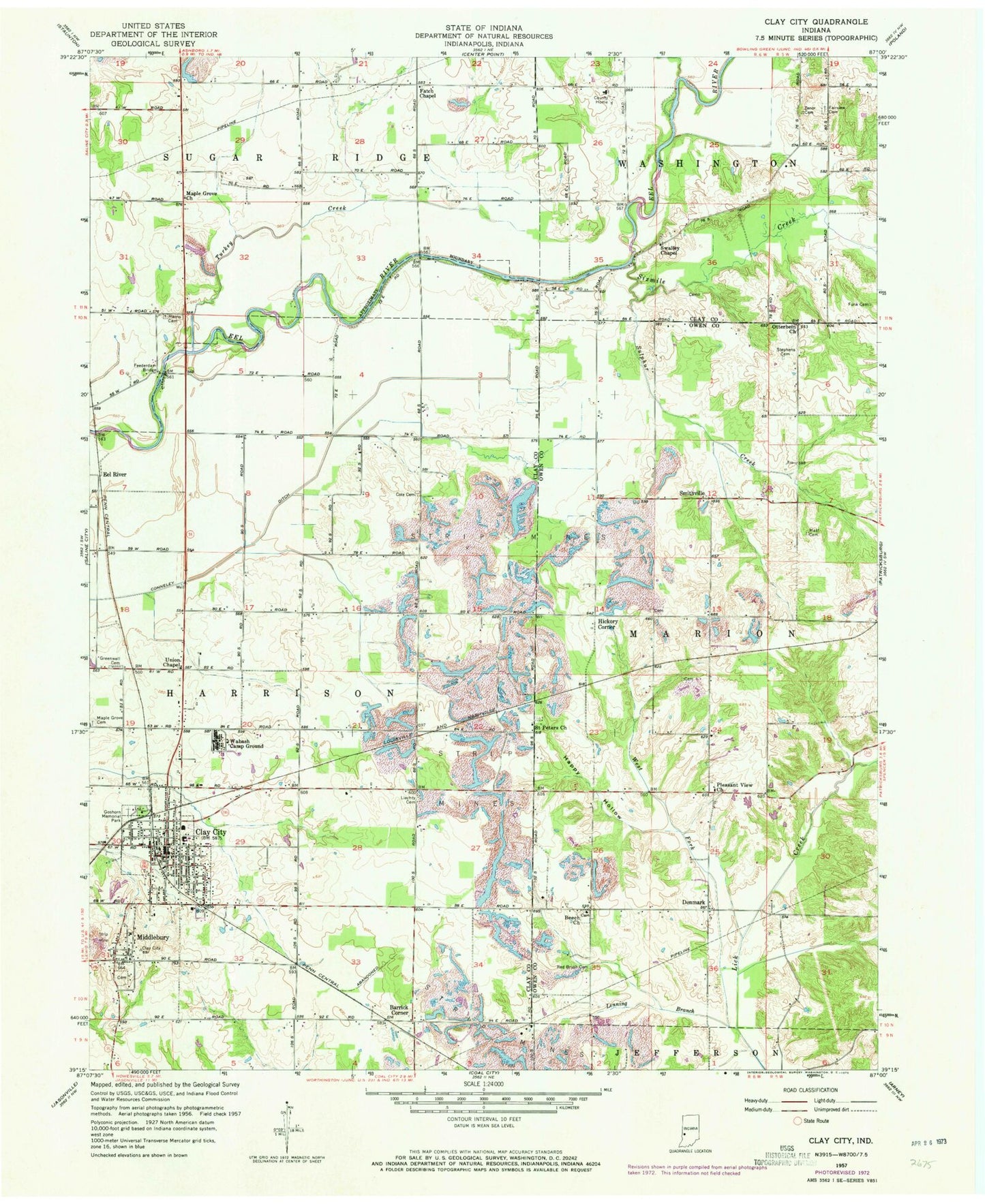
Classic USGS Clay City Indiana 7.5'x7.5' Topo Map
Couldn't load pickup availability
Historical USGS topographic quad map of Clay City in the state of Indiana. Map scale may vary for some years, but is generally around 1:24,000. Print size is approximately 24" x 27"
This quadrangle is in the following counties: Clay, Owen.
The map contains contour lines, roads, rivers, towns, and lakes. Printed on high-quality waterproof paper with UV fade-resistant inks, and shipped rolled.
Contains the following named places: Barrick Corner, Beech Church, Booe Airport, Clay City, Clay City - Harrison Township Volunteer Fire Department, Clay City Police Department, Clay City Post Office, Cole Cemetery, Danville, Denmark, Eel River, Fairview Cemetery, Fatch Chapel, Feederdam Bridge, Funk Cemetery, Furry Ferry Cemetery, Goshorn Memorial Park, Greenwell Cemetery, Happy Hollow, Harris Cemetery, Hickory Corner, Hog Creek, Lenning Branch, Letsinger Ditch, Liechty Cemetery, Maple Grove Church, Mast Cemetery, Middlebury, Otterbein Church, Pleasant View Church, Saint Peters Church, Shelkett Ditch, Sixmile Creek, Smithville, Stephens Cemetery, Sulphur Creek, Swalley Chapel, Town of Clay City, Township of Harrison, Turkey Creek, Union Chapel, Wabash Camp Ground, West Fork Lick Creek, Zenor Cemetery, ZIP Code: 47841