
MyTopo
Classic USGS Clay Sink Florida 7.5'x7.5' Topo Map
Regular price
$16.95
Regular price
Sale price
$16.95
Unit price
per
Couldn't load pickup availability
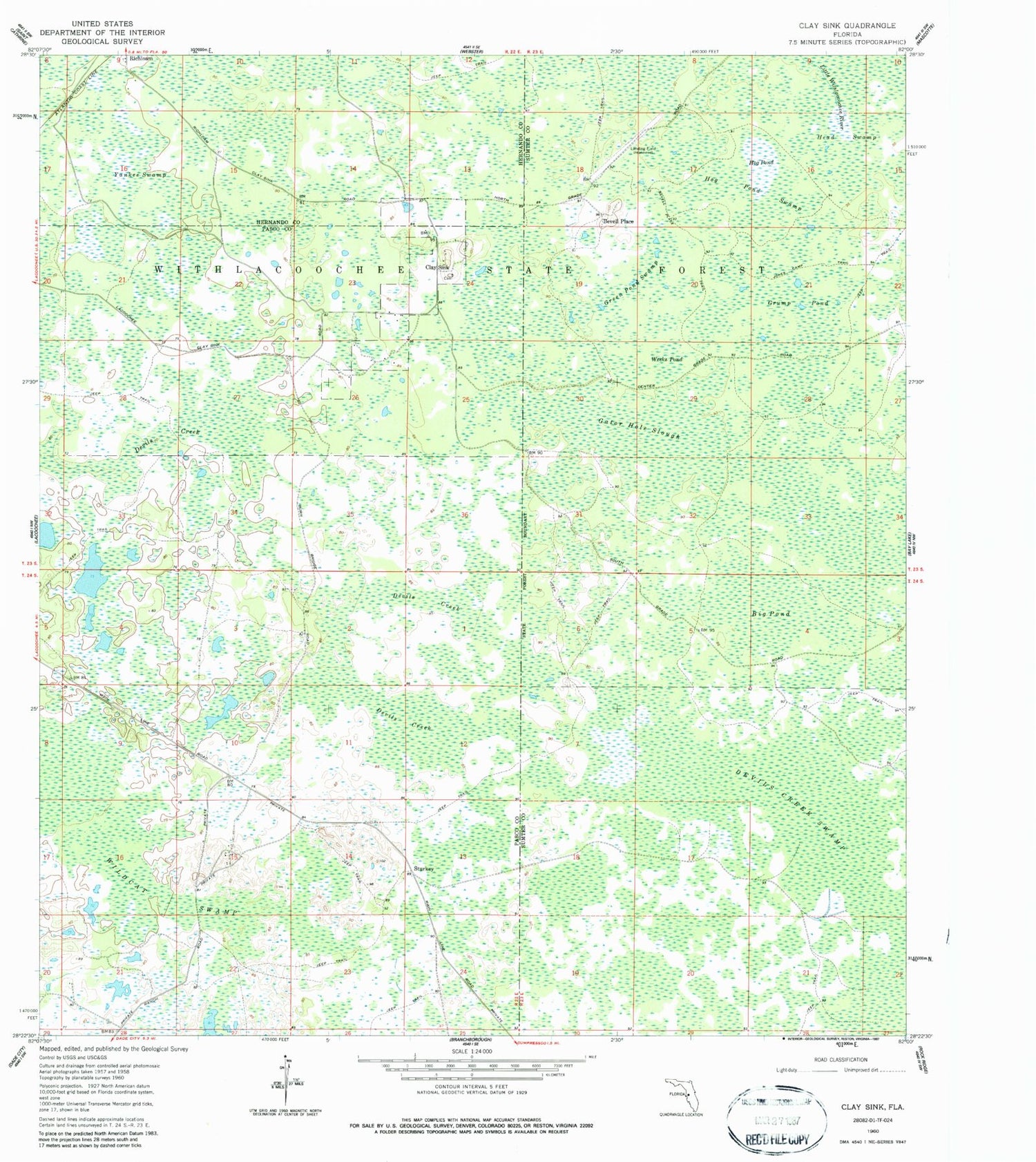
Historical USGS topographic quad map of Clay Sink in the state of Florida. Typical map scale is 1:24,000, but may vary for certain years, if available. Print size: 24" x 27"
This quadrangle is in the following counties: Hernando, Pasco, Sumter.
The map contains contour lines, roads, rivers, towns, and lakes. Printed on high-quality waterproof paper with UV fade-resistant inks, and shipped rolled.
Contains the following named places: Big Pond, Gator Hole Slough, Green Pond Swamp, Grump Pond, Hog Pond, Hog Pond Swamp, Weeks Pond, Wildcat Swamp, Withlacoochee State Forest, Yankee Swamp, Bevell Place, Clay Sink, Sturkey, Wildwood Camp, Raulerson Hammock, Richloam Wildlife Management Area


