MyTopo
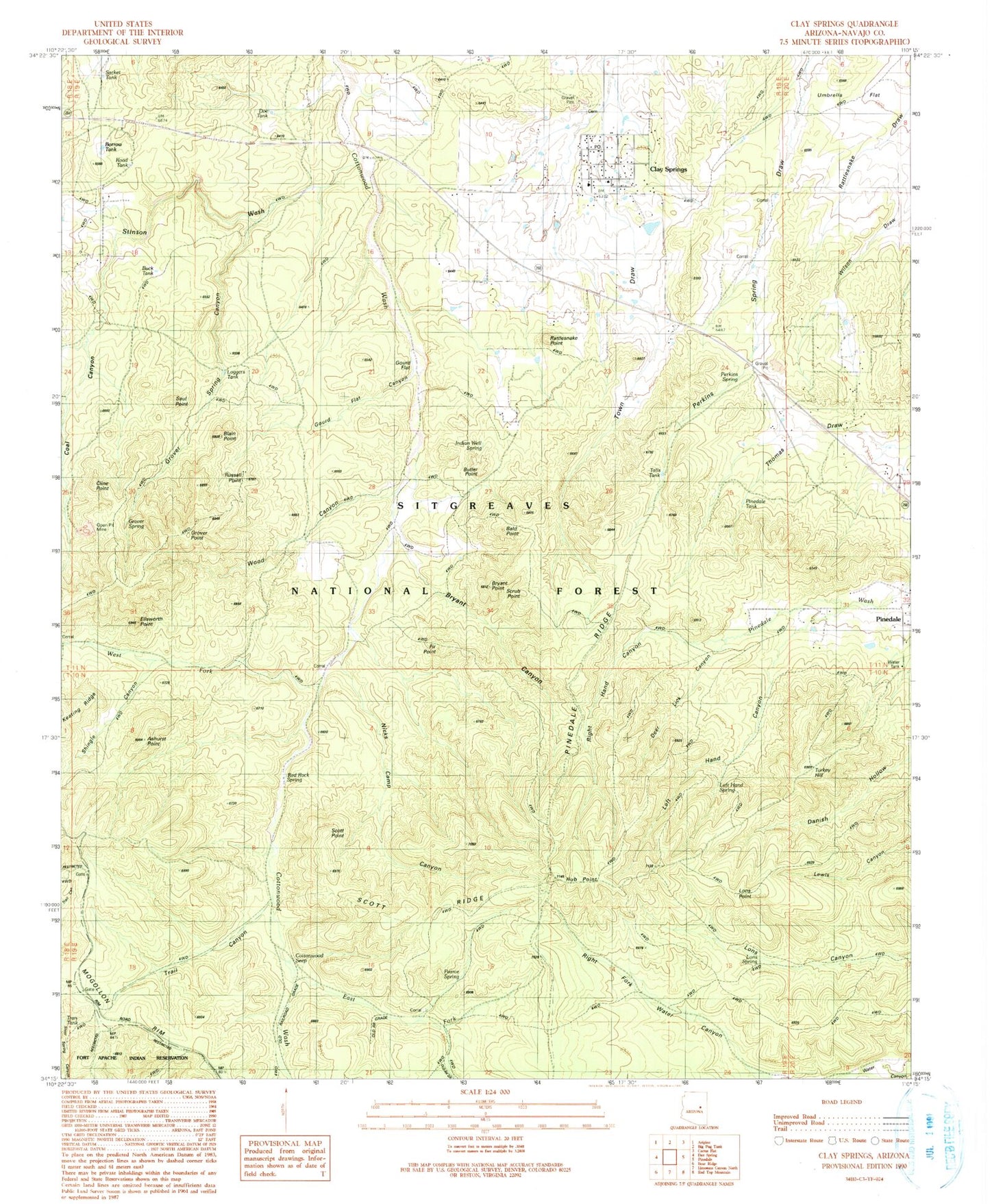
Classic USGS Clay Springs Arizona 7.5'x7.5' Topo Map
Couldn't load pickup availability
Historical USGS topographic quad map of Clay Springs in the state of Arizona. Typical map scale is 1:24,000, but may vary for certain years, if available. Print size: 24" x 27"
This quadrangle is in the following counties: Navajo.
The map contains contour lines, roads, rivers, towns, and lakes. Printed on high-quality waterproof paper with UV fade-resistant inks, and shipped rolled.
Contains the following named places: Ashhurst Point, Bald Point, Blain Point, Bryant Point, Butler Point, Clay Springs, Cline Point, Coal Canyon, Deer Lick Canyon, East Fork Cottonwood Wash, Ellsworth Point, Gourd Flat, Gourd Flat Canyon, Grover Point, Grover Spring, Grover Spring Canyon, Hub Point, Indian Spring, Left Hand Canyon, Left Hand Spring, Loggers Tank, Lons Point, Lons Spring, Nicks Camp Canyon, Pearce Well, Pinedale, Pinedale Ridge, Rattlesnake Point, Red Rock Spring, Right Hand Canyon, Russell Point, Saul Point, Scott Point, Scott Ridge, Scrub Point, Shingle Canyon, Stinson Wash, Talls Tank, Trail Canyon, Turkey Hill, Umbrella Flat, West Fork Cottonwood Wash, Aunt Lottie Mormon Pioneer Historical Marker, Buck Tank, Clay Springs School, Cottonwood Seep, Doe Tank, E J Smith Tank, Perkins Spring, Pinedale Tank, Road Tank, Sacket Tank, Woodys Tank, Borrow Tank, Bryant Canyon, Nicks Tank, Wood Canyon, Fir Point, Clay Springs Post Office, General Crook Connector Trail, Clay Springs Census Designated Place, Pinedale Census Designated Place, Clay Springs Pinedale Fire Department Station 620, Cabin Tank, Cottonwood Trail, Jims Tank, Christmas Tank