MyTopo
Classic USGS Clay Louisiana 7.5'x7.5' Topo Map
Couldn't load pickup availability
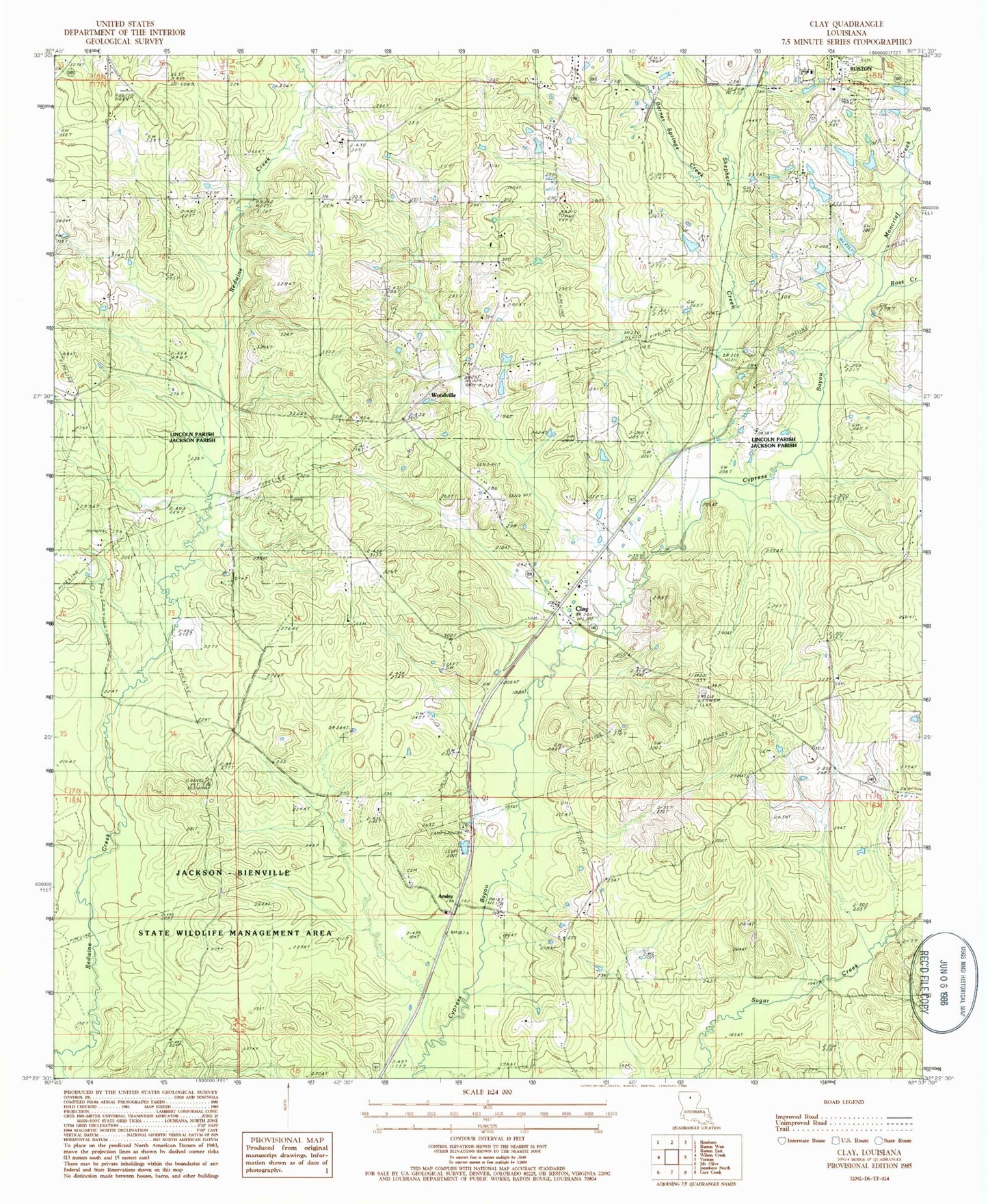
Historical USGS topographic quad map of Clay in the state of Louisiana. Map scale may vary for some years, but is generally around 1:24,000. Print size is approximately 24" x 27"
This quadrangle is in the following counties: Jackson, Lincoln.
The map contains contour lines, roads, rivers, towns, and lakes. Printed on high-quality waterproof paper with UV fade-resistant inks, and shipped rolled.
Contains the following named places: Ansley, Ansley Cemetery, Ansley Union Church, Barnet Springs Creek, Bethel Baptist Church, Bethel Christian School, Bonner, Clay, Clay Gas Field, Clay Post Office, Edmiston Creek, KXKZ-FM (Ruston), Moncrief Creek, New Prospect Memorial Gardens, New Prosperity Baptist Church Cemetery, Parish Governing Authority District 1, Parish Governing Authority District 11, Parish Governing Authority District 1E, Parish Governing Authority District 1F, Pleasant Grove Church, Pleasant Hill, Pleasant Hill Baptist Church, Prospect Church, Prosperity Baptist Church, Quitman Volunteer Fire Department Station 2, Redwine, Riser / Bonner Cemetery, Ross Creek, Salem Church, Shepherd Creek, Shull, South Parkway Worship Center, Wesley Chapel Cemetery, Wesley Chapel United Methodist Church, Woodville, ZIP Code: 71270