
MyTopo
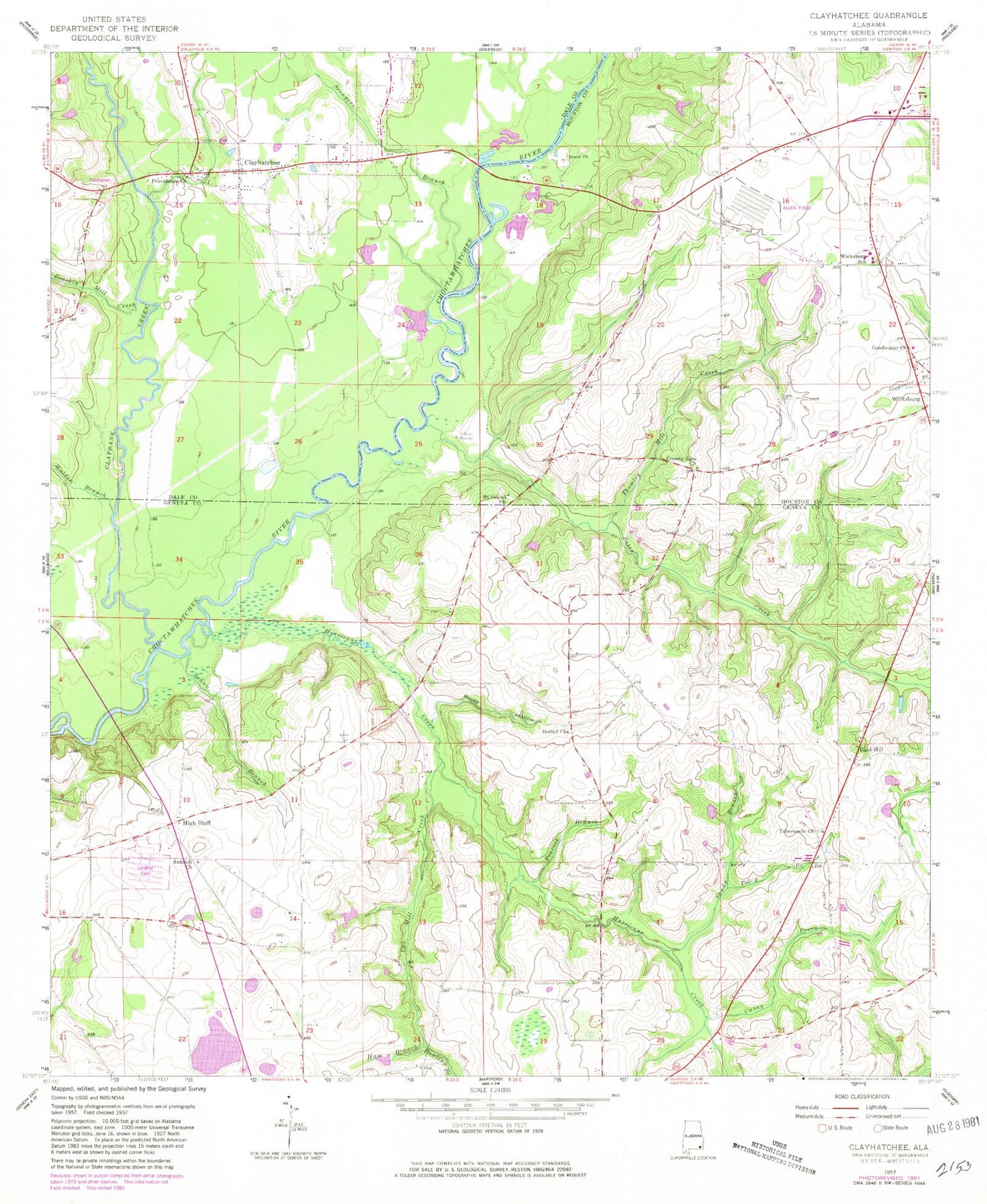
Classic USGS Clayhatchee Alabama 7.5'x7.5' Topo Map
Couldn't load pickup availability
Historical USGS topographic quad map of Clayhatchee in the state of Alabama. Map scale may vary for some years, but is generally around 1:24,000. Print size is approximately 24" x 27"
This quadrangle is in the following counties: Dale, Geneva, Houston.
The map contains contour lines, roads, rivers, towns, and lakes. Printed on high-quality waterproof paper with UV fade-resistant inks, and shipped rolled.
Contains the following named places: Antioch Church, Backems Crossroads, Bald Hill, Ball Hill Church, Bethel Baptist Church, Biffords Branch, Brackin Mill Creek, Caney Creek, Christian Home Church, Claybank Creek, Clayhatchee, Clayhatchee Church, Clayhatchee Police Department, Clayhatchee Quarry, Clayhatchee Volunteer Fire Department, Corbin School, County Line Church, Cox Mill Creek, Dean Mill, Dowling Branch, Goodwater Church, Gospel Hill Church, Ham Branch, High Bluff, High Bluff School, Hinson Mill, House of Prayer Church, Hurricane Creek, Kinsanl School, Macedonia Cemetery, Macedonia Church, Mount Gilead Cemetery, Mount Gilead Primitive Baptist Church, Panther Stadium, Pates Creek, Pates Landing, Peacock Branch, Poley Branch, Posey Hollow, Providence Missionary Baptist Church, Sandy Branch, Sconyers Branch, Sevall School, Shiloh Cemetery, Shiloh Church, Spann Branch, Tabernacle Church, Ted Sketo Dam, Ted Sketo Lake, Thomley Mill Creek, Tindell School, Town of Clayhatchee, Turners Ferry, Walden Branch, Whaley Cemetery, Whaley Chapel, Wicksburg High School, Wilson School


