MyTopo
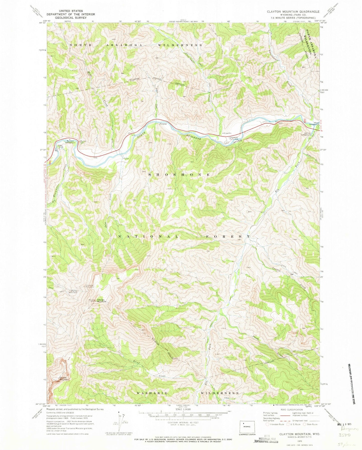
Classic USGS Clayton Mountain Wyoming 7.5'x7.5' Topo Map
Couldn't load pickup availability
Historical USGS topographic quad map of Clayton Mountain in the state of Wyoming. Map scale may vary for some years, but is generally around 1:24,000. Print size is approximately 24" x 27"
This quadrangle is in the following counties: Park.
The map contains contour lines, roads, rivers, towns, and lakes. Printed on high-quality waterproof paper with UV fade-resistant inks, and shipped rolled.
Contains the following named places: Aspen Creek, Aspen Creek Summer Homes, Blackwater Creek, Blackwater Lodge, Blackwater Pond Picnic Ground, Blind Creek, Clayton Mountain, Clearwater campground, Clearwater Creek, Clearwater Picnic Area, Cougar Creek, Double Mountain, Elk Fork, Elk Fork Campground, Elk Fork Creek Watershed Project, Firefighter Monument, Frost Creek, Grace Creek, Icy Creek, June Creek, Moss Creek, Post Point, Rex Hale Campground, Sweetwater Creek, Sweetwater Creek Mine, UXU Lodge, Wapiti Campground