
MyTopo
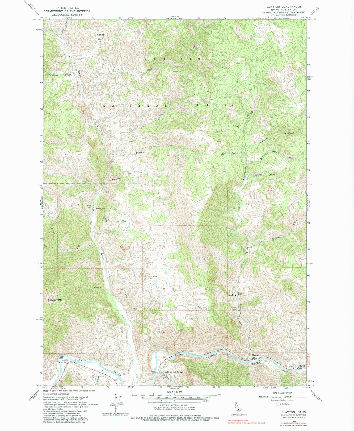
Classic USGS Clayton Idaho 7.5'x7.5' Topo Map
Couldn't load pickup availability
Historical USGS topographic quad map of Clayton in the state of Idaho. Map scale may vary for some years, but is generally around 1:24,000. Print size is approximately 24" x 27"
This quadrangle is in the following counties: Custer.
The map contains contour lines, roads, rivers, towns, and lakes. Printed on high-quality waterproof paper with UV fade-resistant inks, and shipped rolled.
Contains the following named places: Boundary Creek, Broken Ridge Creek, Bruno Creek, Cabin Creek, Cash Creek, Cinnabar Creek, City of Clayton, Clayton, Clayton Mine, Clayton Mine Number One-Upper Dam, Clayton Mine Number Two-Lower Dam, Clayton Post Office, Clayton Primary School, Clayton Ranger Station, Clayton Volunteer Fire District, Coal Creek, Corral Creek, First Creek, French Creek, Happy Hollow, Kinnikinic Creek, Redbird Mine, Saturday Mountain, Sawmill Creek, Second Creek, South Butte Mine, Spring Basin, Sullivan Creek, Sullivan Hot Springs, Transfer Creek, Trealor Creek


