MyTopo
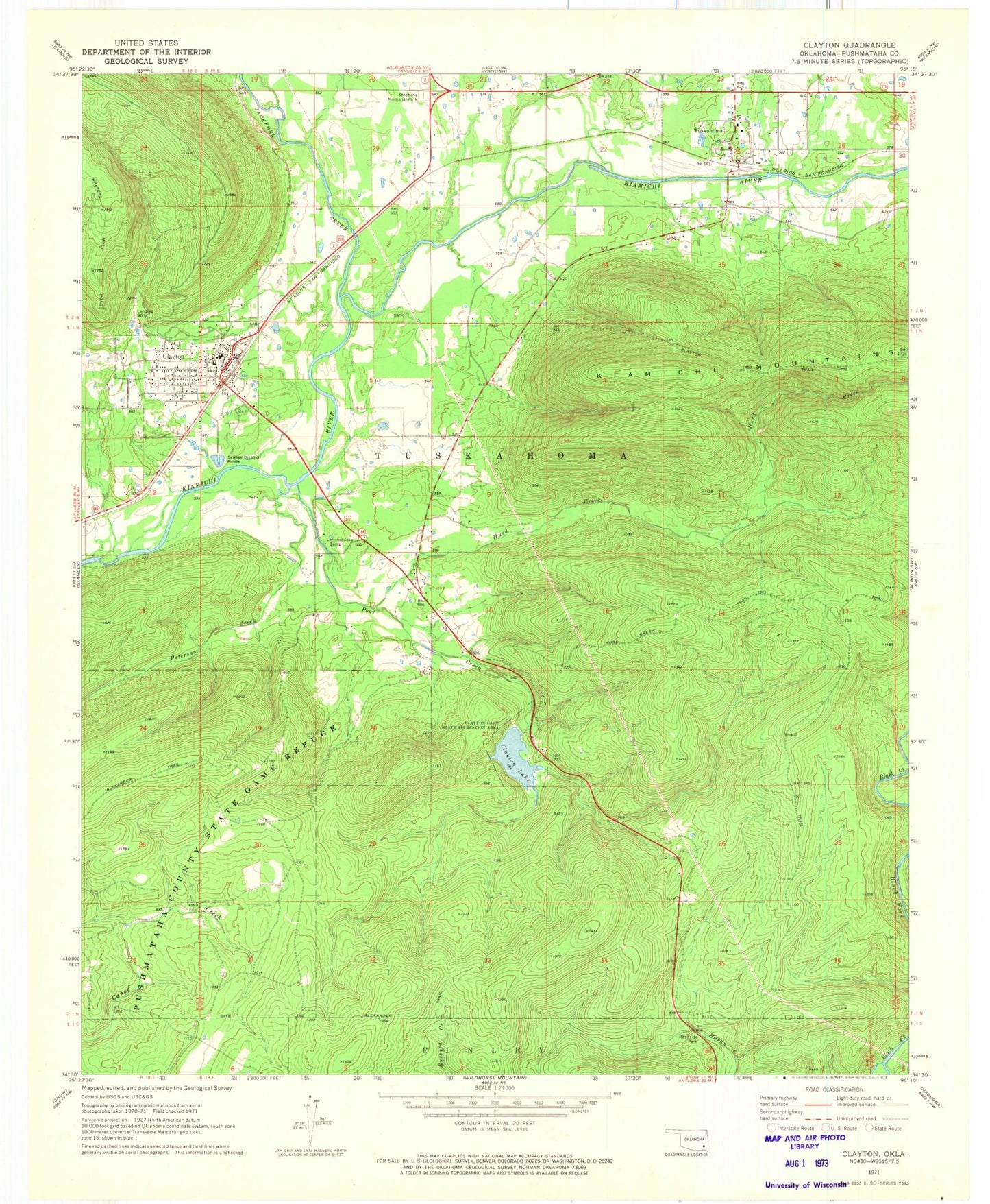
Classic USGS Clayton Oklahoma 7.5'x7.5' Topo Map
Couldn't load pickup availability
Historical USGS topographic quad map of Clayton in the state of Oklahoma. Map scale may vary for some years, but is generally around 1:24,000. Print size is approximately 24" x 27"
This quadrangle is in the following counties: Pushmataha.
The map contains contour lines, roads, rivers, towns, and lakes. Printed on high-quality waterproof paper with UV fade-resistant inks, and shipped rolled.
Contains the following named places: A L Stephens Memorial Park, Alexander Trail, Buffalo Valley Volunteer Fire Department, Clayton, Clayton Dam, Clayton Fire Department, Clayton High School, Clayton Lake, Clayton Lake State Recreation Area, Clayton Old Town Cemetery, Clayton Police Department, Clayton Post Office, Clayton Trail, Crain Elementary School, Hurd Creek, Hurd Creek Trail, Jackfork Creek, Minnetonka Camp, North Pushmataha Division, Oklahoma Department of Wildlife Conservation Pushmataha County State Game Refuge, Peal Creek, Peterson Creek, Town of Clayton, Township of Tuskahoma, Tuskahoma, Tuskahoma Elementary School, Tuskahoma Post Office, Walters Mule Trail