
MyTopo
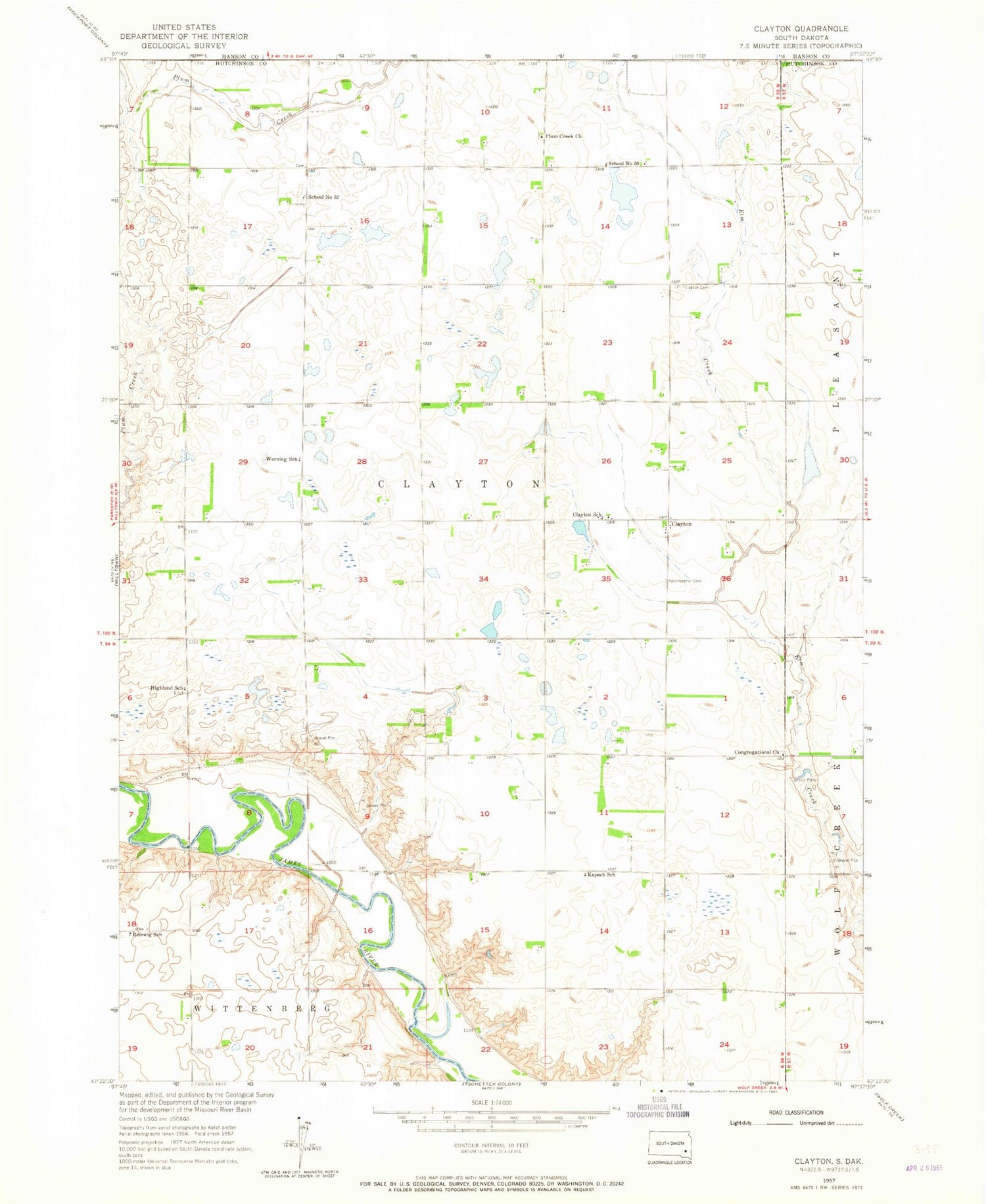
Classic USGS Clayton South Dakota 7.5'x7.5' Topo Map
Couldn't load pickup availability
Historical USGS topographic quad map of Clayton in the state of South Dakota. Map scale may vary for some years, but is generally around 1:24,000. Print size is approximately 24" x 27"
This quadrangle is in the following counties: Hanson, Hutchinson.
The map contains contour lines, roads, rivers, towns, and lakes. Printed on high-quality waterproof paper with UV fade-resistant inks, and shipped rolled.
Contains the following named places: Clayton, Clayton Cemetery, Clayton School, Guericke Dam, Highland School, Kapsch School, Menno Colony, Mensch Dam, Plum Creek Baptist Cemetery, Plum Creek Church, Rademacher Cemetery, Reiswig School, Saint Peters Lutheran Cemetery, School Number 50, School Number 52, Township of Clayton, Werning School, Wolf Creek Congregational Cemetery


