MyTopo
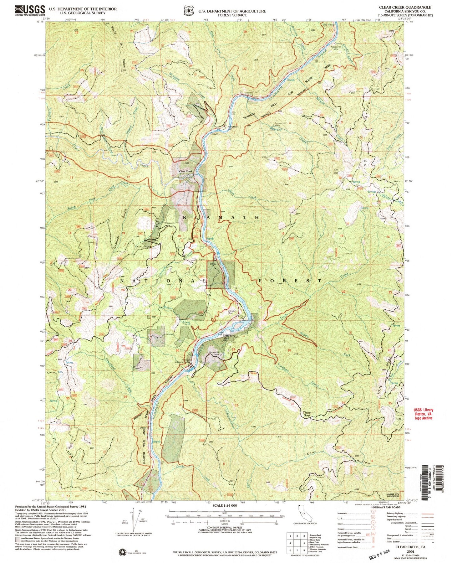
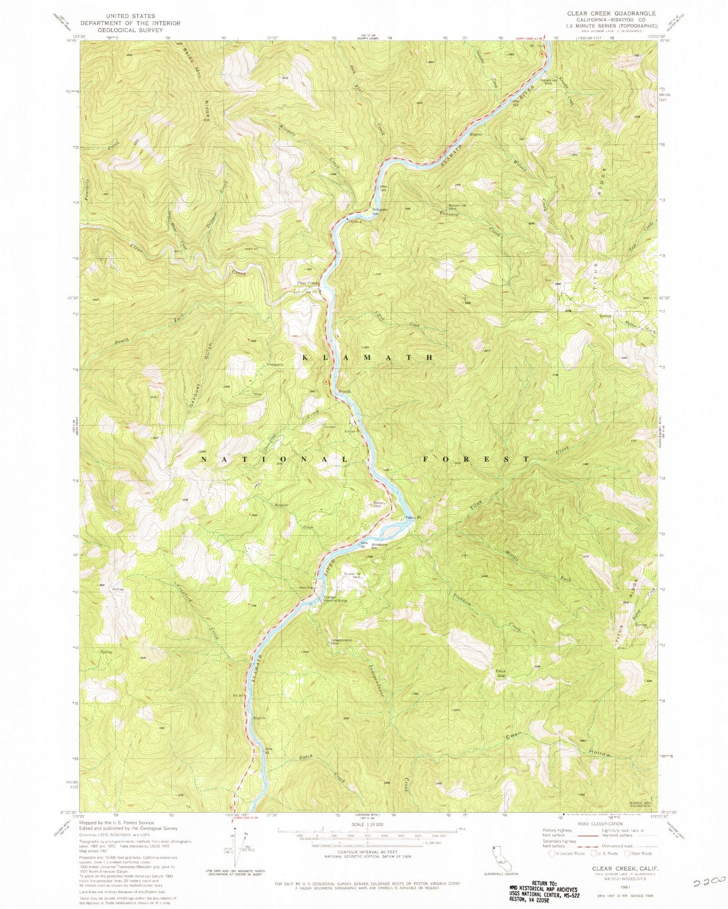
Classic USGS Clear Creek California 7.5'x7.5' Topo Map
Couldn't load pickup availability
Historical USGS topographic quad map of Clear Creek in the state of California. Map scale may vary for some years, but is generally around 1:24,000. Print size is approximately 24" x 27"
This quadrangle is in the following counties: Siskiyou.
The map contains contour lines, roads, rivers, towns, and lakes. Printed on high-quality waterproof paper with UV fade-resistant inks, and shipped rolled.
Contains the following named places: Attebery Bar, Browns Creek, Bunker Hill Mine, Buzzard Creek, Buzzard Hill Mine, Clear Creek, Coon Hollow, Crawford Creek, Daggett Creek, Doolittle Creek, Douglas Creek, Dutch Creek, Ferry Point, Fourmile Creek, Gasquet Gulch, Independence Creek, Independence Mine, Kanaka Creek, Kanaka Hill Mine, Middle Fork Titus Creek, Oak Flat Creek, Pick-aw-Ish Campground, Siskiyou Mine, South Fork Clear Creek, Thornton Memorial Bridge, Tinkham Creek, Titus Creek, Titus Gap, Titus Ridge Trail, Tom Davis Ranch, U-Fish Creek, Wilson Creek, Wingate Bar, Wingate Creek, ZIP Code: 96039