MyTopo
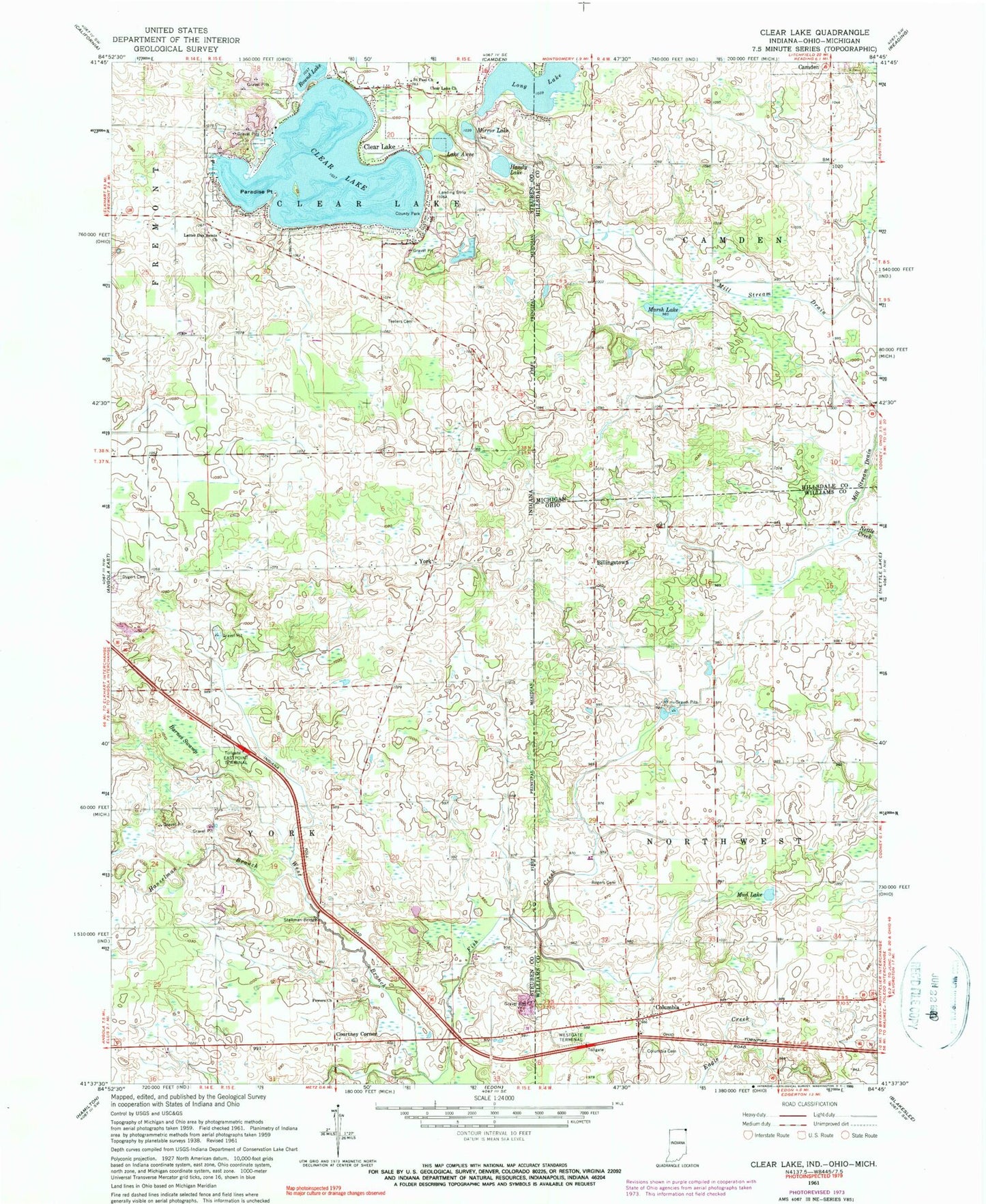
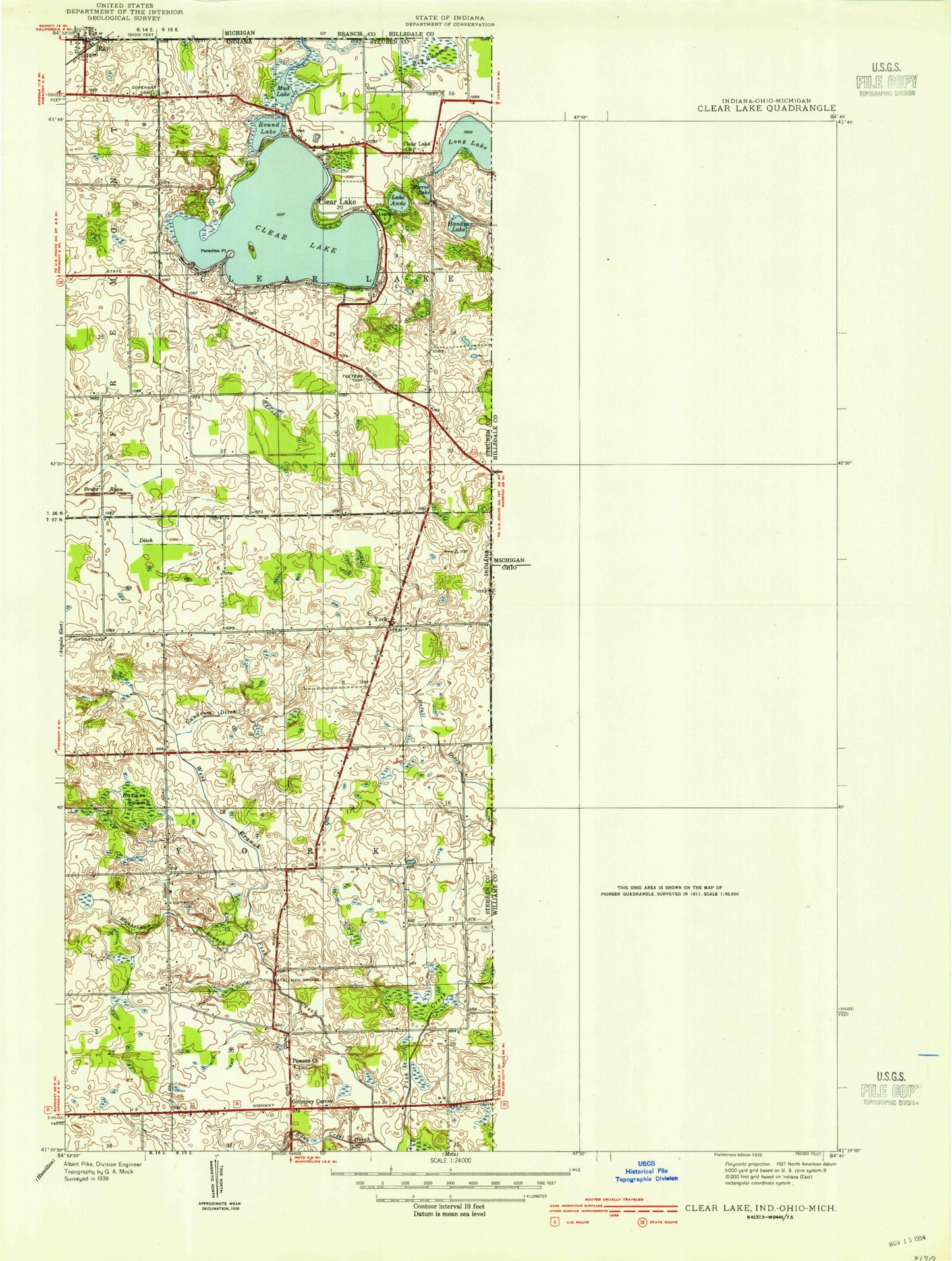
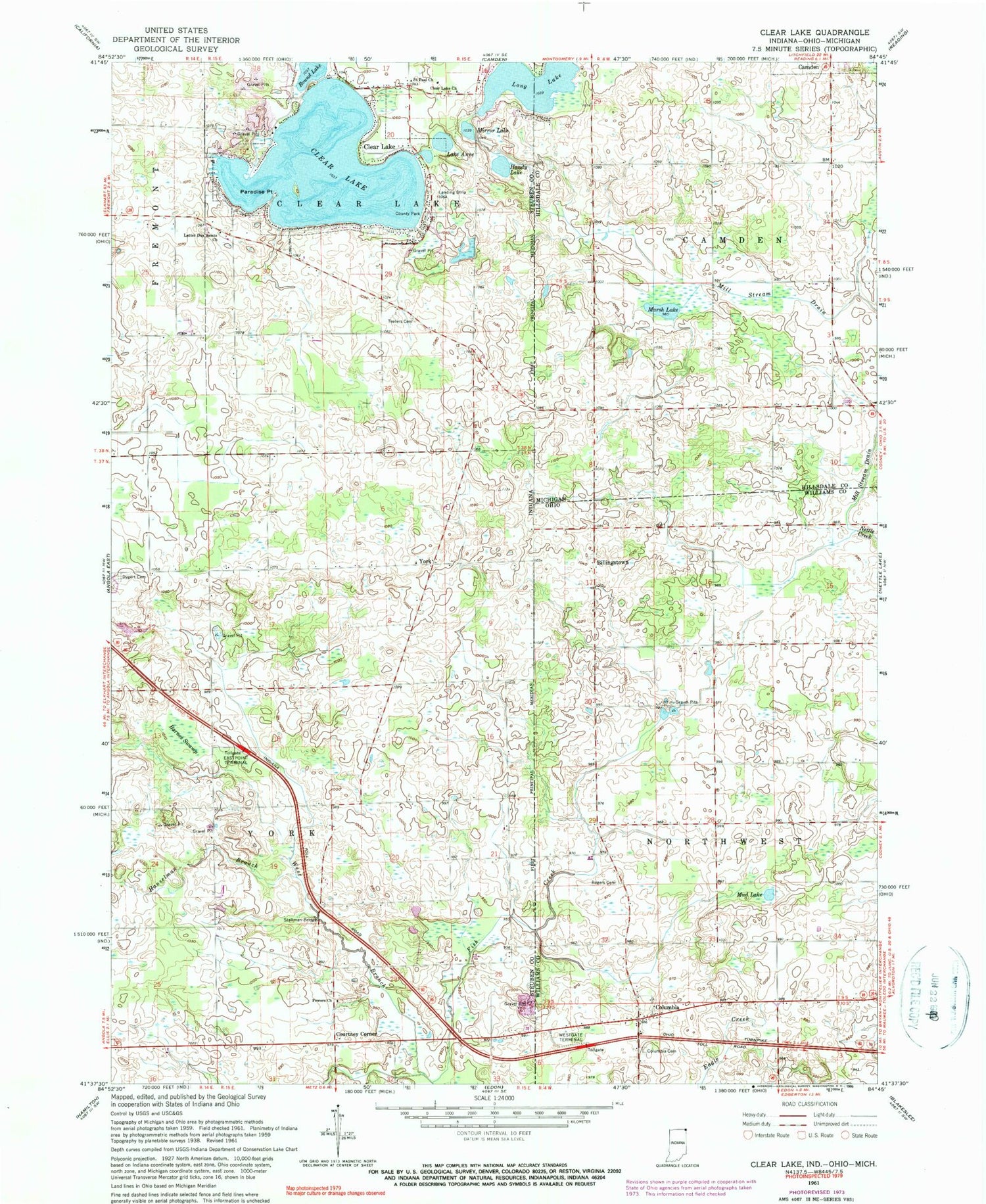
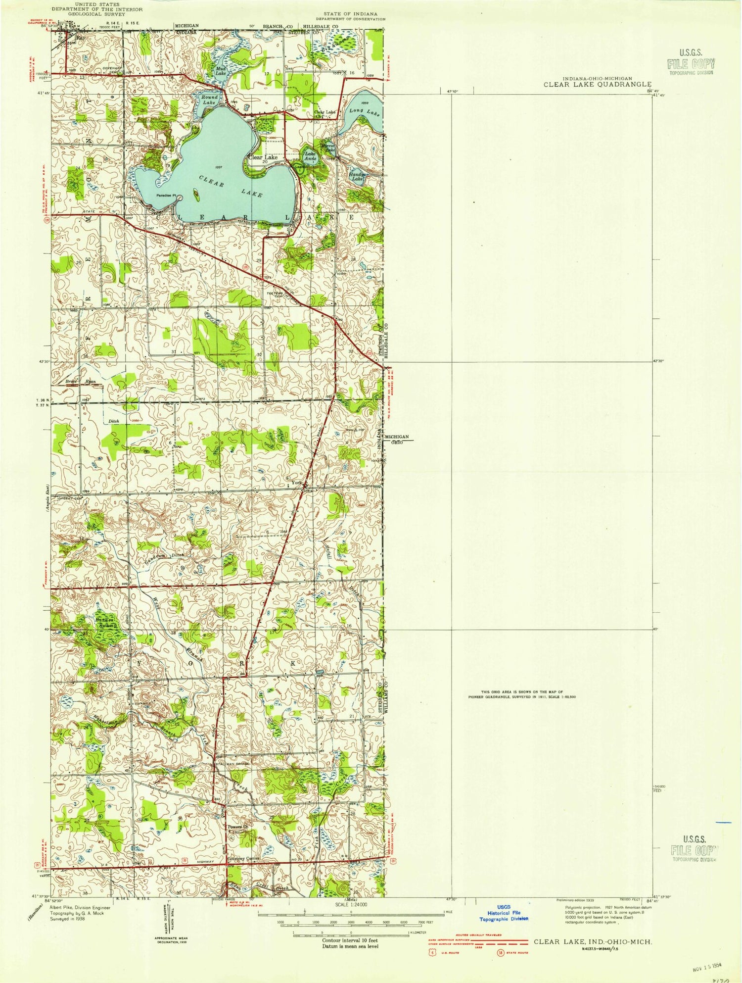
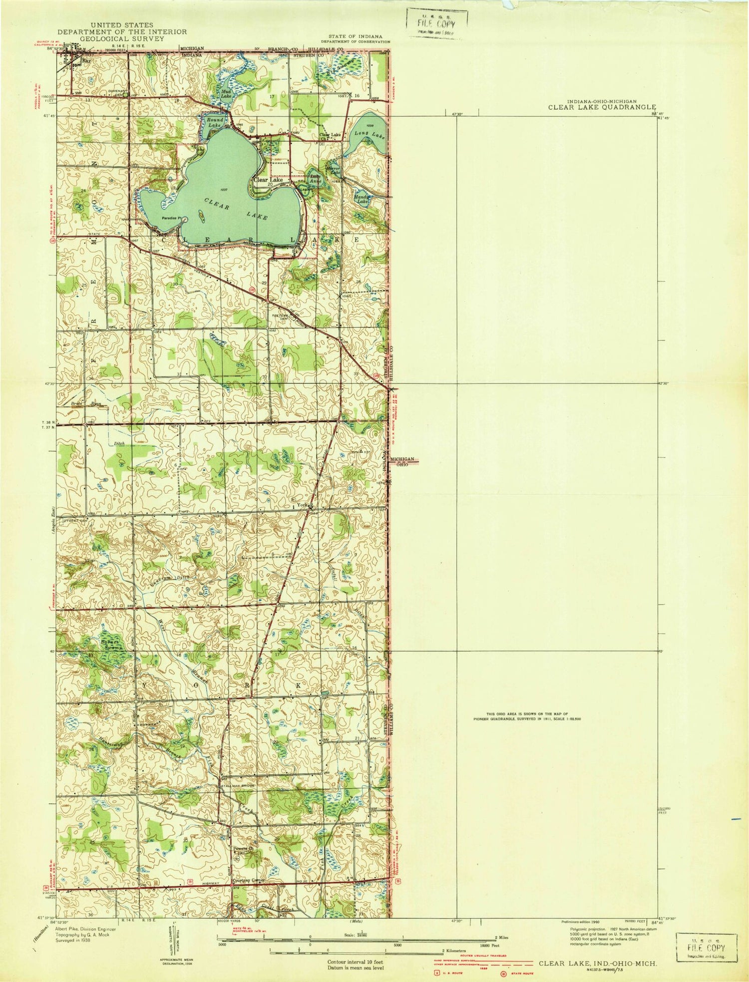
Classic USGS Clear Lake Indiana 7.5'x7.5' Topo Map
Couldn't load pickup availability
Historical USGS topographic quad map of Clear Lake in the states of Indiana, Ohio, Michigan. Map scale may vary for some years, but is generally around 1:24,000. Print size is approximately 24" x 27"
This quadrangle is in the following counties: Hillsdale, Steuben, Williams.
The map contains contour lines, roads, rivers, towns, and lakes. Printed on high-quality waterproof paper with UV fade-resistant inks, and shipped rolled.
Contains the following named places: Barnes Swamp, Billingstown, Billingstown Cemetery, Clear Lake, Clear Lake Church, Clear Lake Police Department, Clear Lake Post Office, Columbia, Columbia Cemetery, Courtney Corner, Dygert Cemetery, Eastpoint Terminal, Handy Lake, Hanselman Branch, Lake Anne, Latter Day Saints Church, Long Lake, Marsh Lake, Mill Stream Drain, Mirror Lake, Mud Lake, Mud Lake Bog Nature Preserve, Murphy Airport, Page, Paradise Point, Powers Church, Rogers Cemetery, Round Lake, Saint Paul Church, School Number 2, South Camden Post Office, Stallman Bridge, Teeters Cemetery, Town of Clear Lake, Township of Clear Lake, Township of York, West Branch Fish Creek, Westgate Terminal, York