MyTopo
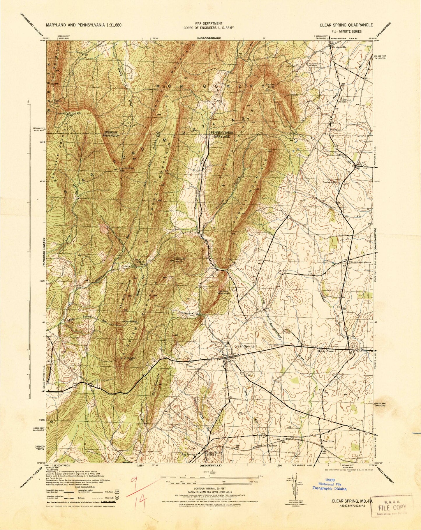
Classic USGS Clear Spring Maryland 7.5'x7.5' Topo Map
Couldn't load pickup availability
Historical USGS topographic quad map of Clear Spring in the states of Maryland, Pennsylvania. Typical map scale is 1:24,000, but may vary for certain years, if available. Print size: 24" x 27"
This quadrangle is in the following counties: Franklin, Washington.
The map contains contour lines, roads, rivers, towns, and lakes. Printed on high-quality waterproof paper with UV fade-resistant inks, and shipped rolled.
Contains the following named places: Indian Springs Wildlife Demonstration Area, Johns Hopkins University Geological Research Station, Abe Mills Mountain, Bear Pond Hollow, Bear Pond Mountains, Boyd Mountain, Bullskin Mountain, Cushwa Cemetery, Fairview Mountain, Gillians Knob, Green Spring Cemetery, Hanging Rock, Hearthstone Mountain, Hinkle Run, Indian Springs, Indian Springs Run, Polecat Hollow, Powell Mountain, Rickard Mountain, Rose Hill Cemetery, Saint Clements Chapel, Saint Pauls Church, Shady Bower, Stone Cabin Gap, Stone Quarry Ridge, Sword Mountain, Dry Run, Ashton, Big Spring, Charlton, Clear Spring, Forsythe, Johnson Mountain, Blairs Valley Dam, Blairs Valley Lake, Oliver Co Dam, WCRH-FM (Williamsport), WHAG-TV (Hagerstown), WWPB-TV (Hagerstown), Big Spring, Clear Spring, Clear Spring Elementary School, Clear Spring High School, Clear Spring Middle School, Clear Spring Park, Clear Spring Post Office, Clear Spring Station (historical), Clear Spring Town Hall, Cushwa Mill, Fairview Outdoor Education Center, Faith School (historical), Little Metropolitan Cemetery, McLaughlin School (historical), Saint Andrews Episcopal Church, Saint Johns United Church of Christ, Saint Michaels Catholic Church, Saint Pauls Lutheran Church Cemetery, Saint Peters Lutheran Church Cemetery, Saint Peters Evangelical Lutheran Church, Trinity Church of God, Blairs Valley First Church of God Cemetery, Union Bethel Church of God, District 4 Clear Spring, Clear Spring Volunteer Fire Company 4, Town of Clear Spring, Big Spring Census Designated Place, Charlton Census Designated Place, Clear Spring Ambulance Squad 49, Stoneleigh Farm, Knob Hill Winery, Blair Valley, Cross Mountain, Dunns Gap, Kasies Knob, The Punchbowl, Union Church, Kasiesville, Two Top Mountain, Union School, Secrest Cemetery, Blairs Valley Methodist Church Cemetery