
MyTopo
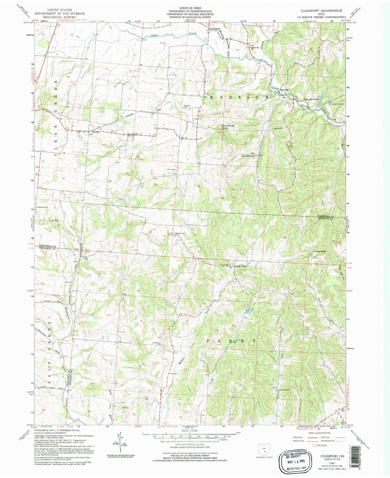
Classic USGS Clearport Ohio 7.5'x7.5' Topo Map
Couldn't load pickup availability
Historical USGS topographic quad map of Clearport in the state of Ohio. Map scale may vary for some years, but is generally around 1:24,000. Print size is approximately 24" x 27"
This quadrangle is in the following counties: Fairfield, Hocking, Pickaway.
The map contains contour lines, roads, rivers, towns, and lakes. Printed on high-quality waterproof paper with UV fade-resistant inks, and shipped rolled.
Contains the following named places: Arney Run, Augustus Cemetery, Bethany Cemetery, Bethany Church, Blackburn, Buena Vista, Buena Vista Cemetery, Camp Indianola, Clearport, Clearport Post Office, Drinkle, Drinkle Cemetery, Emmanuel Knob, Fairfield Sanitary Landfill, Hanaway Bridge, Hopewell Cemetery, Hopewell Church, Johnson Bridge, Julian Cemetery, Kern Cemetery, Lake Romona, Lake Romona Dam, McClelland Cemetery, Morgan Chapel, Morgan Chapel Cemetery, Mount Carmel Cemetery, Muddy Prairie Run, Pine Grove Cemetery, Pine Grove United Methodist Church, Revenge, Revenge Post Office, Shaeffer Cemetery, Snortin Ridge Farm Lake, Snortin Ridge Farm Lake Dam, Stump Run Church, Township of Madison, Township of Perry, Zion Cemetery, Zion Church


