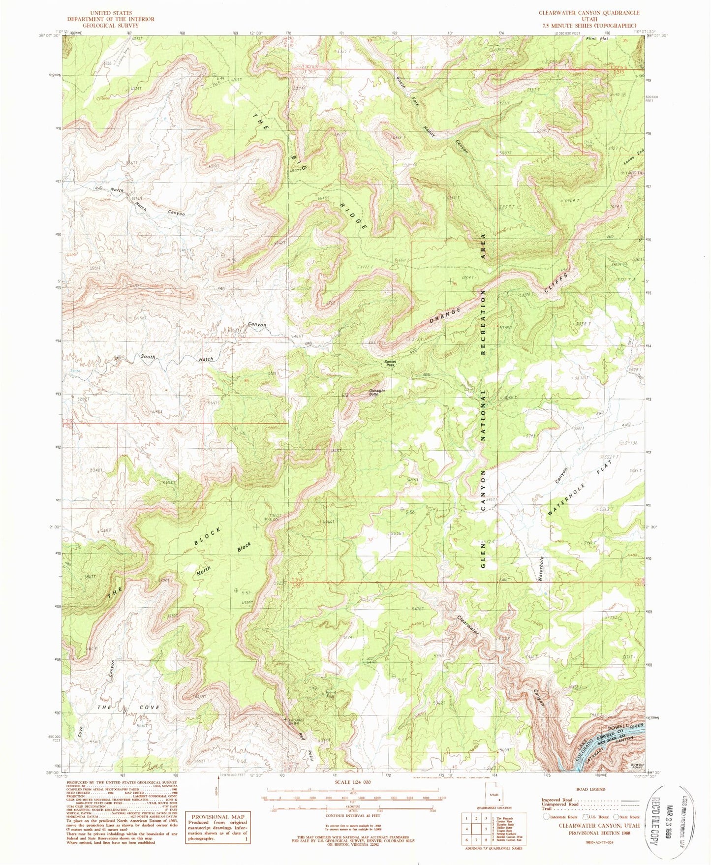
MyTopo
Classic USGS Clearwater Canyon Utah 7.5'x7.5' Topo Map
Regular price
$16.95
Regular price
Sale price
$16.95
Unit price
per
Couldn't load pickup availability
Historical USGS topographic quad map of Clearwater Canyon in the state of Utah. Map scale may vary for some years, but is generally around 1:24,000. Print size is approximately 24" x 27"
This quadrangle is in the following counties: Garfield, San Juan.
The map contains contour lines, roads, rivers, towns, and lakes. Printed on high-quality waterproof paper with UV fade-resistant inks, and shipped rolled.
Contains the following named places: Black Ledge, Flint Trail Overlook, Gunsight Butte, Lands End, North Block, Red Point, Simplot Airstrip, Sunset Pass, The Big Ridge, The Block, Waterhole Canyon