MyTopo
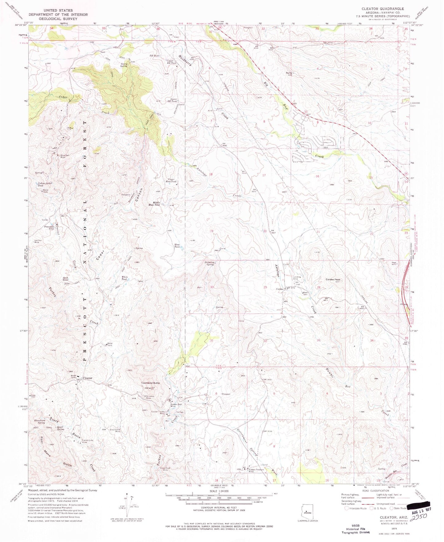
Classic USGS Cleator Arizona 7.5'x7.5' Topo Map
Couldn't load pickup availability
Historical USGS topographic quad map of Cleator in the state of Arizona. Typical map scale is 1:24,000, but may vary for certain years, if available. Print size: 24" x 27"
This quadrangle is in the following counties: Yavapai.
The map contains contour lines, roads, rivers, towns, and lakes. Printed on high-quality waterproof paper with UV fade-resistant inks, and shipped rolled.
Contains the following named places: Antelope Creek, Blanchard Spring, Blue Bell Mine, Cedar Canyon, Cedar Creek, Cleator, Cordes, Cordes Peak, Dripping Spring, French Lilly Mine, Geary Spring, Golden Belt Mine, Golden Turkey Mine, Gray Goose Mine, Hackberry Creek, Hidden Treasure Mine, Hook Tank, Jubilee Mine, Lower RR Tank, Mesa Tank, Middle Mesa Tank, Mineral Creek, Poor Mans Gulch, Powerline Tank, Quail Spring, RR Tank, Saint Johns Mine, Silver Cord Mine, Townsend Butte, Upper Mesa Tank, Upper RR Tank, White Tank, Yellow Jacket Tank, Cedar Well, Little Cedar Tank, Mayer Junior Senior High School, Spring Valley, Swiettendick Place Well, Blue Bell Tank Number Two, Blue Bell Well, Jubilee Spring, Susie Hendrick Place, Blue Bell Trick Tank, Blue Bell (historical), Ocotillo, Cordes Airport (historical), Swiettendick Place, Spring Valley Census Designated Place, Spring Valley Community Church, Mayer Fire Department Fire Station 24, Mayer Fire Department Fire Station 22