MyTopo
Classic USGS Cleghorn Flat California 7.5'x7.5' Topo Map
Regular price
$16.95
Regular price
Sale price
$16.95
Unit price
per
Couldn't load pickup availability
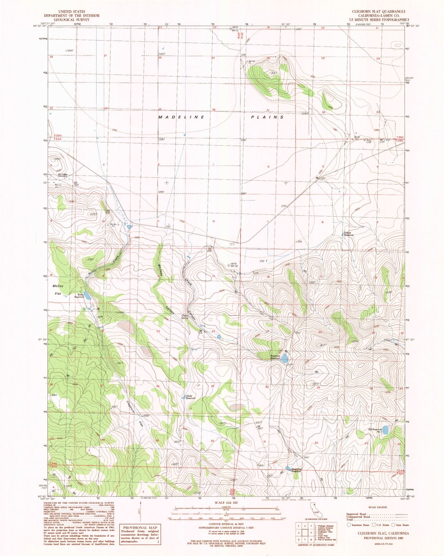
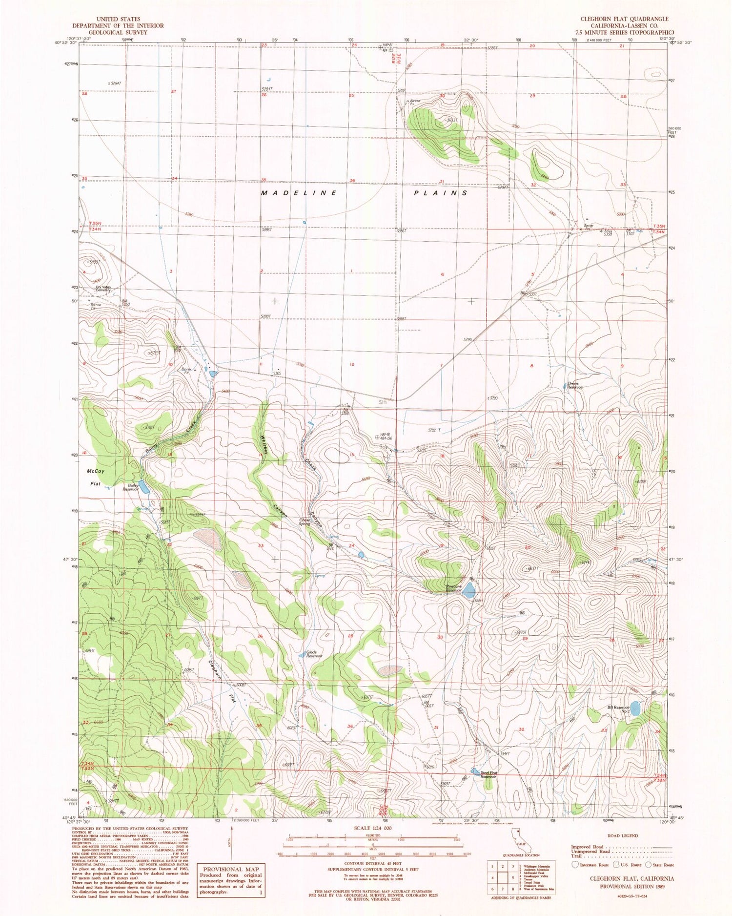
Historical USGS topographic quad map of Cleghorn Flat in the state of California. Map scale may vary for some years, but is generally around 1:24,000. Print size is approximately 24" x 27"
This quadrangle is in the following counties: Lassen.
The map contains contour lines, roads, rivers, towns, and lakes. Printed on high-quality waterproof paper with UV fade-resistant inks, and shipped rolled.
Contains the following named places: Bailey Creek, Bailey Reservoir, Bill Reservoir Number 1, Chase Canyon, Chase Spring, Cleghorn Flat, Dry Valley Cemetery, Elmers Reservoir, Glade Reservoir, McCoy Flat, Pinecone Reservoir, Steel Post Reservoir, Whiskey Canyon