MyTopo
Classic USGS Cleve Creek Baldy Nevada 7.5'x7.5' Topo Map
Couldn't load pickup availability
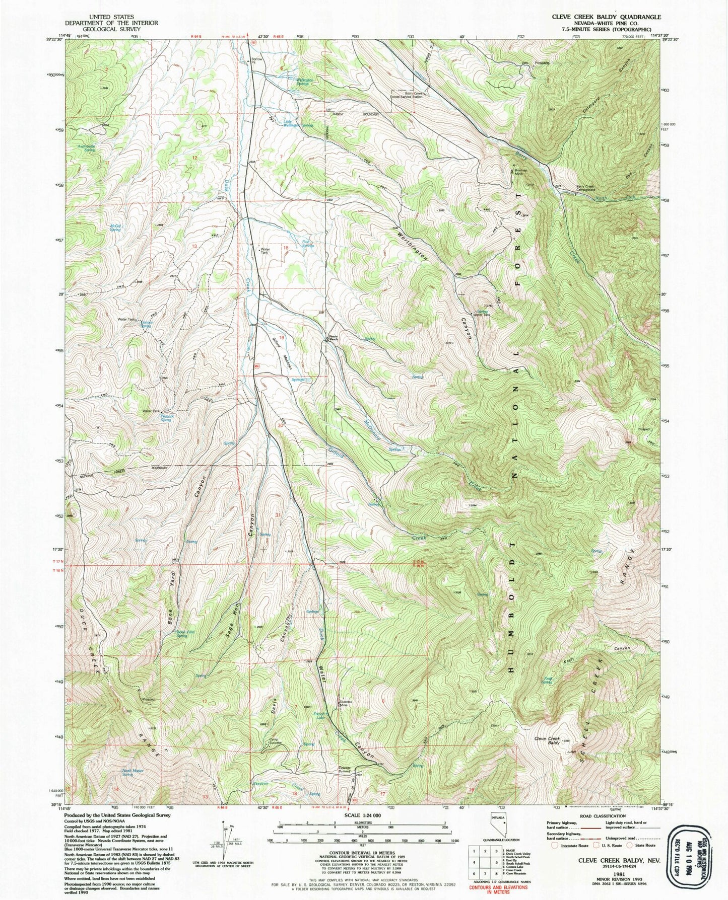
Historical USGS topographic quad map of Cleve Creek Baldy in the state of Nevada. Typical map scale is 1:24,000, but may vary for certain years, if available. Print size: 24" x 27"
This quadrangle is in the following counties: White Pine.
The map contains contour lines, roads, rivers, towns, and lakes. Printed on high-quality waterproof paper with UV fade-resistant inks, and shipped rolled.
Contains the following named places: Duck Creek Mining District, Axehandle Spring, Berry Creek Forest Service Station, Bone Yard Canyon, Camp Success, Canyon Spring, Cleve Creek Baldy, Davis Canyon, Doe Canyon, Gilford Creek, Kraft Spring, McDonald Creek, McGill Spring, North Fork Berry Creek, North Mosier Spring, Ostergard Canyon, Peacock Spring, Sage Hen Canyon, Success Mine, Success Summit, Water Canyon, Worthington Canyon, Bone Yard Spring, Gilford Meadows, Pescio Ranch, Five Springs, Brennen Mine, Little Wellington Springs, Wellington Springs, French Lake, Fera Ninetyeight, Fera Ninetyseven, Sage Hen Summer Home Area, Berry Creek Campground